Free Trade Zone · Saudi Arabia

Al-Ahsa Al-Aḥsāʾ Modon Oasis Active
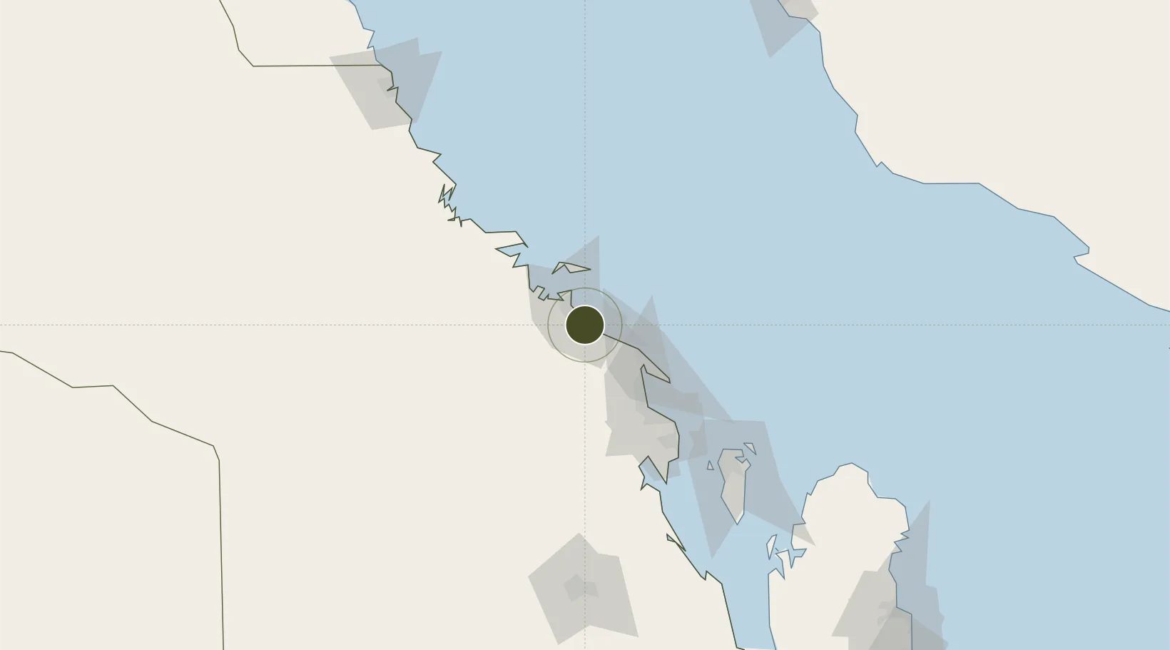
26.9855°, 49.6537°
54 ha
Zone area
10.9 km
Nearest port
25.3 km
Nearest airport

Gateway access

Nearest neighbours — logibook spatial index (haversine) over the source coordinates

Zone profile

Zone type
Free Trade Zone
Open Zone Map
Region
Ash Sharqiyah
Open Zone Map
Status
Active
Open Zone Map
Management
Public
Open Zone Map
Operator
Saudi Authority for Industrial Estates and Technology Zones
Open Zone Map
Legal framework
Ministerial Legislation No. 235 dated 27/8/1422H
Open Zone Map

Location

Location of ozm-4055
Natural Earth 10m (public domain) · Ash Sharqiyah · ozm-4055 · 26.99, 49.65GoogleOSMYandex

Nearby Logistics Neighbours

Ports
  1. 1Al Jubayl11 km
  2. 2Ju Aymah Oil Terminal38 km
  3. 3Ras Tannurah64 km
  4. 4Dammam77 km
  5. 5Al Manamah125 km
Nearest neighbours — logibook spatial index (haversine) over the source coordinates
Airports
  1. 1Jubail Airport25 km
  2. 2Ras Tanura Airport47 km
  3. 3King Fahd International Airport59 km
  4. 4King Abdulaziz Air Base94 km
  5. 5Bahrain International Airport126 km
Nearest neighbours — logibook spatial index (haversine) over the source coordinates
Cities
  1. 1Jubail5 km
  2. 2Al Jubayl Industrial City12 km
  3. 3Juaymah Terminal37 km
  4. 4Ras Tanura63 km
  5. 5Ras Al-Khair77 km
Nearest neighbours — logibook spatial index (haversine) over the source coordinates
Trade Zones
  1. 1Jubail Industrial City10 km
  2. 2Al-Ahsa Al-Aḥsāʾ Industrial City Salwa (Second)16 km
  3. 3Ras Al-Khair Industrial City73 km
  4. 4Dammam Industrial City (First)81 km
  5. 5Dammam Industrial City (Second)87 km
Nearest neighbours — logibook spatial index (haversine) over the source coordinates
DatabookThe Record of Consolidated Knowledge
Saudi Arabia beyond logistics?
Browse databook

All Sources

Trade ZonesOpen Zone Map
CC BY
Portsthe NGA World Port Index
Public domain (US gov)
AirportsOurAirports
Public domain
LocationsUN/LOCODE
UN/LOCODE — free
← Saudi Arabia trade zones