Export Processing Zone · Philippines

DADC Economic Zone Active
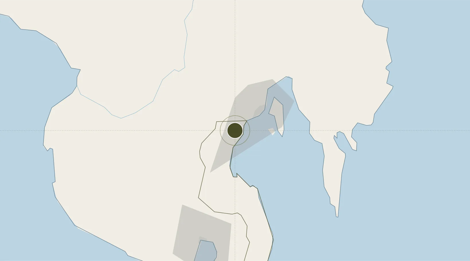
6.9414°, 125.4187°
15 ha
Zone area
25.9 km
Nearest port
32.4 km
Nearest airport

Gateway access

Nearest neighbours — logibook spatial index (haversine) over the source coordinates

Zone profile

Zone type
Export Processing Zone
Open Zone Map
Region
Davao del Sur
Open Zone Map
Status
Active
Open Zone Map
Management
Private
Open Zone Map
Operator
Darong Agricultural and Development Corp.
Open Zone Map
Legal framework
Special Economic Zone Act (Republic Act No. 7916) (as amended by Republic Act No. 8748)
Open Zone Map

Location

Location of ozm-3241
Natural Earth 10m (public domain) · Davao del Sur · ozm-3241 · 6.94, 125.42GoogleOSMYandex

Nearby Logistics Neighbours

Ports
  1. 1Davao26 km
  2. 2Mati88 km
  3. 3General Santos95 km
  4. 4Polloc (Cotabato)140 km
  5. 5Mangagoy174 km
Nearest neighbours — logibook spatial index (haversine) over the source coordinates
Airports
  1. 1Francisco Bangoy International Airport32 km
  2. 2Central Mindanao Airport55 km
  3. 3Mati National Airport94 km
  4. 4Rajah Buayan Air Base95 km
  5. 5Allah Valley Airport97 km
Nearest neighbours — logibook spatial index (haversine) over the source coordinates
Cities
  1. 1Astorga7 km
  2. 2Davao, Mindanao36 km
  3. 3DICT / SVT49 km
  4. 4Panabo49 km
  5. 5General Santos99 km
Nearest neighbours — logibook spatial index (haversine) over the source coordinates
Trade Zones
  1. 1Astorga Business & Industrial Park12 km
  2. 2Ayala Business Center13 km
  3. 3SM Lanang Premier IT Center14 km
  4. 4Abreeza Corporate Center14 km
  5. 5The Annex-SM City Davao IT Center22 km
Nearest neighbours — logibook spatial index (haversine) over the source coordinates
DatabookThe Record of Consolidated Knowledge
Philippines beyond logistics?
Browse databook

All Sources

Trade ZonesOpen Zone Map
CC BY
Portsthe NGA World Port Index
Public domain (US gov)
AirportsOurAirports
Public domain
LocationsUN/LOCODE
UN/LOCODE — free
← Philippines trade zones