Diversified Zone · Malaysia

Senai-Skudai Flagship Zone Under Development

1.5746°, 103.6568°
404 ha
Zone area
27.7 km
Nearest port
7.6 km
Nearest airport

Gateway access

Nearest neighbours — logibook spatial index (haversine) over the source coordinates

Zone profile

Zone type
Diversified Zone
Open Zone Map
Region
Johor
Open Zone Map
Status
Under Development
Open Zone Map
Management
Public
Open Zone Map
Operator
Iksander Development Regional Authority
Open Zone Map
Legal framework
Iksander Development Regional Authority Act of 2007 (Act 664), Free Trade Zone Act 1971, Free Zones Act 1990; Customs Act (Amendment) 2019.
Open Zone Map

Location

Location of ozm-2764
Natural Earth 10m (public domain) · Johor · ozm-2764 · 1.57, 103.66GoogleOSMYandex

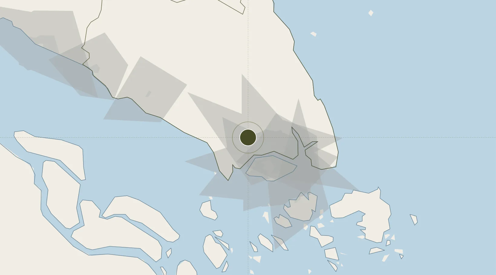
Nearby Logistics Neighbours

Ports
  1. 1Tanjung Pelepas28 km
  2. 2Johor31 km
  3. 3Jurong Island34 km
  4. 4Keppel - (East Singapore)39 km
  5. 5Pulau Bukom40 km
Nearest neighbours — logibook spatial index (haversine) over the source coordinates
Airports
  1. 1Senai International Airport8 km
  2. 2Tengah Air Base22 km
  3. 3Sembawang Air Base24 km
  4. 4Seletar Airport29 km
  5. 5Paya Lebar Air Base37 km
Nearest neighbours — logibook spatial index (haversine) over the source coordinates
Cities
  1. 1Senai3 km
  2. 2Tampoi11 km
  3. 3Taman Molek16 km
  4. 4Ulu Tiram21 km
  5. 5Gelang Patah25 km
Nearest neighbours — logibook spatial index (haversine) over the source coordinates
Trade Zones
  1. 1I-Park@ Senai Airport City4 km
  2. 2Senai Airport City Phase One7 km
  3. 3Senai Free Zone7 km
  4. 4Sultan Ismail International Airport Free Industrial Zone, Johor7 km
  5. 5Iskander Development Region12 km
Nearest neighbours — logibook spatial index (haversine) over the source coordinates
DatabookThe Record of Consolidated Knowledge
Malaysia beyond logistics?
Browse databook

All Sources

Trade ZonesOpen Zone Map
CC BY
Portsthe NGA World Port Index
Public domain (US gov)
AirportsOurAirports
Public domain
LocationsUN/LOCODE
UN/LOCODE — free
← Malaysia trade zones