Diversified Zone · Albania

Vlora Technical and Economic Development Area Active
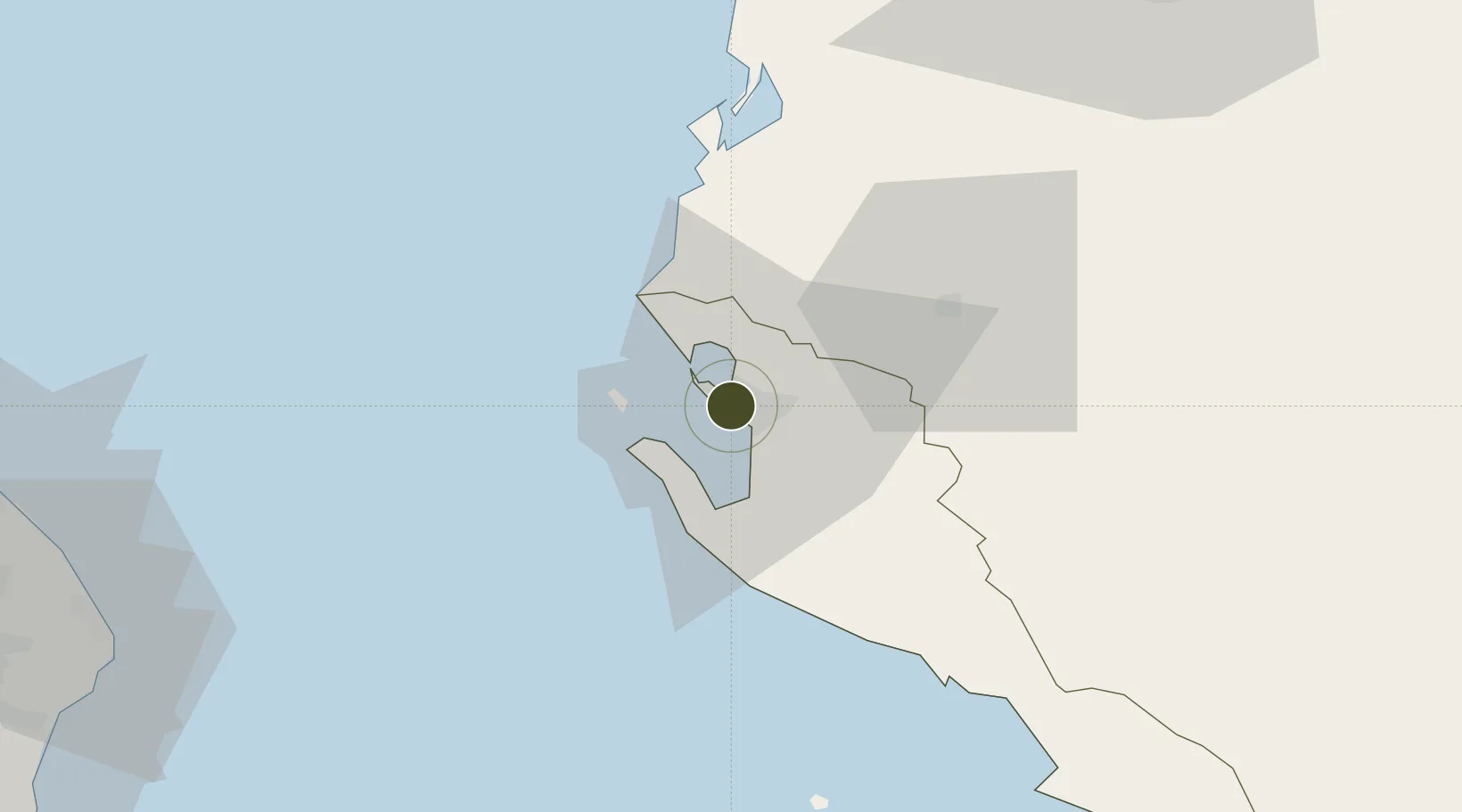
40.4862°, 19.4478°
230 ha
Zone area
4.9 km
Nearest port
49.8 km
Nearest airport

Gateway access

Nearest neighbours — logibook spatial index (haversine) over the source coordinates

Zone profile

Zone type
Diversified Zone
Open Zone Map
Region
Vlorë
Open Zone Map
Status
Active
Open Zone Map
Management
Public
Open Zone Map
Operator
Albania Investment Development Agency
Open Zone Map
Legal framework
Decree No. 628: June 11, 2009. Law No. 9789 Dated 19.07.2007, DCM 646: 22.07.2015, DCM 647: 22.07.2015,
Open Zone Map

Location

Location of ozm-18
Natural Earth 10m (public domain) · Vlorë · ozm-18 · 40.49, 19.45GoogleOSMYandex

Nearby Logistics Neighbours

Ports
  1. 1Vlore5 km
  2. 2Otranto89 km
  3. 3Durres92 km
  4. 4Porto Romano100 km
  5. 5Kerkira105 km
Nearest neighbours — logibook spatial index (haversine) over the source coordinates
Airports
  1. 1Kuçovë Air Base50 km
  2. 2Tirana International Airport Mother Teresa106 km
  3. 3Corfu Ioannis Kapodistrias International Airport106 km
  4. 4Lecce Galatina Air Base / Galatina Fortunato Cesari Airport115 km
  5. 5Brindisi Airport128 km
Nearest neighbours — logibook spatial index (haversine) over the source coordinates
Cities
  1. 1Vlorë4 km
  2. 2Fier29 km
  3. 3Himare45 km
  4. 4Berat50 km
  5. 5Ereikousses Diapontioi Islands70 km
Nearest neighbours — logibook spatial index (haversine) over the source coordinates
Trade Zones
  1. 1Fier Freezone28 km
  2. 2Gjirokastër Freezone76 km
  3. 3Përmet Freezone82 km
  4. 4Elbasan Industrial Park83 km
  5. 5Spitalle Spitalla Technical and Economic Development Area95 km
Nearest neighbours — logibook spatial index (haversine) over the source coordinates
DatabookThe Record of Consolidated Knowledge
Albania beyond logistics?
Browse databook

All Sources

Trade ZonesOpen Zone Map
CC BY
Portsthe NGA World Port Index
Public domain (US gov)
AirportsOurAirports
Public domain
LocationsUN/LOCODE
UN/LOCODE — free
← Albania trade zones