Export Processing Zone · China

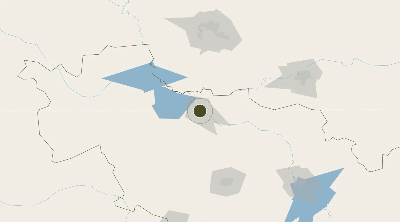
Chagan Lake Tourism Economic Development Zone Active

45.1200°, 124.8489°
2,327 ha
Zone area
537.3 km
Nearest port
31.4 km
Nearest airport

Gateway access

Nearest neighbours — logibook spatial index (haversine) over the source coordinates

Zone profile

Zone type
Export Processing Zone
Open Zone Map
Region
Jilin
Open Zone Map
Status
Active
Open Zone Map
Management
Public
Open Zone Map
Operator
Working Committee of Chagan Lake Tourism Economic Development Zone
Open Zone Map
Legal framework
Request for Defining the Scope and Planned Area of Chagan Lake Tourism Economic Development Zone (Songzhengwen [2018] No. 32
Open Zone Map

Location

Location of ozm-1366
Natural Earth 10m (public domain) · Jilin · ozm-1366 · 45.12, 124.85GoogleOSMYandex

Nearby Logistics Neighbours

Ports
  1. 1Yingkou537 km
  2. 2Najin543 km
  3. 3Ch'ongjin547 km
  4. 4Pos'yet550 km
  5. 5Zarubino571 km
Nearest neighbours — logibook spatial index (haversine) over the source coordinates
Airports
  1. 1Songyuan Chaganhu Airport31 km
  2. 2Harbin Taiping International Airport123 km
  3. 3Changchun Air Base138 km
  4. 4Changchun Longjia International Airport141 km
  5. 5Baicheng Chang'an Airport149 km
Nearest neighbours — logibook spatial index (haversine) over the source coordinates
Cities
  1. 1Dehui94 km
  2. 2Shuangcheng115 km
  3. 3Zhaodong137 km
  4. 4Changchun141 km
  5. 5Harbin153 km
Nearest neighbours — logibook spatial index (haversine) over the source coordinates
DatabookThe Record of Consolidated Knowledge
China beyond logistics?
Browse databook

All Sources

Trade ZonesOpen Zone Map
CC BY
Portsthe NGA World Port Index
Public domain (US gov)
AirportsOurAirports
Public domain
LocationsUN/LOCODE
UN/LOCODE — free
← China trade zones