Industrial Zone · Vietnam

Khai Quang Industrial Zone Active
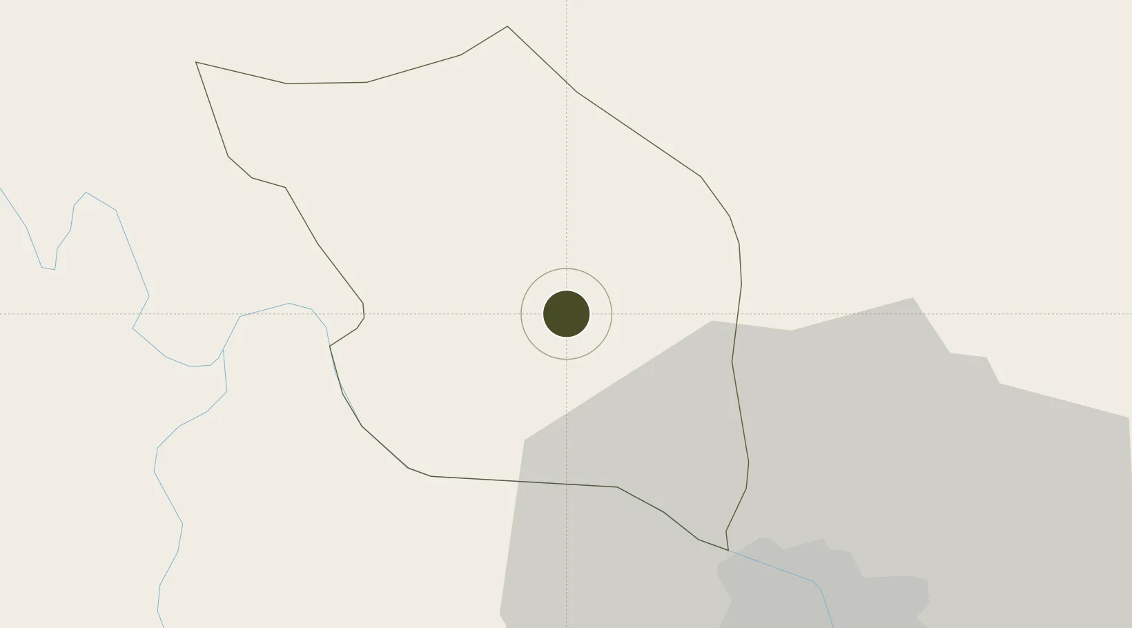
21.3031°, 105.6274°
216 ha
Zone area
117.7 km
Nearest port
20.7 km
Nearest airport

Gateway access

Nearest neighbours — logibook spatial index (haversine) over the source coordinates

Zone profile

Zone type
Industrial Zone
the World Bank SEZ database
Region
Vĩnh Phúc
the World Bank SEZ database
Status
Active
the World Bank SEZ database
Established
2007
the World Bank SEZ database
Management
Private management
the World Bank SEZ database
Operator
Vinh Phuc Development Infrastructure Joint Stock Company
the World Bank SEZ database
Regulatory authority
Chairmen of Provincial People's Committees
the World Bank SEZ database
Legal framework
Law on Foreign Investment in Vietnam, 1996; Decree No. 36/1997/CP on The Regulation of Industrial, Economic and Export processing zones
the World Bank SEZ database

Location

Location of VNM105
Natural Earth 10m (public domain) · Vĩnh Phúc · VNM105 · 21.30, 105.63GoogleOSMYandex

Fiscal & incentives

Corporate tax
20%
the World Bank SEZ database
Tax relief
100% exempt
the World Bank SEZ database
Relief duration
4 years
the World Bank SEZ database
VAT
No exemption
the World Bank SEZ database
Import duty (inputs)
0% exempt
the World Bank SEZ database
Import duty (capex)
100% exempt
the World Bank SEZ database
Profit repatriation
No exemption
the World Bank SEZ database
Capital gains
No exemption
the World Bank SEZ database
Withholding tax
No exemption
the World Bank SEZ database
Min. investment
None
the World Bank SEZ database
Min. export
0%
the World Bank SEZ database
Employment incentive
No exemption
the World Bank SEZ database
Developer incentive
No established framework
the World Bank SEZ database

Nearby Logistics Neighbours

Ports
  1. 1Hai Phong118 km
  2. 2Hon Gai154 km
  3. 3Cam Pha183 km
  4. 4Nghe Tinh282 km
  5. 5Fang-Cheng286 km
Nearest neighbours — logibook spatial index (haversine) over the source coordinates
Airports
  1. 1Noi Bai International Airport21 km
  2. 2Gia Lam Air Base40 km
  3. 3Cat Bi International Airport126 km
  4. 4Tho Xuan Airport157 km
  5. 5Baihe Ningming Air Base179 km
Nearest neighbours — logibook spatial index (haversine) over the source coordinates
Cities
  1. 1Hoa Lac18 km
  2. 2Thái Nguyên37 km
  3. 3Hanoi43 km
  4. 4Luong Tai64 km
  5. 5Hoa Mac84 km
Nearest neighbours — logibook spatial index (haversine) over the source coordinates
Trade Zones
  1. 1Bình Xuyên Industrial Estate4 km
  2. 2Binh Xuyen Industrial Zone4 km
  3. 3Ba Thien Industrial Estate7 km
  4. 4Kim Hoa Industrial Zone13 km
  5. 5Quang Minh I Industrial Park20 km
Nearest neighbours — logibook spatial index (haversine) over the source coordinates
DatabookThe Record of Consolidated Knowledge
Vietnam beyond logistics?
Browse databook

All Sources

Trade Zonesthe World Bank SEZ database
CC BY 4.0
Portsthe NGA World Port Index
Public domain (US gov)
AirportsOurAirports
Public domain
LocationsUN/LOCODE
UN/LOCODE — free
← Vietnam trade zones