Export Processing Zone · Nigeria

Calabar Free Trade Zone Active
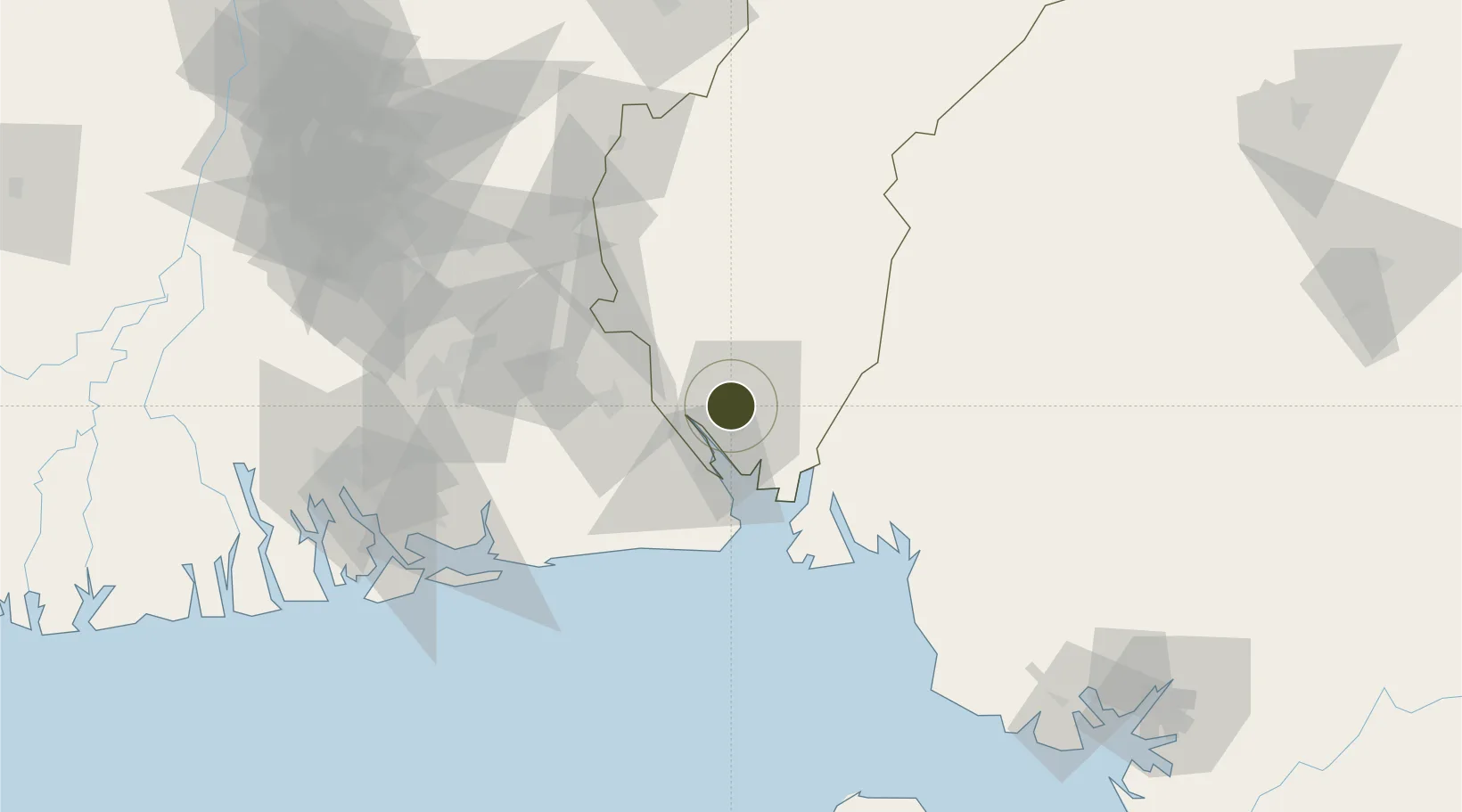
5.0190°, 8.3247°
152 ha
Zone area
5.9 km
Nearest port
5.4 km
Nearest airport

Gateway access

Nearest neighbours — logibook spatial index (haversine) over the source coordinates

Zone profile

Zone type
Export Processing Zone
the World Bank SEZ database
Region
Cross River
the World Bank SEZ database
Status
Active
the World Bank SEZ database
Established
1999
the World Bank SEZ database
Management
Public agency
the World Bank SEZ database
Operator
Nigeria Export Procesing Board Authority
the World Bank SEZ database
Regulatory authority
Nigeria Export Processing Zone Authority (NEPZA)
the World Bank SEZ database
Legal framework
Nigeria Export Processing Zones Decree No 63
the World Bank SEZ database

Location

Location of NGA1
Natural Earth 10m (public domain) · Cross River · NGA1 · 5.02, 8.32GoogleOSMYandex

Fiscal & incentives

Corporate tax
30%
the World Bank SEZ database
Tax relief
100% exempt
the World Bank SEZ database
Relief duration
Perpetual
the World Bank SEZ database
VAT
100% exempt from consumption tax on utilities
the World Bank SEZ database
Import duty (inputs)
100% exempt
the World Bank SEZ database
Import duty (capex)
100% exempt
the World Bank SEZ database
Profit repatriation
100% exempt from repatriation tax on capital, profits, and dividends
the World Bank SEZ database
Capital gains
100% exempt from any government tax
the World Bank SEZ database
Withholding tax
100% exempt from any government tax
the World Bank SEZ database
Min. investment
None
the World Bank SEZ database
Min. export
0%
the World Bank SEZ database
Employment incentive
100% exempt from any government tax
the World Bank SEZ database
Developer incentive
Yes
the World Bank SEZ database

Nearby Logistics Neighbours

Ports
  1. 1Calabar6 km
  2. 2Kole Oil Terminal89 km
  3. 3Antan Oil Terminal89 km
  4. 4Qua Iboe Oil Terminal93 km
  5. 5Moudi Marine Terminal102 km
Nearest neighbours — logibook spatial index (haversine) over the source coordinates
Cities
  1. 1Antan89 km
  2. 2Moudi Terminal102 km
  3. 3Kumba130 km
  4. 4Zafiro Terminal131 km
  5. 5Onne135 km
Nearest neighbours — logibook spatial index (haversine) over the source coordinates
Trade Zones
  1. 1Tinapa Free Zone & Resort4 km
  2. 2Ibom Science & Technology Free Zone43 km
  3. 3Ibom Industrial City Free Zone54 km
  4. 4Enyimba Economic City82 km
  5. 5Aluminium Smelting Company of Nigeria (ALSCON) Export Processing Zone94 km
Nearest neighbours — logibook spatial index (haversine) over the source coordinates
DatabookThe Record of Consolidated Knowledge
Nigeria beyond logistics?
Browse databook

All Sources

Trade Zonesthe World Bank SEZ database
CC BY 4.0
Portsthe NGA World Port Index
Public domain (US gov)
AirportsOurAirports
Public domain
LocationsUN/LOCODE
UN/LOCODE — free
← Nigeria trade zones