Free Zone · Honduras

ZIP El Porvenir Free Zone Active
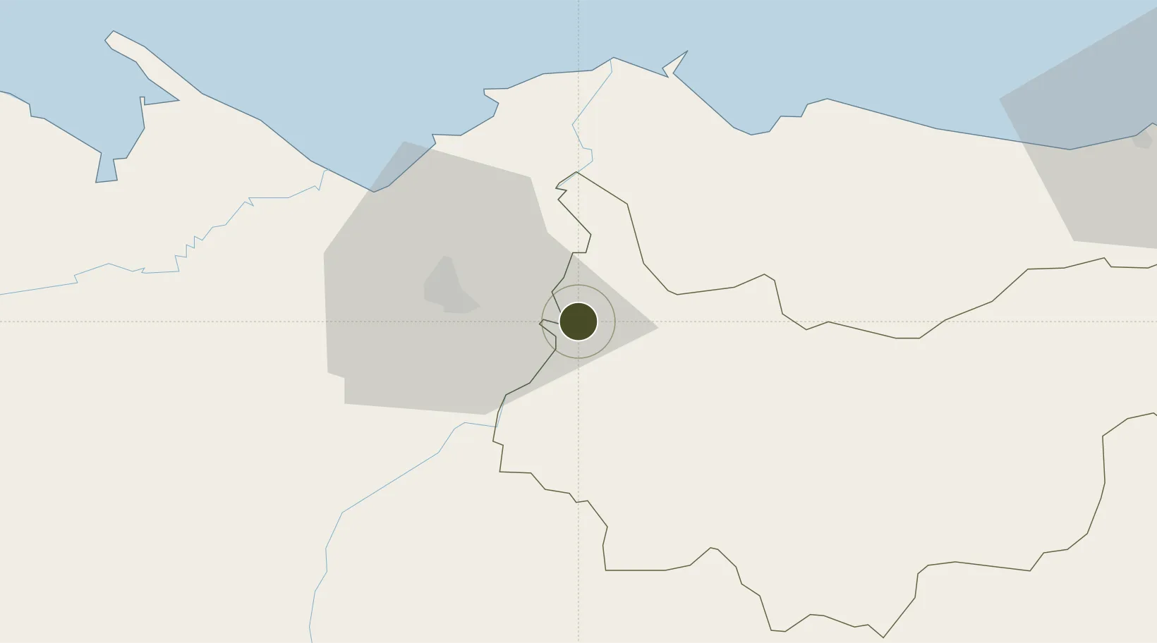
15.4564°, -87.7841°
18 ha
Zone area
45.5 km
Nearest port
15.0 km
Nearest airport

Gateway access

Nearest neighbours — logibook spatial index (haversine) over the source coordinates

Zone profile

Zone type
Free Zone
the World Bank SEZ database
Region
Yoro
the World Bank SEZ database
Status
Active
the World Bank SEZ database
Established
1996
the World Bank SEZ database
Management
Private management
the World Bank SEZ database
Operator
Private developer/operator
the World Bank SEZ database
Regulatory authority
Division of Industry and Commerce
the World Bank SEZ database
Legal framework
Law of Industrial Zones of Processing for Exports - Decree No 131-98
the World Bank SEZ database

Location

Location of HND13
Natural Earth 10m (public domain) · Yoro · HND13 · 15.46, -87.78GoogleOSMYandex

Fiscal & incentives

Corporate tax
30%
the World Bank SEZ database
Tax relief
100% exempt
the World Bank SEZ database
Relief duration
Perpetual
the World Bank SEZ database
VAT
100% exempt from VAT
the World Bank SEZ database
Import duty (inputs)
100% exempt
the World Bank SEZ database
Import duty (capex)
100% exempt
the World Bank SEZ database
Profit repatriation
100% exempt from repatriation tax on profits
the World Bank SEZ database
Capital gains
No exemption
the World Bank SEZ database
Withholding tax
No exemption
the World Bank SEZ database
Min. investment
None
the World Bank SEZ database
Min. export
95%
the World Bank SEZ database
Employment incentive
No exemption
the World Bank SEZ database
Developer incentive
Yes
the World Bank SEZ database

Nearby Logistics Neighbours

Ports
  1. 1Puerto Cortes46 km
  2. 2Tela51 km
  3. 3Puerto Barrios93 km
  4. 4Santo Tomas De Castilla93 km
  5. 5La Ceiba112 km
Nearest neighbours — logibook spatial index (haversine) over the source coordinates
Airports
  1. 1Ramón Villeda Morales International Airport15 km
  2. 2Tela Airport49 km
  3. 3Puerto Barrios Airport91 km
  4. 4Golosón International Airport105 km
  5. 5Palmerola International Airport121 km
Nearest neighbours — logibook spatial index (haversine) over the source coordinates
Cities
  1. 1El Progreso7 km
  2. 2San Pedro Sula22 km
  3. 3Búfalo25 km
  4. 4Chamelecón25 km
  5. 5Villanueva28 km
Nearest neighbours — logibook spatial index (haversine) over the source coordinates
Trade Zones
  1. 1ZIP Continental13 km
  2. 2ZIP Calpules20 km
  3. 3ZOLI Honduras Free Zone23 km
  4. 4ZOLI America Free Zone24 km
  5. 5ZIP San José24 km
Nearest neighbours — logibook spatial index (haversine) over the source coordinates
DatabookThe Record of Consolidated Knowledge
Honduras beyond logistics?
Browse databook

All Sources

Trade Zonesthe World Bank SEZ database
CC BY 4.0
Portsthe NGA World Port Index
Public domain (US gov)
AirportsOurAirports
Public domain
LocationsUN/LOCODE
UN/LOCODE — free
← Honduras trade zones