UN/LOCODE hub · United States
USLPD

Lincoln Park, Chicago

41.9167°, -87.6500°
2
Transport functions

Transport Functions

Road
Multimodal
UN/LOCODE

Hub Profile

Region
IL
GeoNames

Location

Location of USLPD
Natural Earth 10m (public domain) · IL · USLPD · 41.92, -87.65GoogleOSMYandex

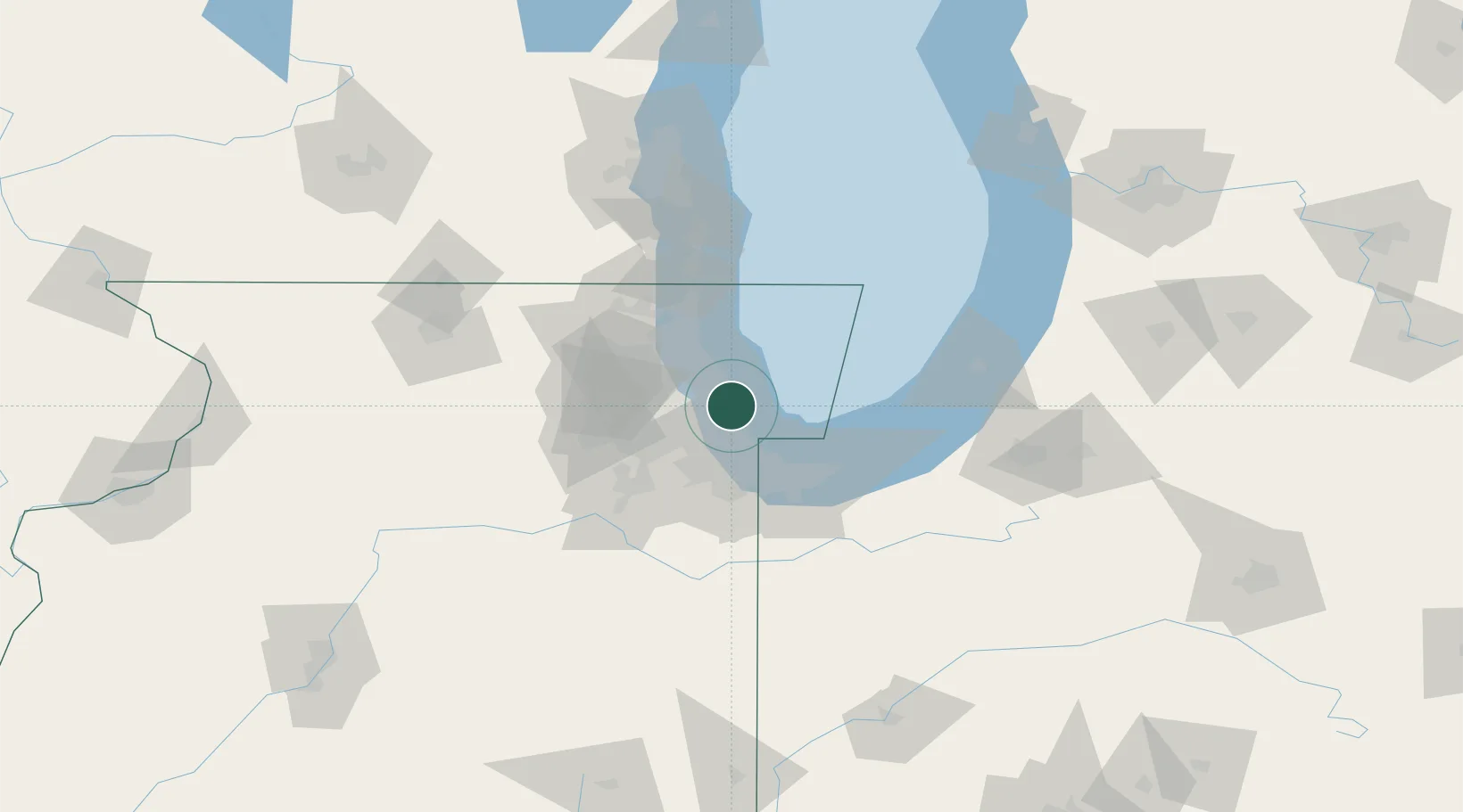
Nearby Logistics Neighbours

Cities
  1. 1Wicker Park2 km
  2. 2Oak Park12 km
  3. 3Harwood Heights14 km
  4. 4Norridge14 km
  5. 5River Grove15 km
Nearest neighbours — logibook spatial index (haversine) over the source coordinates
Ports
  1. 1Chicago6 km
  2. 2Wilmette19 km
  3. 3Calumet Harbor23 km
  4. 4Indiana Harbor33 km
  5. 5Gary43 km
Nearest neighbours — logibook spatial index (haversine) over the source coordinates
Airports
  1. 1Chicago Midway International Airport17 km
  2. 2Chicago O'Hare International Airport22 km
  3. 3Chicago Executive Airport30 km
  4. 4Gary/Chicago International Airport39 km
  5. 5Dupage Airport50 km
Nearest neighbours — logibook spatial index (haversine) over the source coordinates
Trade Zones
  1. 1FTZ No. 022 Chicago21 km
  2. 2FTZ No. 292 Lake County49 km
  3. 3FTZ No. 152 Burns Harbor52 km
  4. 4FTZ No. 125 South Bend111 km
  5. 5FTZ No. 041 Milwaukee132 km
Nearest neighbours — logibook spatial index (haversine) over the source coordinates
DatabookThe Record of Consolidated Knowledge
United States beyond logistics?
Browse databook

All Sources

LocationsUN/LOCODE
UN/LOCODE — free
Portsthe NGA World Port Index
Public domain (US gov)
AirportsOurAirports
Public domain
Trade Zonesthe World Bank SEZ database
CC BY 4.0
Trade ZonesOpen Zone Map
CC BY
← United States locations