UN/LOCODE hub · Ukraine
UAZUS

Orane

50.8000°, 24.2000°
1
Transport functions

Transport Functions

Multimodal
UN/LOCODE

Hub Profile

Place type
Populated place
GeoNames
Region
Kyiv
GeoNames
Time zone
Europe/Kyiv
GeoNames
Elevation
110 m
GeoNames

Location

Location of UAZUS
Natural Earth 10m (public domain) · Kyiv · UAZUS · 50.80, 24.20GoogleOSMYandex

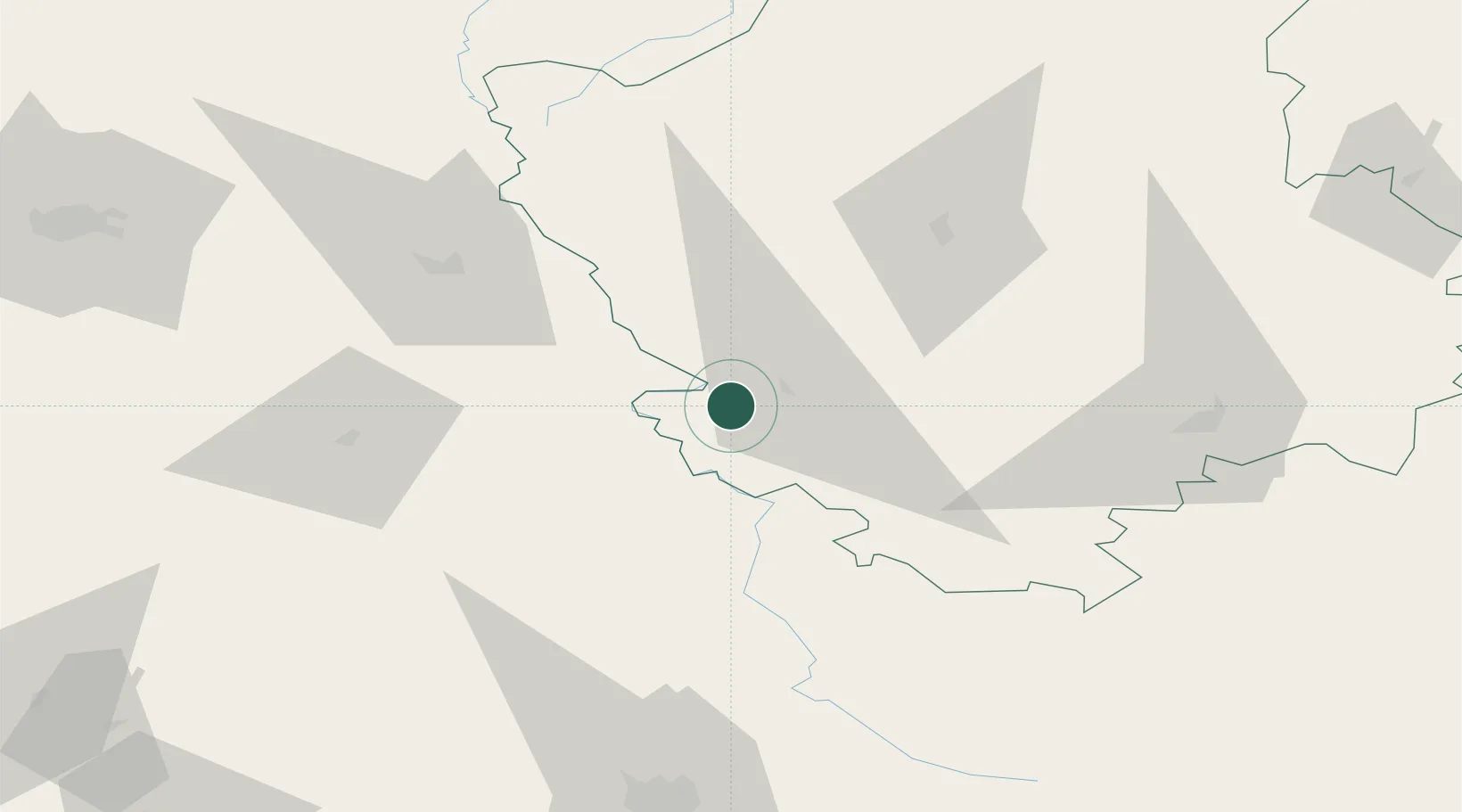
Nearby Logistics Neighbours

Cities
  1. 1Novovolyns'k8 km
  2. 2Hrubieszów20 km
  3. 3Nieledew28 km
  4. 4Teresin43 km
  5. 5Dorohusk50 km
Nearest neighbours — logibook spatial index (haversine) over the source coordinates
Ports
  1. 1Kaliningrad501 km
  2. 2Baltiysk515 km
  3. 3Gdansk543 km
  4. 4Nowy Port549 km
  5. 5Gdynia563 km
Nearest neighbours — logibook spatial index (haversine) over the source coordinates
Airports
  1. 1Lviv International Airport111 km
  2. 2Lublin Airport115 km
  3. 3Rivne International Airport138 km
  4. 4Brest International Airport147 km
  5. 5Rzeszów-Jasionka Airport172 km
Nearest neighbours — logibook spatial index (haversine) over the source coordinates
Trade Zones
  1. 1Special Economic Zone Interport Kovel38 km
  2. 2Special Economic Zone Yavoriv111 km
  3. 3Lublin Subzone (of Euro-Park Mielec)133 km
  4. 4Free Customs Area in Małaszewicze145 km
  5. 5Free Economic Zone Brest147 km
Nearest neighbours — logibook spatial index (haversine) over the source coordinates
DatabookThe Record of Consolidated Knowledge
Ukraine beyond logistics?
Browse databook

All Sources

LocationsUN/LOCODE
UN/LOCODE — free
Portsthe NGA World Port Index
Public domain (US gov)
AirportsOurAirports
Public domain
Trade Zonesthe World Bank SEZ database
CC BY 4.0
Trade ZonesOpen Zone Map
CC BY
← Ukraine locations