UN/LOCODE hub · Türkiye
TRKPY

Kapiköy

38.5000°, 44.3000°
1
Transport functions

Transport Functions

Rail
UN/LOCODE

Hub Profile

Region
65
GeoNames

Location

Location of TRKPY
Natural Earth 10m (public domain) · 65 · TRKPY · 38.50, 44.30GoogleOSMYandex

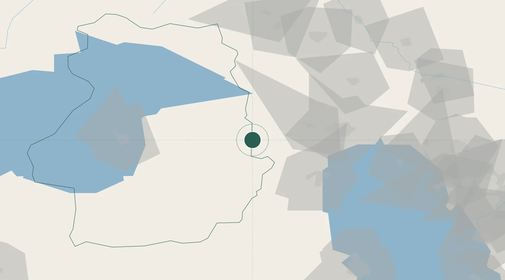
Nearby Logistics Neighbours

Cities
  1. 1Emek30 km
  2. 2Ercis100 km
  3. 3Naxcivan112 km
  4. 4Dogubayazit116 km
  5. 5Jolfa127 km
Nearest neighbours — logibook spatial index (haversine) over the source coordinates
Ports
  1. 1Hopa408 km
  2. 2Batumi417 km
  3. 3Rize431 km
  4. 4Supsa Marine Terminal456 km
  5. 5Trabzon478 km
Nearest neighbours — logibook spatial index (haversine) over the source coordinates
Airports
  1. 1Van Ferit Melen Airport84 km
  2. 2Maku National Airport94 km
  3. 3Hakkari Yüksekova Airport106 km
  4. 4Urmia Airport114 km
  5. 5Nakhchivan International Airport126 km
Nearest neighbours — logibook spatial index (haversine) over the source coordinates
Trade Zones
  1. 1Salmas Special Economic Zone50 km
  2. 2Maku Mako Trade-Industrial Free Zone97 km
  3. 3Aras Trade Industrial Free Zone125 km
  4. 4Sahlan Special Economic Zone163 km
  5. 5West Islamabad Special Economic Zone168 km
Nearest neighbours — logibook spatial index (haversine) over the source coordinates
DatabookThe Record of Consolidated Knowledge
Türkiye beyond logistics?
Browse databook

All Sources

LocationsUN/LOCODE
UN/LOCODE — free
Portsthe NGA World Port Index
Public domain (US gov)
AirportsOurAirports
Public domain
Trade Zonesthe World Bank SEZ database
CC BY 4.0
Trade ZonesOpen Zone Map
CC BY
← Türkiye locations