UN/LOCODE hub · Saudi Arabia
SAJYC

Jeddah Yachts Club Port

21.6500°, 39.1000°
1
Transport functions

Transport Functions

Port
UN/LOCODE

Hub Profile

Region
02
GeoNames

Location

Location of SAJYC
Natural Earth 10m (public domain) · 02 · SAJYC · 21.65, 39.10GoogleOSMYandex

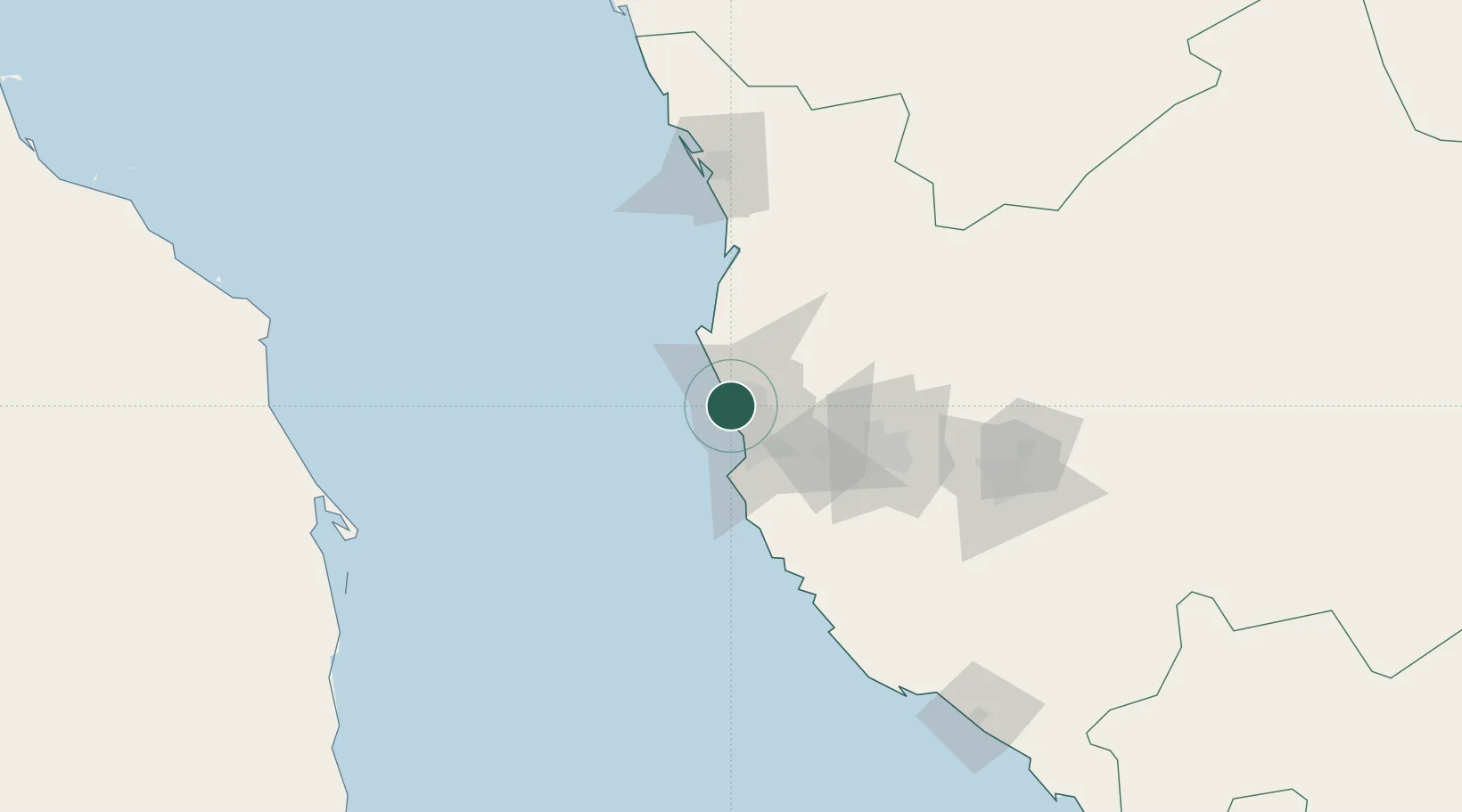
Nearby Logistics Neighbours

Cities
  1. 1Tusdeer Free Zone19 km
  2. 2Jeddah33 km
  3. 3King Abdullah City91 km
  4. 4Shuaibah116 km
  5. 5Gialtra143 km
Nearest neighbours — logibook spatial index (haversine) over the source coordinates
Ports
  1. 1Jiddah20 km
  2. 2Rabigh121 km
  3. 3Yanbu291 km
  4. 4Port Sudan300 km
  5. 5Sawakin Harbor334 km
Nearest neighbours — logibook spatial index (haversine) over the source coordinates
Airports
  1. 1King Abdulaziz International Airport7 km
  2. 2King Faisal Naval Base34 km
  3. 3Mecca East Airport96 km
  4. 4Taif International Airport151 km
  5. 5Prince Abdulmohsen Bin Abdulaziz International Airport297 km
Nearest neighbours — logibook spatial index (haversine) over the source coordinates
Trade Zones
  1. 1Jeddah Industrial City (First)27 km
  2. 2Jeddah Modon Oasis34 km
  3. 3Jeddah Industrial City (Second)62 km
  4. 4Jeddah Industrial City (Third)64 km
  5. 5Makkah Industrial City74 km
Nearest neighbours — logibook spatial index (haversine) over the source coordinates
DatabookThe Record of Consolidated Knowledge
Saudi Arabia beyond logistics?
Browse databook

All Sources

LocationsUN/LOCODE
UN/LOCODE — free
Portsthe NGA World Port Index
Public domain (US gov)
AirportsOurAirports
Public domain
Trade Zonesthe World Bank SEZ database
CC BY 4.0
Trade ZonesOpen Zone Map
CC BY
← Saudi Arabia locations