UN/LOCODE hub · Philippines
PHAMU

Amunitan/Aparri

18.3167°, 122.0500°
1
Transport functions

Transport Functions

Port
UN/LOCODE

Hub Profile

Region
CAG
GeoNames

Location

Location of PHAMU
Natural Earth 10m (public domain) · CAG · PHAMU · 18.32, 122.05GoogleOSMYandex

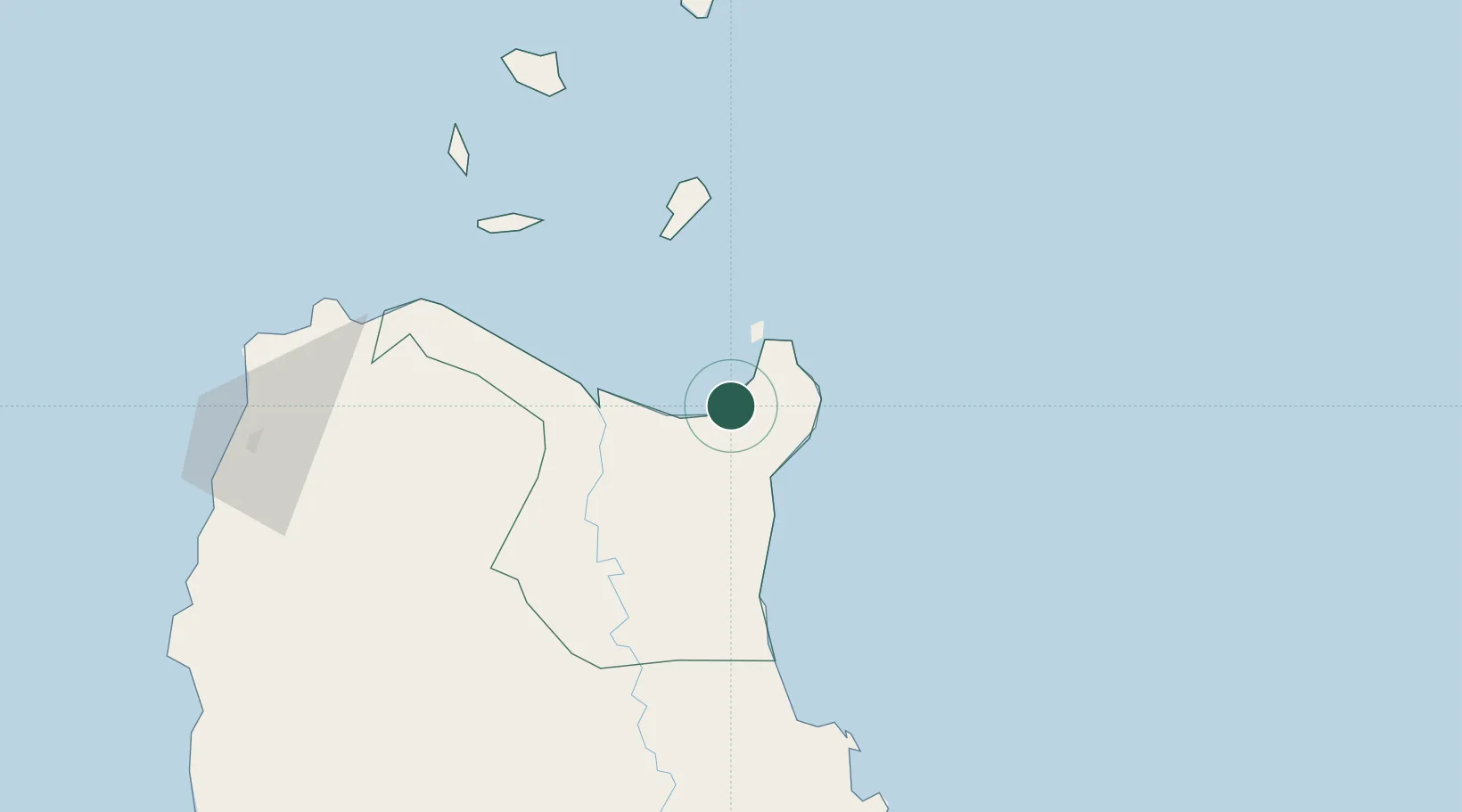
Nearby Logistics Neighbours

Cities
  1. 1Port Irene8 km
  2. 2Abulug65 km
  3. 3Pasaleng, Luzon122 km
  4. 4Sucat145 km
  5. 5Laoag, Luzon156 km
Nearest neighbours — logibook spatial index (haversine) over the source coordinates
Ports
  1. 1Aparri44 km
  2. 2Claveria107 km
  3. 3Basco237 km
  4. 4San Fernando Harbor264 km
  5. 5Masinloc380 km
Nearest neighbours — logibook spatial index (haversine) over the source coordinates
Airports
  1. 1Cagayan North International Airport35 km
  2. 2Tuguegarao Airport82 km
  3. 3Palanan Community Airport145 km
  4. 4Cauayan Airport157 km
  5. 5Laoag International Airport161 km
Nearest neighbours — logibook spatial index (haversine) over the source coordinates
Trade Zones
  1. 1PIPC Cagayan North35 km
  2. 2Ecofuel Agro-Industrial Ecozone148 km
  3. 3Ilocano Heroes Hall Techno Center155 km
  4. 4The VYV155 km
  5. 5Venvi IT Hub155 km
Nearest neighbours — logibook spatial index (haversine) over the source coordinates
DatabookThe Record of Consolidated Knowledge
Philippines beyond logistics?
Browse databook

All Sources

LocationsUN/LOCODE
UN/LOCODE — free
Portsthe NGA World Port Index
Public domain (US gov)
AirportsOurAirports
Public domain
Trade Zonesthe World Bank SEZ database
CC BY 4.0
Trade ZonesOpen Zone Map
CC BY
← Philippines locations