UN/LOCODE hub · Norway
NOSTY

Stjernøya

70.3000°, 22.7167°
1
Transport functions

Transport Functions

Port
UN/LOCODE

Hub Profile

Region
20
GeoNames

Location

Location of NOSTY
Natural Earth 10m (public domain) · 20 · NOSTY · 70.30, 22.72GoogleOSMYandex

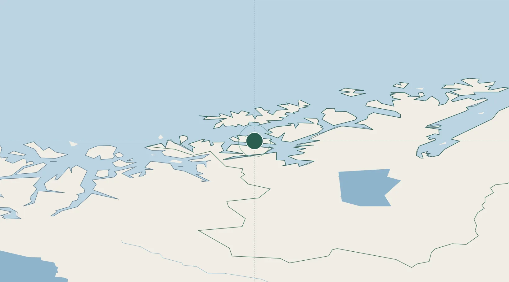
Nearby Logistics Neighbours

Cities
  1. 1Øksfjord16 km
  2. 2Hasvik28 km
  3. 3Kårhamn32 km
  4. 4Breivikbotn35 km
  5. 5Bergsfjord36 km
Nearest neighbours — logibook spatial index (haversine) over the source coordinates
Ports
  1. 1Oksfjord16 km
  2. 2Alta41 km
  3. 3Sorvaer46 km
  4. 4Kvalsund53 km
  5. 5Hammerfest54 km
Nearest neighbours — logibook spatial index (haversine) over the source coordinates
Airports
  1. 1Hasvik Airport30 km
  2. 2Alta Airport44 km
  3. 3Hammerfest Airport55 km
  4. 4Sørkjosen Airport88 km
  5. 5Lakselv Airport, Banak89 km
Nearest neighbours — logibook spatial index (haversine) over the source coordinates
Trade Zones
  1. 1Murmansk Special Economic Zone427 km
  2. 2Oulu Port Free Warehouse Area601 km
  3. 3Free Zone of Lappeenranta1058 km
  4. 4Turku Free Zone1096 km
  5. 5Port of Hamina-Kotka1110 km
Nearest neighbours — logibook spatial index (haversine) over the source coordinates
DatabookThe Record of Consolidated Knowledge
Norway beyond logistics?
Browse databook

All Sources

LocationsUN/LOCODE
UN/LOCODE — free
Portsthe NGA World Port Index
Public domain (US gov)
AirportsOurAirports
Public domain
Trade Zonesthe World Bank SEZ database
CC BY 4.0
Trade ZonesOpen Zone Map
CC BY
← Norway locations