UN/LOCODE hub · Norway
NONZD

Bremnes

59.7833°, 5.1667°
1
Transport functions

Transport Functions

Multimodal
UN/LOCODE

Hub Profile

Place type
Populated place
GeoNames
Region
Nordland
GeoNames
Time zone
Europe/Oslo
GeoNames

Location

Location of NONZD
Natural Earth 10m (public domain) · Nordland · NONZD · 59.78, 5.17GoogleOSMYandex

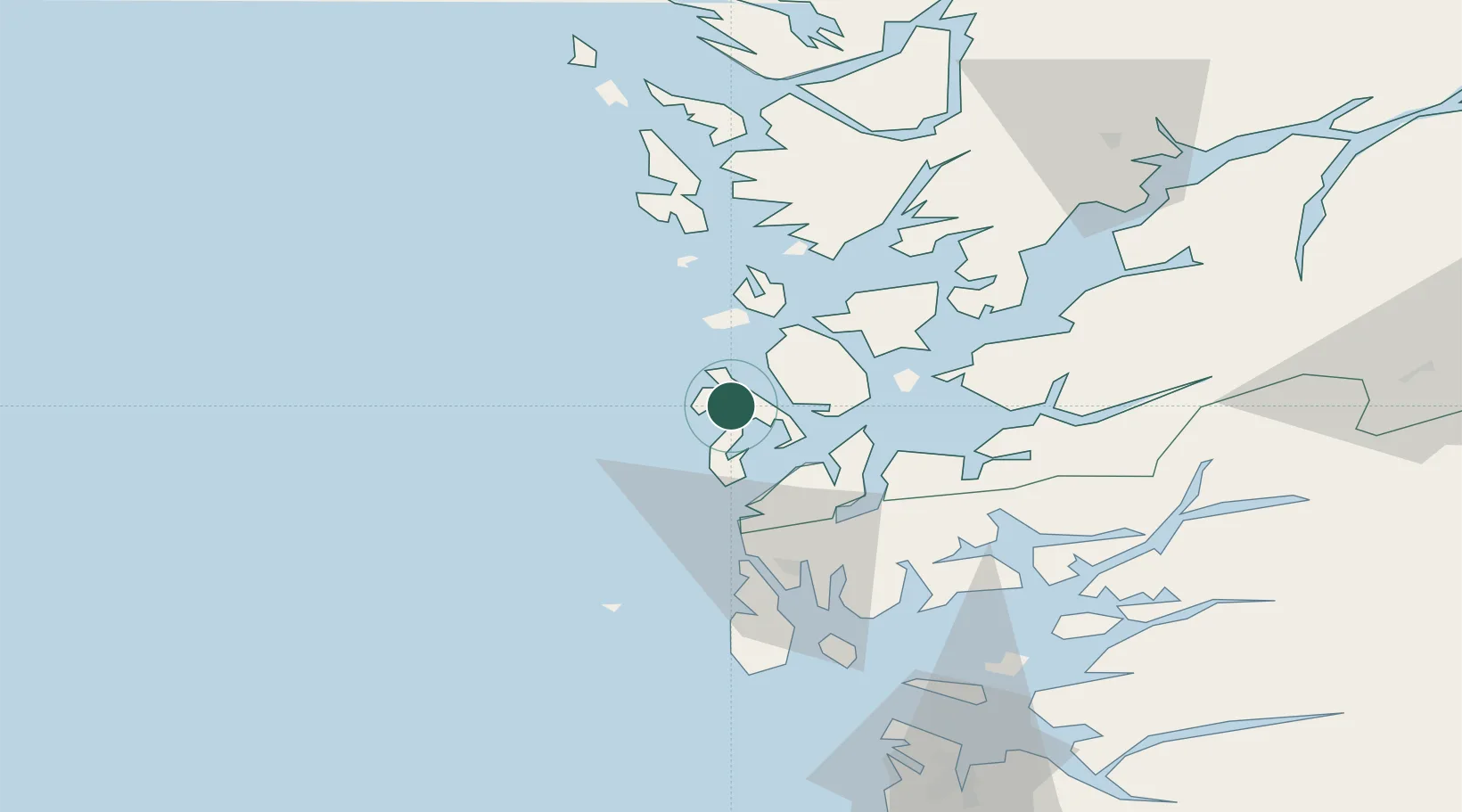
Nearby Logistics Neighbours

Cities
  1. 1Rubbestadneset6 km
  2. 2Brandasund14 km
  3. 3Fitjar17 km
  4. 4Stord base18 km
  5. 5Stord18 km
Nearest neighbours — logibook spatial index (haversine) over the source coordinates
Ports
  1. 1Mosterhamn16 km
  2. 2Leirvik19 km
  3. 3Husnes35 km
  4. 4Haugesund42 km
  5. 5Kopervik56 km
Nearest neighbours — logibook spatial index (haversine) over the source coordinates
Airports
  1. 1Stord Airport, Sørstokken10 km
  2. 2Haugesund Airport, Karmøy49 km
  3. 3Bergen Airport, Flesland57 km
  4. 4Stavanger Airport, Sola104 km
  5. 5Førde Airport, Bringeland182 km
Nearest neighbours — logibook spatial index (haversine) over the source coordinates
Trade Zones
  1. 1Gothenburg Boundless Customs Warehouse447 km
  2. 2North Eastern Enterprise Zone672 km
  3. 3Freeport of Kiel677 km
  4. 4Tees Valley Enterprise Zone691 km
  5. 5Freeport of Cuxhaven (Freihafen Cuxhaven)694 km
Nearest neighbours — logibook spatial index (haversine) over the source coordinates
DatabookThe Record of Consolidated Knowledge
Norway beyond logistics?
Browse databook

All Sources

LocationsUN/LOCODE
UN/LOCODE — free
Portsthe NGA World Port Index
Public domain (US gov)
AirportsOurAirports
Public domain
Trade Zonesthe World Bank SEZ database
CC BY 4.0
Trade ZonesOpen Zone Map
CC BY
← Norway locations