UN/LOCODE hub · Norway
NOKRA

Kragerø

58.8667°, 9.4000°
3
Transport functions

Transport Functions

Port
Rail
Road
Kragerø is also a profiled seaport →
UN/LOCODE

Hub Profile

Region
08
GeoNames

Location

Location of NOKRA
Natural Earth 10m (public domain) · 08 · NOKRA · 58.87, 9.40GoogleOSMYandex

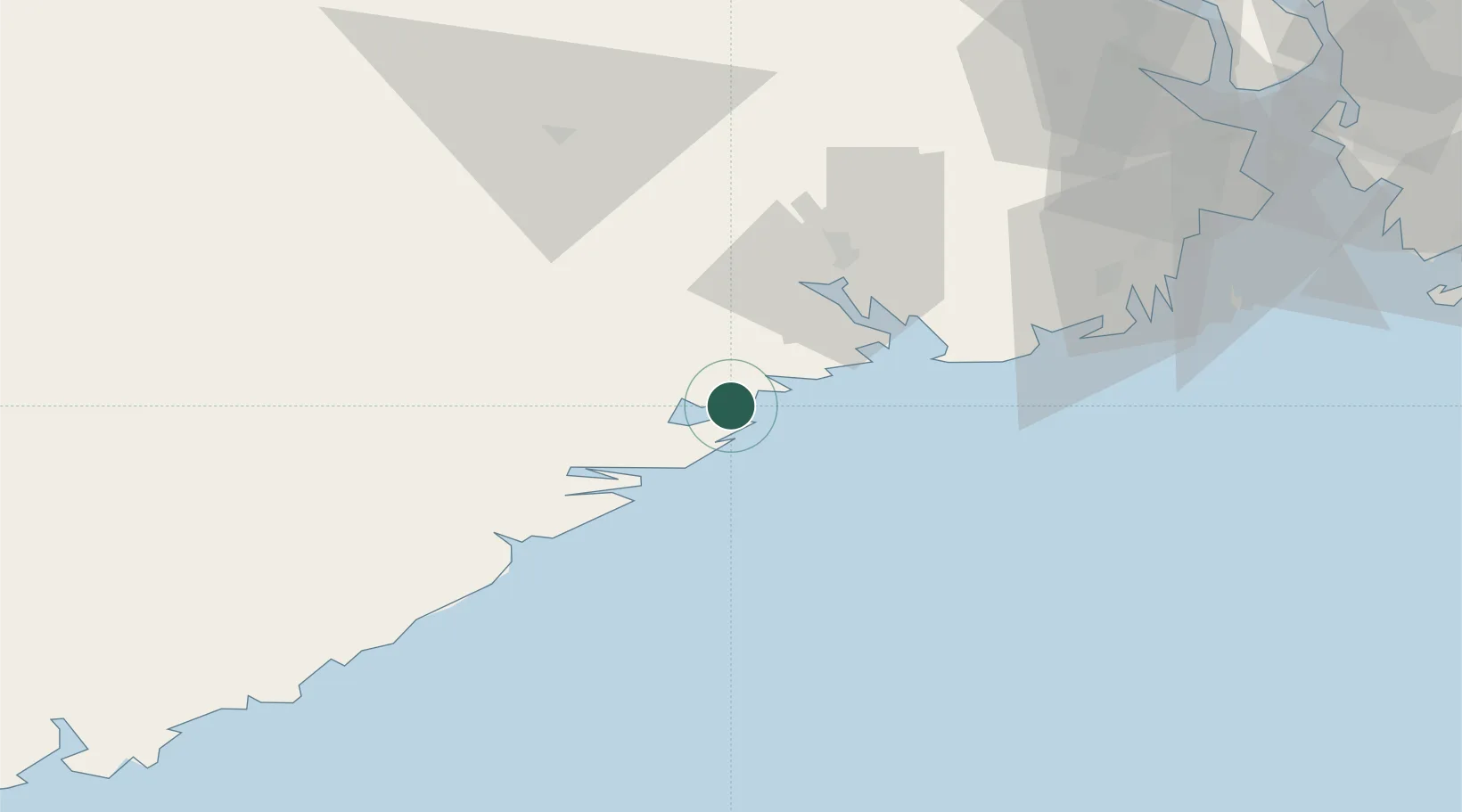
Nearby Logistics Neighbours

Cities
  1. 1Valberg2 km
  2. 2Åtangen3 km
  3. 3Helle - Kragerø4 km
  4. 4Snekkevik6 km
  5. 5Litangen6 km
Nearest neighbours — logibook spatial index (haversine) over the source coordinates
Ports
  1. 1Risor18 km
  2. 2Brevik28 km
  3. 3Porsgrunn34 km
  4. 4Tvedestrand39 km
  5. 5Skien39 km
Nearest neighbours — logibook spatial index (haversine) over the source coordinates
Airports
  1. 1Skien Airport37 km
  2. 2Sandefjord Airport, Torp61 km
  3. 3Notodden Airport78 km
  4. 4Moss Airport, Rygge97 km
  5. 5Kristiansand Airport106 km
Nearest neighbours — logibook spatial index (haversine) over the source coordinates
Trade Zones
  1. 1Gothenburg Boundless Customs Warehouse191 km
  2. 2Jönköping Free Zone300 km
  3. 3Freeport of Copenhagen- Nordhavn400 km
  4. 4MTS Malmö Transport and Spedition425 km
  5. 5Freeport of Kiel506 km
Nearest neighbours — logibook spatial index (haversine) over the source coordinates
DatabookThe Record of Consolidated Knowledge
Norway beyond logistics?
Browse databook

All Sources

LocationsUN/LOCODE
UN/LOCODE — free
Portsthe NGA World Port Index
Public domain (US gov)
AirportsOurAirports
Public domain
Trade Zonesthe World Bank SEZ database
CC BY 4.0
Trade ZonesOpen Zone Map
CC BY
← Norway locations