UN/LOCODE hub · Norway
NOHKR

Helle - Kragerø

58.9000°, 9.4000°
1
Transport functions

Transport Functions

Port
UN/LOCODE

Hub Profile

Region
08
GeoNames

Location

Location of NOHKR
Natural Earth 10m (public domain) · 08 · NOHKR · 58.90, 9.40GoogleOSMYandex

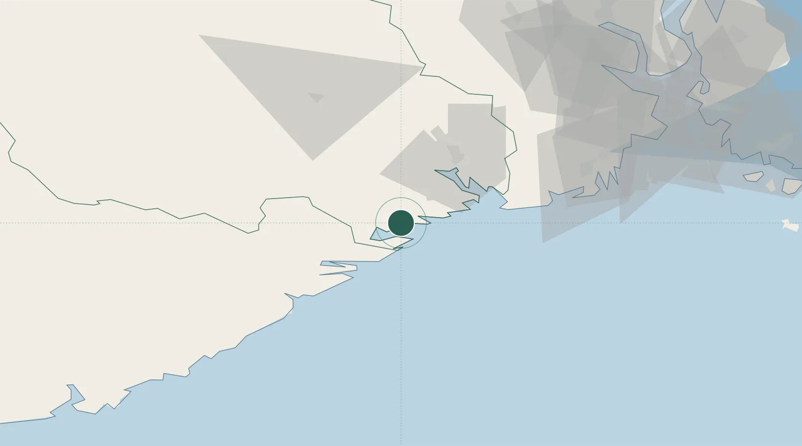
Nearby Logistics Neighbours

Cities
  1. 1Valberg2 km
  2. 2Kragerø4 km
  3. 3Åtangen5 km
  4. 4Kjørebonn5 km
  5. 5Fossing5 km
Nearest neighbours — logibook spatial index (haversine) over the source coordinates
Ports
  1. 1Kragero4 km
  2. 2Risor22 km
  3. 3Brevik25 km
  4. 4Porsgrunn31 km
  5. 5Skien35 km
Nearest neighbours — logibook spatial index (haversine) over the source coordinates
Airports
  1. 1Skien Airport33 km
  2. 2Sandefjord Airport, Torp59 km
  3. 3Notodden Airport75 km
  4. 4Moss Airport, Rygge95 km
  5. 5Kristiansand Airport109 km
Nearest neighbours — logibook spatial index (haversine) over the source coordinates
Trade Zones
  1. 1Gothenburg Boundless Customs Warehouse194 km
  2. 2Jönköping Free Zone302 km
  3. 3Freeport of Copenhagen- Nordhavn403 km
  4. 4MTS Malmö Transport and Spedition428 km
  5. 5Freeport of Kiel510 km
Nearest neighbours — logibook spatial index (haversine) over the source coordinates
DatabookThe Record of Consolidated Knowledge
Norway beyond logistics?
Browse databook

All Sources

LocationsUN/LOCODE
UN/LOCODE — free
Portsthe NGA World Port Index
Public domain (US gov)
AirportsOurAirports
Public domain
Trade Zonesthe World Bank SEZ database
CC BY 4.0
Trade ZonesOpen Zone Map
CC BY
← Norway locations