UN/LOCODE hub · Norway
NOATA

Åtangen

58.8667°, 9.3500°
1
Transport functions

Transport Functions

Port
UN/LOCODE

Hub Profile

Place type
Populated place
GeoNames
Region
Telemark
GeoNames
Time zone
Europe/Oslo
GeoNames
Elevation
24 m
GeoNames

Location

Location of NOATA
Natural Earth 10m (public domain) · Telemark · NOATA · 58.87, 9.35GoogleOSMYandex

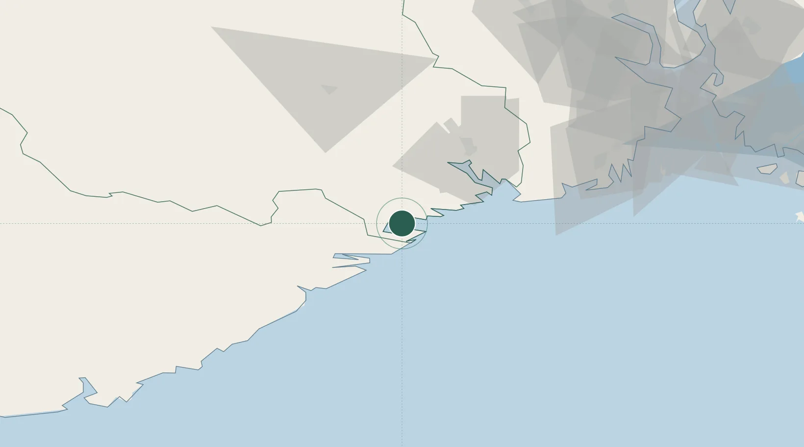
Nearby Logistics Neighbours

Cities
  1. 1Snekkevik3 km
  2. 2Kragerø3 km
  3. 3Litangen3 km
  4. 4Sannidal4 km
  5. 5Valberg4 km
Nearest neighbours — logibook spatial index (haversine) over the source coordinates
Ports
  1. 1Kragero4 km
  2. 2Risor17 km
  3. 3Brevik30 km
  4. 4Porsgrunn36 km
  5. 5Tvedestrand37 km
Nearest neighbours — logibook spatial index (haversine) over the source coordinates
Airports
  1. 1Skien Airport38 km
  2. 2Sandefjord Airport, Torp63 km
  3. 3Notodden Airport78 km
  4. 4Moss Airport, Rygge100 km
  5. 5Kristiansand Airport104 km
Nearest neighbours — logibook spatial index (haversine) over the source coordinates
Trade Zones
  1. 1Gothenburg Boundless Customs Warehouse193 km
  2. 2Jönköping Free Zone303 km
  3. 3Freeport of Copenhagen- Nordhavn401 km
  4. 4MTS Malmö Transport and Spedition427 km
  5. 5Freeport of Kiel507 km
Nearest neighbours — logibook spatial index (haversine) over the source coordinates
DatabookThe Record of Consolidated Knowledge
Norway beyond logistics?
Browse databook

All Sources

LocationsUN/LOCODE
UN/LOCODE — free
Portsthe NGA World Port Index
Public domain (US gov)
AirportsOurAirports
Public domain
Trade Zonesthe World Bank SEZ database
CC BY 4.0
Trade ZonesOpen Zone Map
CC BY
← Norway locations