UN/LOCODE hub · Italy
ITBOA

Bosa

40.3000°, 8.5000°
7,874
Population
3
Transport functions

Transport Functions

Port
Rail
Road
UN/LOCODE

Hub Profile

Place type
District seat
GeoNames
Region
Sardinia
GeoNames
Population
7,874
GeoNames
Time zone
Europe/Rome
GeoNames
Elevation
2 m
GeoNames

Location

Location of ITBOA
Natural Earth 10m (public domain) · Sardinia · ITBOA · 40.30, 8.50GoogleOSMYandex

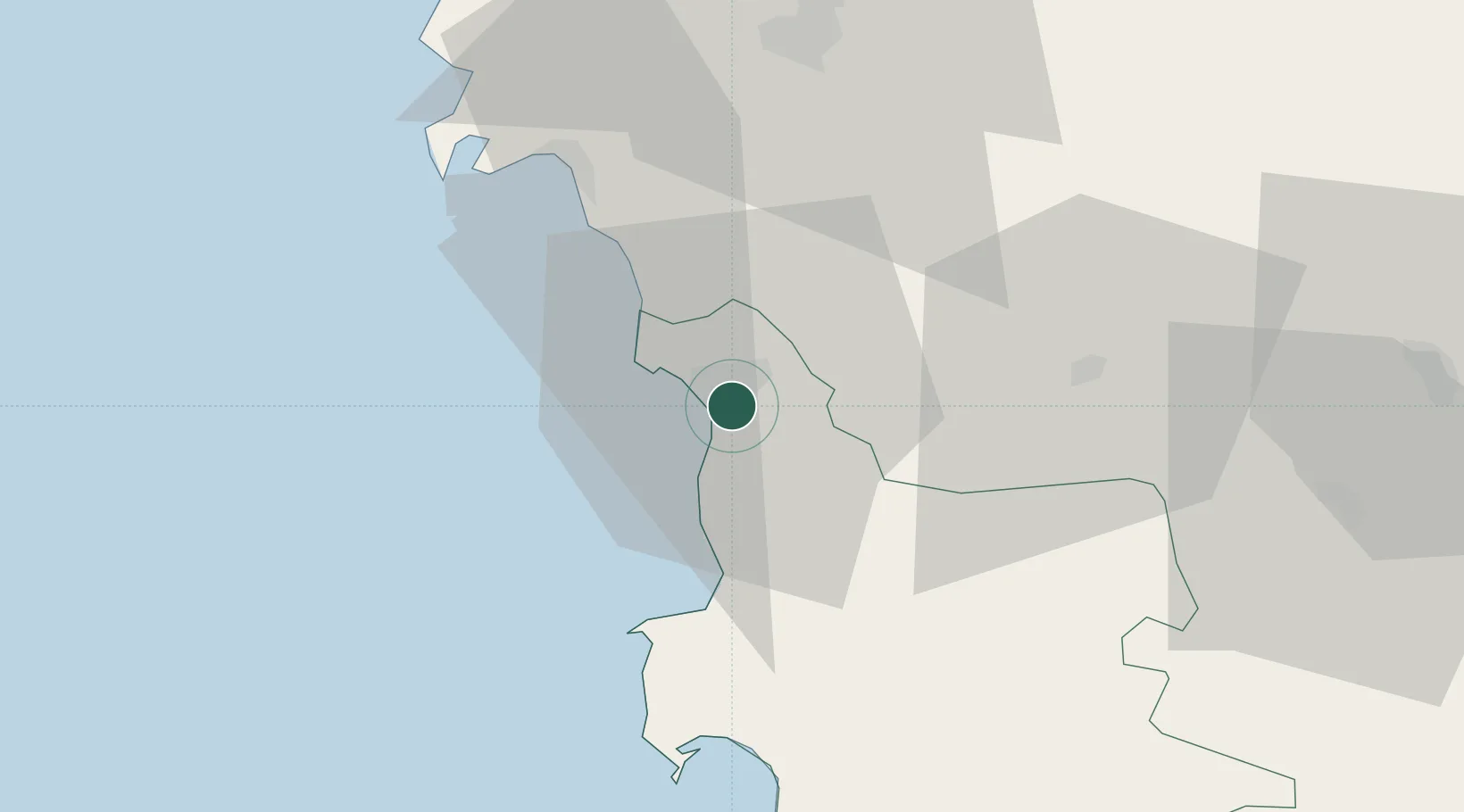
Nearby Logistics Neighbours

Cities
  1. 1Macomer23 km
  2. 2Alghero32 km
  3. 3Porto Conte Torre Nuova42 km
  4. 4Oristano45 km
  5. 5Sassari47 km
Nearest neighbours — logibook spatial index (haversine) over the source coordinates
Ports
  1. 1Alghero34 km
  2. 2Porto Di Oristano48 km
  3. 3Porto Torres62 km
  4. 4Arbatax110 km
  5. 5Olbia111 km
Nearest neighbours — logibook spatial index (haversine) over the source coordinates
Airports
  1. 1Alghero-Fertilia Airport41 km
  2. 2Olbia Costa Smeralda Airport109 km
  3. 3Tortolì Airport109 km
  4. 4Decimomannu Air Base113 km
  5. 5Cagliari Elmas Airport126 km
Nearest neighbours — logibook spatial index (haversine) over the source coordinates
Trade Zones
  1. 1Sardinia Special Economic Zone Area53 km
  2. 2Free Zone of Portovesme124 km
  3. 3Bizerte Park of Economic Activities357 km
  4. 4ZFU Toulon379 km
  5. 5ZFU La Seyne-sur-Mer380 km
Nearest neighbours — logibook spatial index (haversine) over the source coordinates
DatabookThe Record of Consolidated Knowledge
Italy beyond logistics?
Browse databook

All Sources

LocationsUN/LOCODE
UN/LOCODE — free
LocationsGeoNames
CC BY 4.0
Portsthe NGA World Port Index
Public domain (US gov)
AirportsOurAirports
Public domain
Trade Zonesthe World Bank SEZ database
CC BY 4.0
Trade ZonesOpen Zone Map
CC BY
← Italy locations