UN/LOCODE hub · India
INTPJ

ECTN SEZ/Tiruchirapalli

10.8167°, 78.6833°
1
Transport functions

Transport Functions

Multimodal
UN/LOCODE

Hub Profile

Region
TN
GeoNames

Location

Location of INTPJ
Natural Earth 10m (public domain) · TN · INTPJ · 10.82, 78.68GoogleOSMYandex

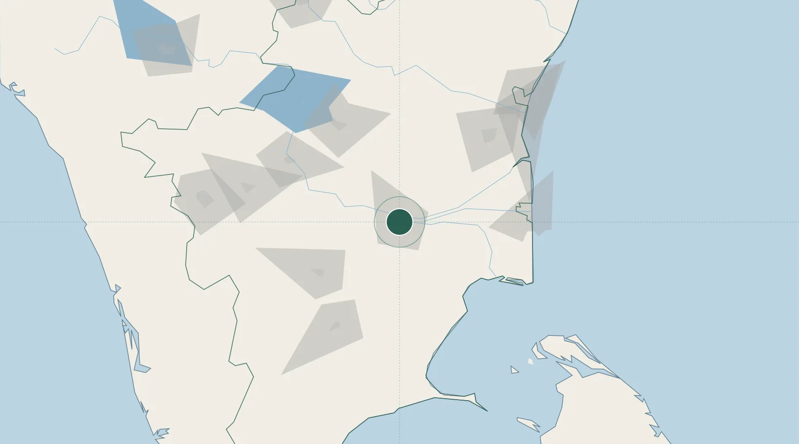
Nearby Logistics Neighbours

Cities
  1. 1Karur67 km
  2. 2Kumbakonam78 km
  3. 3Ambatturai (Ambathurai)102 km
  4. 4Fllpl-SEZ/Thirruvallur106 km
  5. 5ECTN SEZ/Salem109 km
Nearest neighbours — logibook spatial index (haversine) over the source coordinates
Ports
  1. 1Nagappattinam128 km
  2. 2Karaikal Port129 km
  3. 3Cuddalore155 km
  4. 4Pondicherry176 km
  5. 5Kankesanturai186 km
Nearest neighbours — logibook spatial index (haversine) over the source coordinates
Airports
  1. 1Tiruchirappalli International Airport7 km
  2. 2Salem Airport127 km
  3. 3Madurai Airport127 km
  4. 4Pondicherry Airport178 km
  5. 5Coimbatore International Airport181 km
Nearest neighbours — logibook spatial index (haversine) over the source coordinates
Trade Zones
  1. 1Aspen Karumathamapatti Special Economic Zone (Formerly Aspen)169 km
  2. 2Rathinam Techzone186 km
  3. 3Span Ventures187 km
  4. 4Jaffna - Atchchuveli Industrial Estate195 km
  5. 5Hcl Technologies Ltd.246 km
Nearest neighbours — logibook spatial index (haversine) over the source coordinates
DatabookThe Record of Consolidated Knowledge
India beyond logistics?
Browse databook

All Sources

LocationsUN/LOCODE
UN/LOCODE — free
Portsthe NGA World Port Index
Public domain (US gov)
AirportsOurAirports
Public domain
Trade Zonesthe World Bank SEZ database
CC BY 4.0
Trade ZonesOpen Zone Map
CC BY
← India locations