UN/LOCODE hub · India
INTCR

Tics ICD/Mathilakam

10.5167°, 76.2167°
1
Transport functions

Transport Functions

Multimodal
UN/LOCODE

Hub Profile

Region
KL
GeoNames

Location

Location of INTCR
Natural Earth 10m (public domain) · KL · INTCR · 10.52, 76.22GoogleOSMYandex

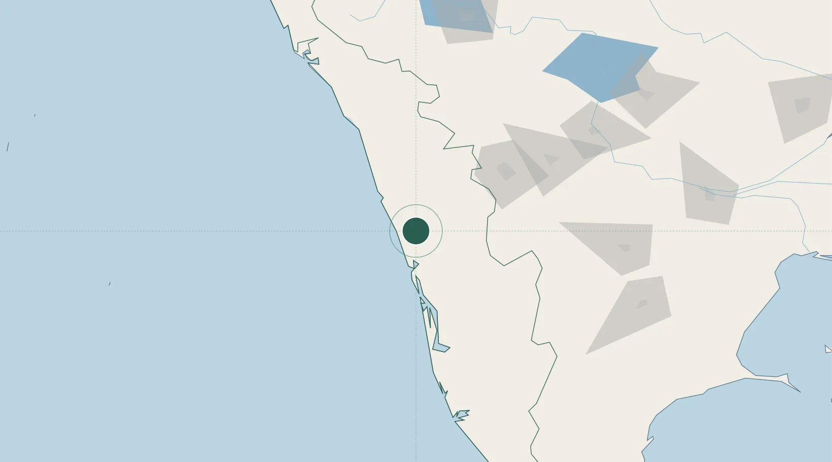
Nearby Logistics Neighbours

Cities
  1. 1INFOPARK SEZ/Koratty29 km
  2. 2Ernakulam50 km
  3. 3Palghat56 km
  4. 4Cochin59 km
  5. 5Puthuvypeen-SEZ/Ernakulam60 km
Nearest neighbours — logibook spatial index (haversine) over the source coordinates
Ports
  1. 1Kochi (Cochin)61 km
  2. 2Beypore85 km
  3. 3Calicut (Kozhikode)95 km
  4. 4Azhikal (Azhikkal)187 km
  5. 5Quilon (Kollam)187 km
Nearest neighbours — logibook spatial index (haversine) over the source coordinates
Airports
  1. 1Cochin International Airport45 km
  2. 2Calicut International Airport75 km
  3. 3Coimbatore International Airport107 km
  4. 4Kannur International Airport172 km
  5. 5Mysore Airport196 km
Nearest neighbours — logibook spatial index (haversine) over the source coordinates
Trade Zones
  1. 1Carborundum Universal Ltd53 km
  2. 2M s. Smart City (Kochi) Infrastructure Limited59 km
  3. 3Cochin Special Economic Zone59 km
  4. 4Sutherland Global Services Pvt Ltd59 km
  5. 5Infopark Kochi59 km
Nearest neighbours — logibook spatial index (haversine) over the source coordinates
DatabookThe Record of Consolidated Knowledge
India beyond logistics?
Browse databook

All Sources

LocationsUN/LOCODE
UN/LOCODE — free
Portsthe NGA World Port Index
Public domain (US gov)
AirportsOurAirports
Public domain
Trade Zonesthe World Bank SEZ database
CC BY 4.0
Trade ZonesOpen Zone Map
CC BY
← India locations