UN/LOCODE hub · India
INERP

Puthuvypeen-SEZ/Ernakulam

9.9833°, 76.2833°
1
Transport functions

Transport Functions

Multimodal
UN/LOCODE

Hub Profile

Region
KL
GeoNames

Location

Location of INERP
Natural Earth 10m (public domain) · KL · INERP · 9.98, 76.28GoogleOSMYandex

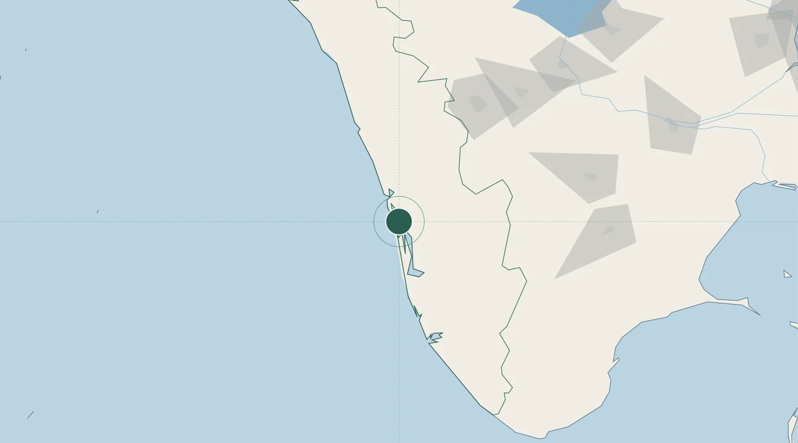
Nearby Logistics Neighbours

Cities
  1. 1Vallarpadom-SEZ/Ernakulam0 km
  2. 2Cochin1 km
  3. 3Edappally3 km
  4. 4Kakkanad6 km
  5. 5Thoppumpady7 km
Nearest neighbours — logibook spatial index (haversine) over the source coordinates
Ports
  1. 1Kochi (Cochin)6 km
  2. 2Quilon (Kollam)128 km
  3. 3Beypore142 km
  4. 4Calicut (Kozhikode)152 km
  5. 5Trivandrum182 km
Nearest neighbours — logibook spatial index (haversine) over the source coordinates
Airports
  1. 1Cochin International Airport23 km
  2. 2Calicut International Airport133 km
  3. 3Coimbatore International Airport143 km
  4. 4Thiruvananthapuram International Airport181 km
  5. 5Madurai Airport199 km
Nearest neighbours — logibook spatial index (haversine) over the source coordinates
Trade Zones
  1. 1Cochin Port Trust4 km
  2. 2Sutherland Global Services Pvt Ltd6 km
  3. 3Cochin Special Economic Zone7 km
  4. 4Carborundum Universal Ltd8 km
  5. 5Infopark Kochi10 km
Nearest neighbours — logibook spatial index (haversine) over the source coordinates
DatabookThe Record of Consolidated Knowledge
India beyond logistics?
Browse databook

All Sources

LocationsUN/LOCODE
UN/LOCODE — free
Portsthe NGA World Port Index
Public domain (US gov)
AirportsOurAirports
Public domain
Trade Zonesthe World Bank SEZ database
CC BY 4.0
Trade ZonesOpen Zone Map
CC BY
← India locations