UN/LOCODE hub · India
INEKM

Ernakulam

10.0794°, 76.3052°
2
Transport functions

Transport Functions

Port
Road
UN/LOCODE

Hub Profile

Place type
Populated place
GeoNames
Region
Kerala
GeoNames
Time zone
Asia/Kolkata
GeoNames
Elevation
11 m
GeoNames
Logistics facilities
1
UN/LOCODE

Location

Location of INEKM
Natural Earth 10m (public domain) · Kerala · INEKM · 10.08, 76.31GoogleOSMYandex

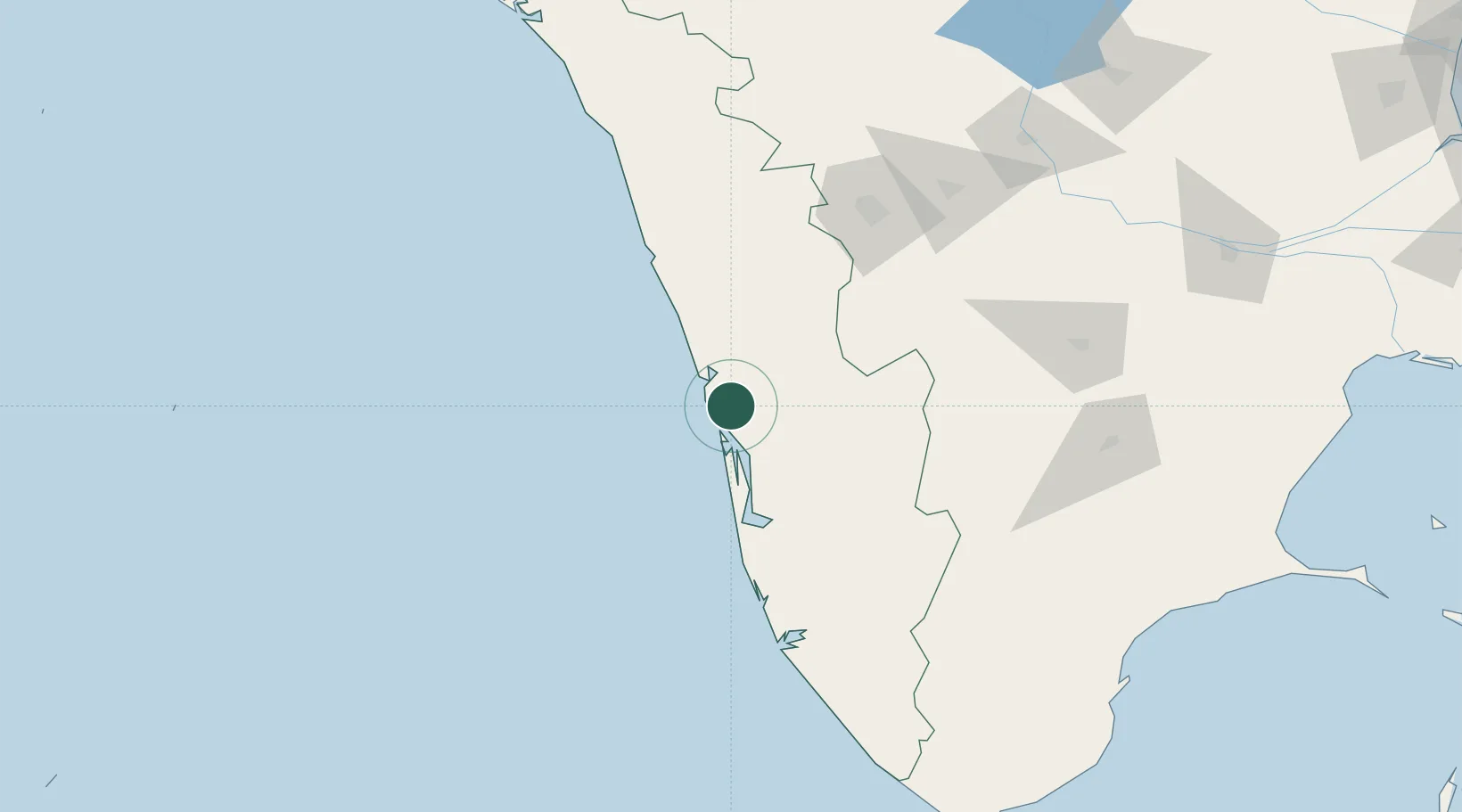
Nearby Logistics Neighbours

Cities
  1. 1Cochin10 km
  2. 2Puthuvypeen-SEZ/Ernakulam11 km
  3. 3Vallarpadom-SEZ/Ernakulam11 km
  4. 4Kakkanad11 km
  5. 5Edappally13 km
Nearest neighbours — logibook spatial index (haversine) over the source coordinates
Ports
  1. 1Kochi (Cochin)15 km
  2. 2Beypore133 km
  3. 3Quilon (Kollam)138 km
  4. 4Calicut (Kozhikode)143 km
  5. 5Trivandrum191 km
Nearest neighbours — logibook spatial index (haversine) over the source coordinates
Airports
  1. 1Cochin International Airport13 km
  2. 2Calicut International Airport124 km
  3. 3Coimbatore International Airport133 km
  4. 4Thiruvananthapuram International Airport190 km
  5. 5Madurai Airport198 km
Nearest neighbours — logibook spatial index (haversine) over the source coordinates
Trade Zones
  1. 1Carborundum Universal Ltd4 km
  2. 2Cochin Special Economic Zone9 km
  3. 3Sutherland Global Services Pvt Ltd10 km
  4. 4M s. Smart City (Kochi) Infrastructure Limited10 km
  5. 5Infopark Kochi11 km
Nearest neighbours — logibook spatial index (haversine) over the source coordinates
DatabookThe Record of Consolidated Knowledge
India beyond logistics?
Browse databook

All Sources

LocationsUN/LOCODE
UN/LOCODE — free
Portsthe NGA World Port Index
Public domain (US gov)
AirportsOurAirports
Public domain
Trade Zonesthe World Bank SEZ database
CC BY 4.0
Trade ZonesOpen Zone Map
CC BY
← India locations