UN/LOCODE hub · India
INNPT

Nagappattinam

10.7833°, 79.8167°
2
Transport functions

Transport Functions

Port
Road
Nagappattinam is also a profiled seaport →
UN/LOCODE

Hub Profile

Region
TN
GeoNames

Location

Location of INNPT
Natural Earth 10m (public domain) · TN · INNPT · 10.78, 79.82GoogleOSMYandex

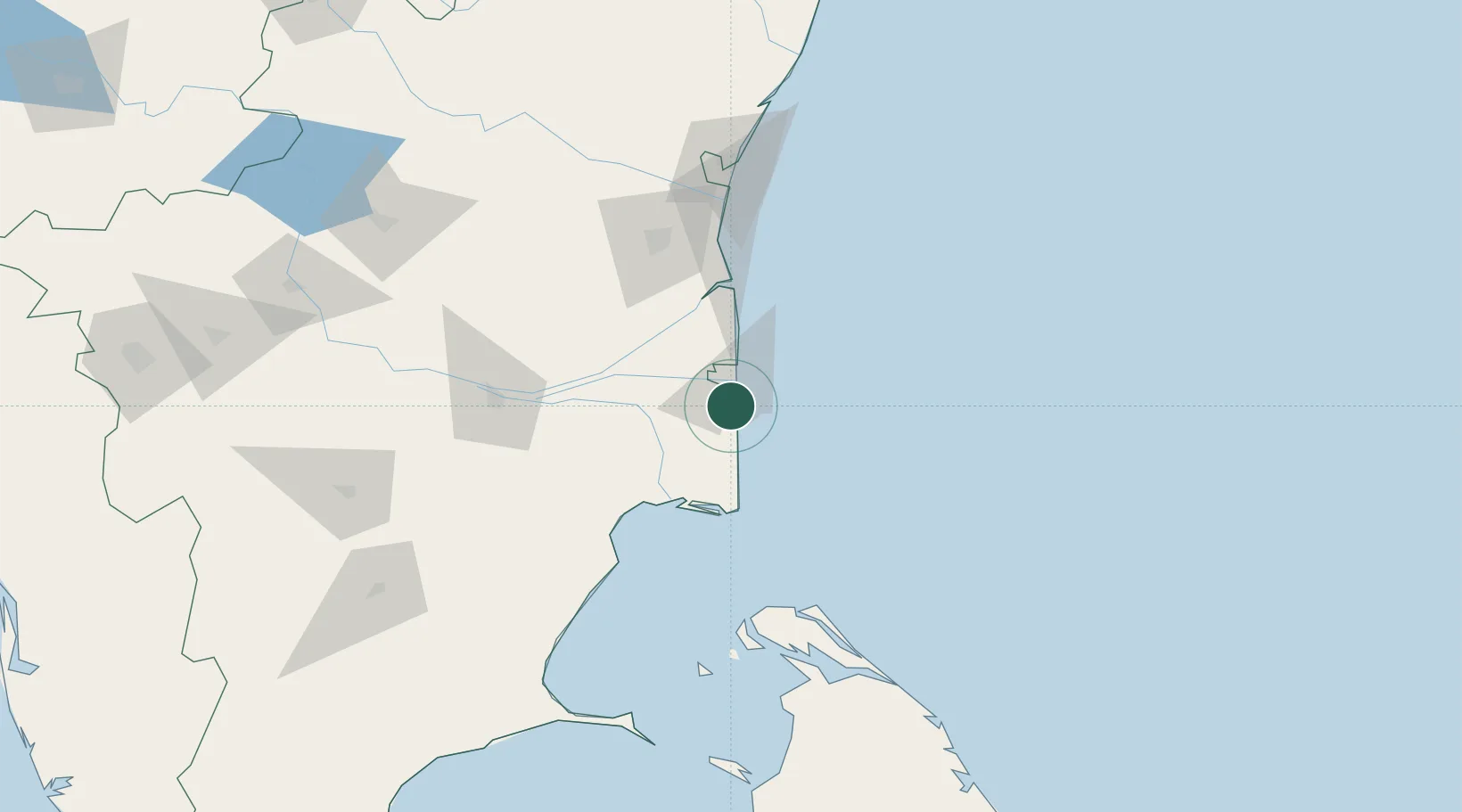
Nearby Logistics Neighbours

Cities
  1. 1Karaikal7 km
  2. 2Fllpl-SEZ/Thirruvallur18 km
  3. 3Kumbakonam52 km
  4. 4Chidambaram70 km
  5. 5ECTN SEZ/Tiruchirapalli124 km
Nearest neighbours — logibook spatial index (haversine) over the source coordinates
Ports
  1. 1Karaikal Port8 km
  2. 2Cuddalore104 km
  3. 3Kankesanturai111 km
  4. 4Pondicherry128 km
  5. 5Chennai (Madras)263 km
Nearest neighbours — logibook spatial index (haversine) over the source coordinates
Airports
  1. 1Jaffna International Airport114 km
  2. 2Tiruchirappalli International Airport120 km
  3. 3Pondicherry Airport132 km
  4. 4Iranamadu Airport180 km
  5. 5Madurai Airport216 km
Nearest neighbours — logibook spatial index (haversine) over the source coordinates
DatabookThe Record of Consolidated Knowledge
India beyond logistics?
Browse databook

All Sources

LocationsUN/LOCODE
UN/LOCODE — free
Portsthe NGA World Port Index
Public domain (US gov)
AirportsOurAirports
Public domain
Trade Zonesthe World Bank SEZ database
CC BY 4.0
Trade ZonesOpen Zone Map
CC BY
← India locations