UN/LOCODE hub · India
INLPJ

Reliance SEZ/Jamnagar

22.4667°, 70.0667°
1
Transport functions

Transport Functions

Multimodal
UN/LOCODE

Hub Profile

Region
GJ
GeoNames

Location

Location of INLPJ
Natural Earth 10m (public domain) · GJ · INLPJ · 22.47, 70.07GoogleOSMYandex

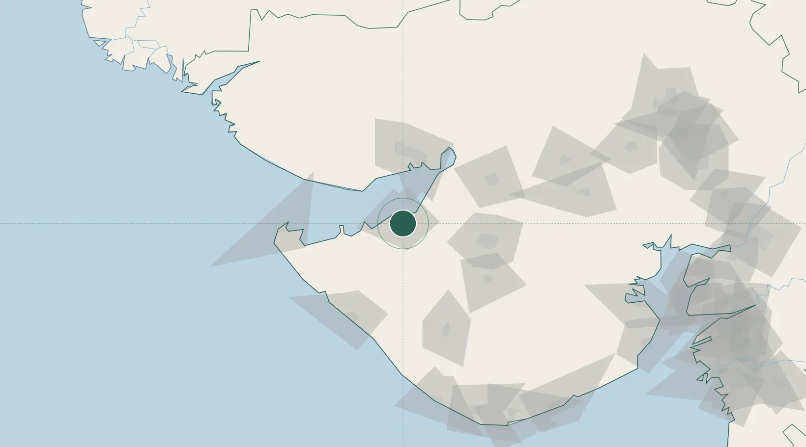
Nearby Logistics Neighbours

Cities
  1. 1Rozi12 km
  2. 2Sika24 km
  3. 3Mundra Port SEZ50 km
  4. 4Mundra54 km
  5. 5Kandla65 km
Nearest neighbours — logibook spatial index (haversine) over the source coordinates
Ports
  1. 1Bedi12 km
  2. 2Sikka24 km
  3. 3Vadinar Terminal41 km
  4. 4Mundra47 km
  5. 5Kandla65 km
Nearest neighbours — logibook spatial index (haversine) over the source coordinates
Airports
  1. 1Jamnagar Airport6 km
  2. 2Kandla Airport72 km
  3. 3Rajkot Airport75 km
  4. 4Bhuj Airport100 km
  5. 5Porbandar Airport100 km
Nearest neighbours — logibook spatial index (haversine) over the source coordinates
Trade Zones
  1. 1Reliance Jamnagar Infrastructure Ltd.3 km
  2. 2Adani Mundra Port49 km
  3. 3Ganesh Infrastructure Pvt. Ltd.54 km
  4. 4Kandla Special Economic Zone63 km
  5. 5Kandla Special Economic Zone64 km
Nearest neighbours — logibook spatial index (haversine) over the source coordinates
DatabookThe Record of Consolidated Knowledge
India beyond logistics?
Browse databook

All Sources

LocationsUN/LOCODE
UN/LOCODE — free
Portsthe NGA World Port Index
Public domain (US gov)
AirportsOurAirports
Public domain
Trade Zonesthe World Bank SEZ database
CC BY 4.0
Trade ZonesOpen Zone Map
CC BY
← India locations