Diversified Zone · India

Kandla Special Economic Zone Active
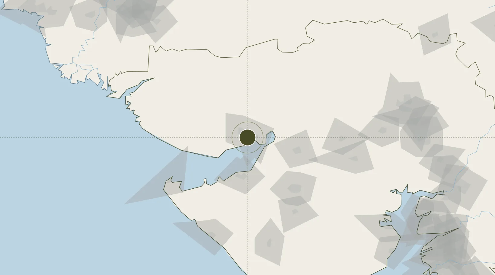
23.0340°, 70.1341°
404 ha
Zone area
8.4 km
Nearest port
9.4 km
Nearest airport

Gateway access

Nearest neighbours — logibook spatial index (haversine) over the source coordinates

Zone profile

Zone type
Diversified Zone
Open Zone Map
Region
Gujarat
Open Zone Map
Status
Active
Open Zone Map
Management
Public
Open Zone Map
Operator
Ministry of Commerce & Industry
Open Zone Map
Legal framework
Gujarat Special Economic Zone ACT, 2004., The Special Economic Zones Act, 2005
Open Zone Map

Location

Location of ozm-2117
Natural Earth 10m (public domain) · Gujarat · ozm-2117 · 23.03, 70.13GoogleOSMYandex

Nearby Logistics Neighbours

Ports
  1. 1Kandla8 km
  2. 2Navlakhi33 km
  3. 3Bedi52 km
  4. 4Mundra55 km
  5. 5Sikka74 km
Nearest neighbours — logibook spatial index (haversine) over the source coordinates
Airports
  1. 1Kandla Airport9 km
  2. 2Bhuj Airport55 km
  3. 3Jamnagar Airport64 km
  4. 4Rajkot Airport104 km
  5. 5Rajkot International Airport118 km
Nearest neighbours — logibook spatial index (haversine) over the source coordinates
Cities
  1. 1Kandla4 km
  2. 2OPGS SEZ/Gandhidham6 km
  3. 3Gandhidham6 km
  4. 4Kandla-SEZ/Gandhidham7 km
  5. 5Welspun Anjar-SEZ/Anjar16 km
Nearest neighbours — logibook spatial index (haversine) over the source coordinates
Trade Zones
  1. 1Kandla Special Economic Zone1 km
  2. 2Euro Multivision Pvt. Ltd.32 km
  3. 3Ganesh Infrastructure Pvt. Ltd.47 km
  4. 4Adani Mundra Port55 km
  5. 5Reliance Jamnagar Infrastructure Ltd.62 km
Nearest neighbours — logibook spatial index (haversine) over the source coordinates
DatabookThe Record of Consolidated Knowledge
India beyond logistics?
Browse databook

All Sources

Trade ZonesOpen Zone Map
CC BY
Portsthe NGA World Port Index
Public domain (US gov)
AirportsOurAirports
Public domain
LocationsUN/LOCODE
UN/LOCODE — free
← India trade zones