Diversified Zone · India

Adani Mundra Port Active
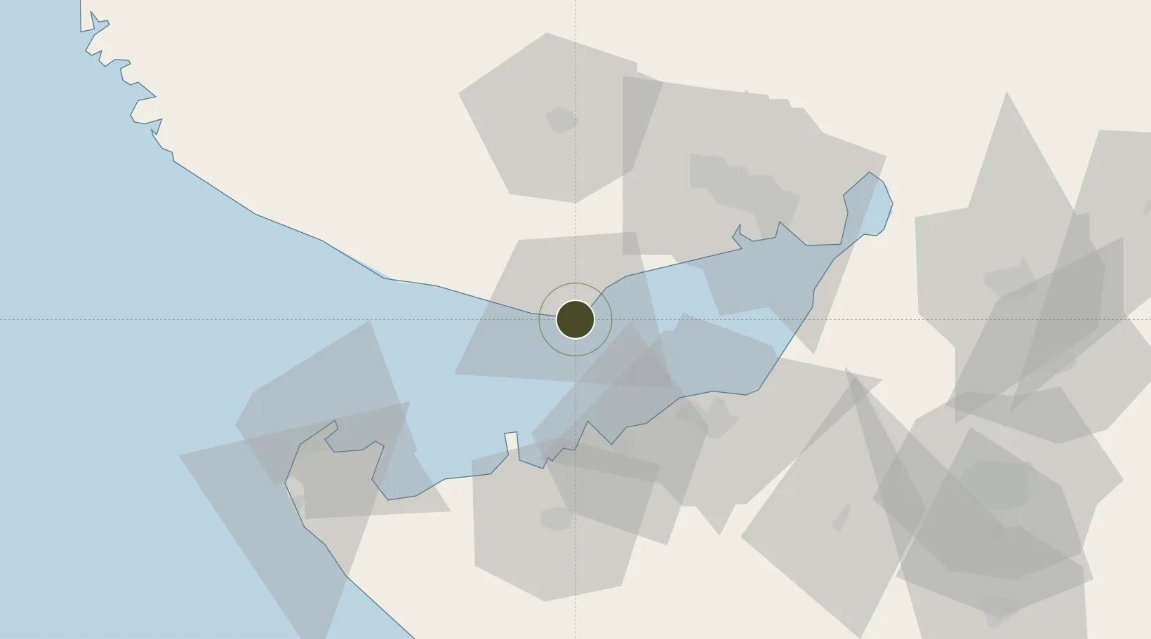
22.7450°, 69.7009°
6,456 ha
Zone area
1.9 km
Nearest port
44.6 km
Nearest airport

Gateway access

Nearest neighbours — logibook spatial index (haversine) over the source coordinates

Zone profile

Zone type
Diversified Zone
Open Zone Map
Region
Gujarat
Open Zone Map
Status
Active
Open Zone Map
Management
Private
Open Zone Map
Operator
Adani Logistics Ltd
Open Zone Map
Legal framework
Gujarat Special Economic Zone ACT, 2004., The Special Economic Zones Act, 2005
Open Zone Map

Location

Location of ozm-2132
Natural Earth 10m (public domain) · Gujarat · ozm-2132 · 22.75, 69.70GoogleOSMYandex

Nearby Logistics Neighbours

Ports
  1. 1Mundra2 km
  2. 2Vadinar Terminal31 km
  3. 3Sikka37 km
  4. 4Mandvi37 km
  5. 5Bedi40 km
Nearest neighbours — logibook spatial index (haversine) over the source coordinates
Airports
  1. 1Jamnagar Airport45 km
  2. 2Kandla Airport58 km
  3. 3Bhuj Airport60 km
  4. 4Rajkot Airport121 km
  5. 5Porbandar Airport122 km
Nearest neighbours — logibook spatial index (haversine) over the source coordinates
Cities
  1. 1Mundra Port SEZ1 km
  2. 2Mundra8 km
  3. 3Måndvi36 km
  4. 4Sika37 km
  5. 5Rozi40 km
Nearest neighbours — logibook spatial index (haversine) over the source coordinates
Trade Zones
  1. 1Ganesh Infrastructure Pvt. Ltd.11 km
  2. 2Reliance Jamnagar Infrastructure Ltd.46 km
  3. 3Kandla Special Economic Zone54 km
  4. 4Kandla Special Economic Zone55 km
  5. 5Euro Multivision Pvt. Ltd.78 km
Nearest neighbours — logibook spatial index (haversine) over the source coordinates
DatabookThe Record of Consolidated Knowledge
India beyond logistics?
Browse databook

All Sources

Trade ZonesOpen Zone Map
CC BY
Portsthe NGA World Port Index
Public domain (US gov)
AirportsOurAirports
Public domain
LocationsUN/LOCODE
UN/LOCODE — free
← India trade zones