UN/LOCODE hub · India
INGRW

Apm Icd/Bhamboli-Khed

17.7167°, 73.3833°
1
Transport functions

Transport Functions

Multimodal
UN/LOCODE

Hub Profile

Region
MH
GeoNames

Location

Location of INGRW
Natural Earth 10m (public domain) · MH · INGRW · 17.72, 73.38GoogleOSMYandex

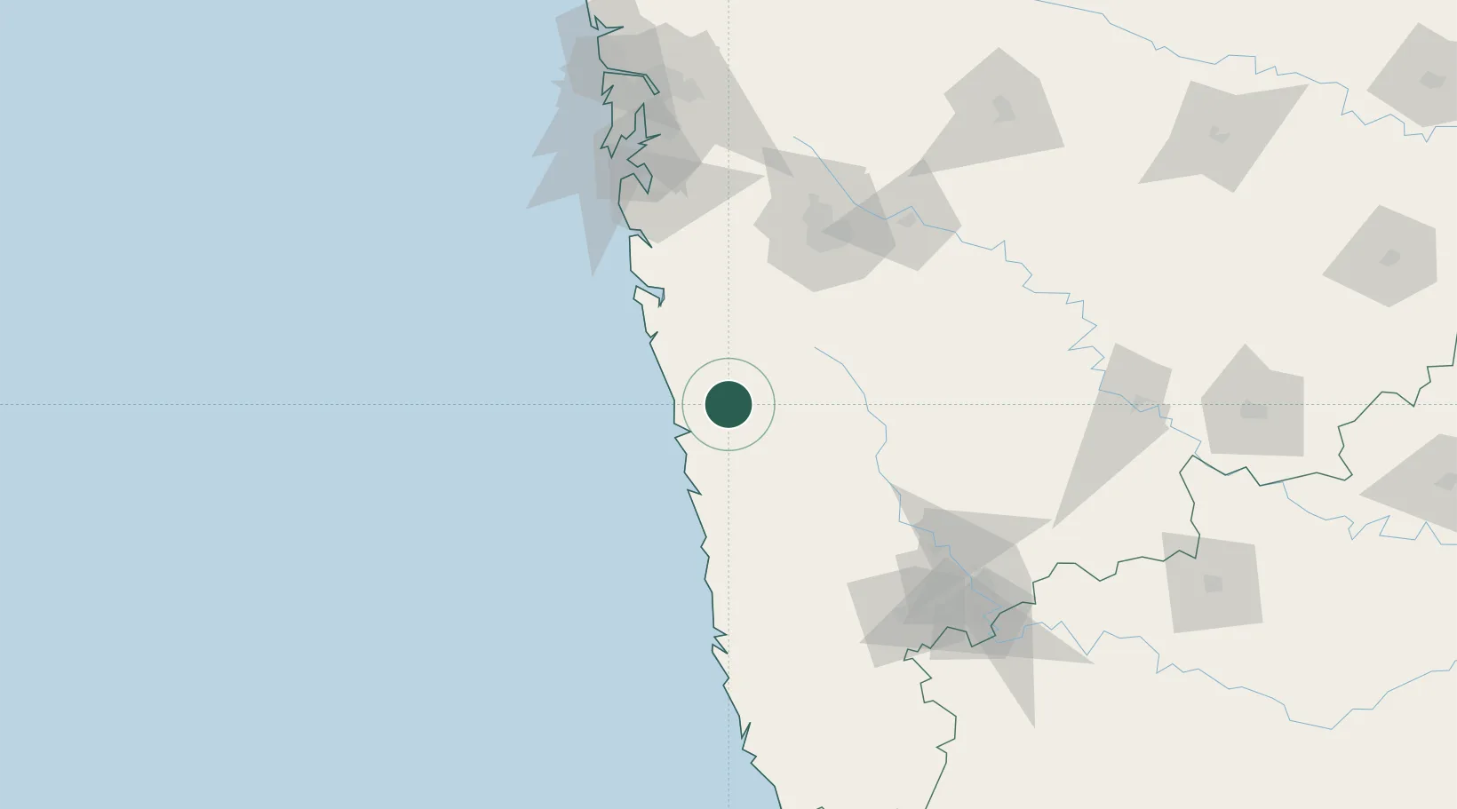
Nearby Logistics Neighbours

Cities
  1. 1Jaigad50 km
  2. 2IT-ITES-B-SEZ/Ulwe60 km
  3. 3Multi Services-SEZ/Ulwe60 km
  4. 4IT-ITES-A-SEZ/Ulwe60 km
  5. 5Satara64 km
Nearest neighbours — logibook spatial index (haversine) over the source coordinates
Ports
  1. 1Port Dabhol27 km
  2. 2Jaigarh Bay50 km
  3. 3Ratnagiri82 km
  4. 4Jawaharlal Nehru Port (Nhava Shiva)145 km
  5. 5Mumbai (Bombay)149 km
Nearest neighbours — logibook spatial index (haversine) over the source coordinates
Airports
  1. 1Ratnagiri Airport78 km
  2. 2Pune International Airport112 km
  3. 3Baramati Airport140 km
  4. 4Navi Mumbai International Airport145 km
  5. 5Kolhapur Airport152 km
Nearest neighbours — logibook spatial index (haversine) over the source coordinates
Trade Zones
  1. 1Embassy Quadron Tech Park102 km
  2. 2Infosys Limited104 km
  3. 3Maharashtra Industrial Development Corporation, Hinjewadi Pune.104 km
  4. 4M s. Khed Economic Infrastructure Private Limited104 km
  5. 5Khed Economic Infrastructure Pvt. Ltd.104 km
Nearest neighbours — logibook spatial index (haversine) over the source coordinates
DatabookThe Record of Consolidated Knowledge
India beyond logistics?
Browse databook

All Sources

LocationsUN/LOCODE
UN/LOCODE — free
Portsthe NGA World Port Index
Public domain (US gov)
AirportsOurAirports
Public domain
Trade Zonesthe World Bank SEZ database
CC BY 4.0
Trade ZonesOpen Zone Map
CC BY
← India locations