UN/LOCODE hub · India
INBJP

Bijapur

16.8333°, 75.7000°
1
Transport functions

Transport Functions

Multimodal
UN/LOCODE

Hub Profile

Place type
Populated place
GeoNames
Region
Maharashtra
GeoNames
Time zone
Asia/Kolkata
GeoNames
Elevation
361 m
GeoNames

Location

Location of INBJP
Natural Earth 10m (public domain) · Maharashtra · INBJP · 16.83, 75.70GoogleOSMYandex

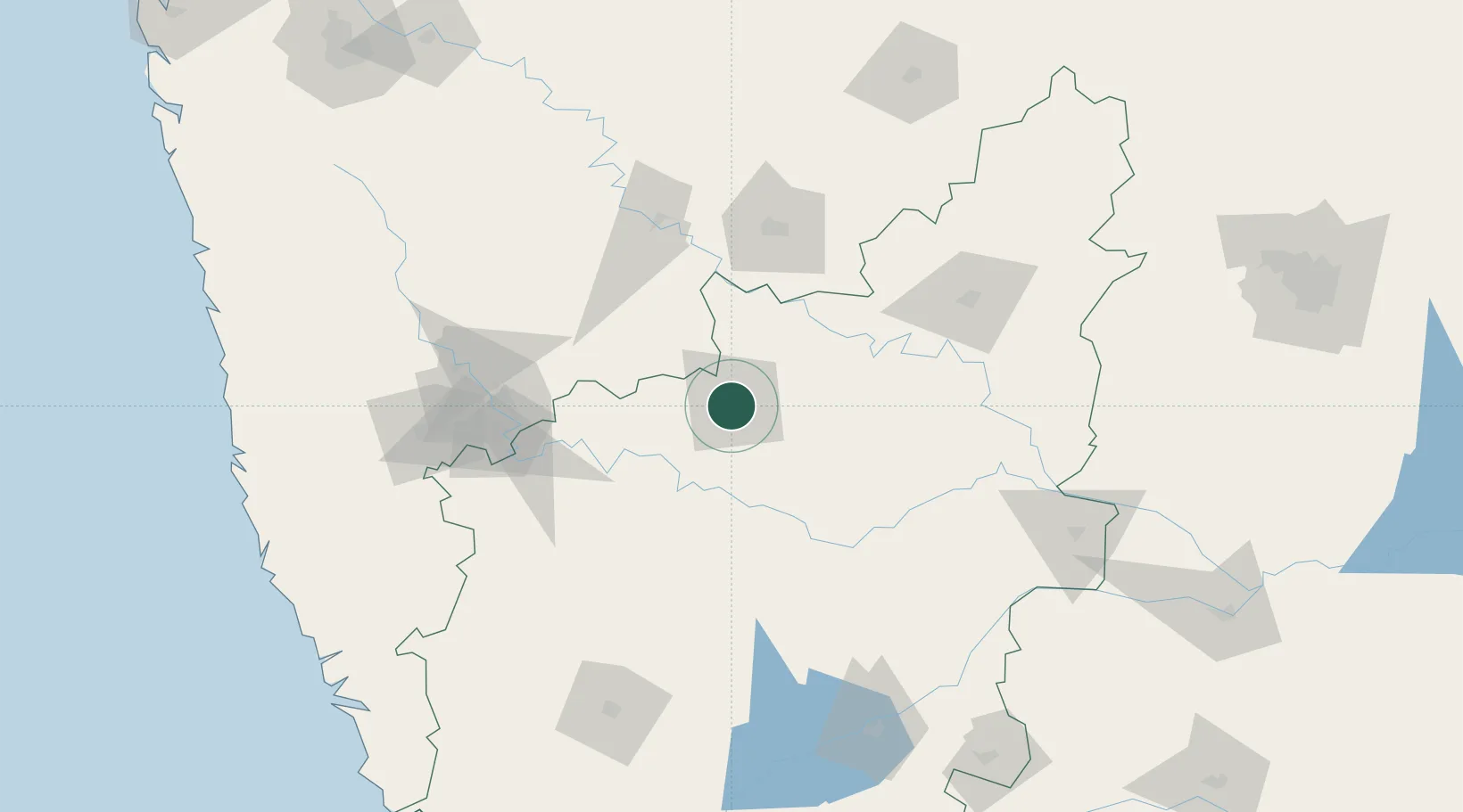
Nearby Logistics Neighbours

Cities
  1. 1Kippl-Gdpl Sez/Kharadi94 km
  2. 2Badami102 km
  3. 3Kagal150 km
  4. 4Tumkur152 km
  5. 5Quest-SEZ/Belgaum167 km
Nearest neighbours — logibook spatial index (haversine) over the source coordinates
Ports
  1. 1Panaji250 km
  2. 2Marmagao257 km
  3. 3Ratnagiri258 km
  4. 4Jaigarh Bay269 km
  5. 5Karwar281 km
Nearest neighbours — logibook spatial index (haversine) over the source coordinates
Airports
  1. 1Solapur Airport92 km
  2. 2Kalaburagi Airport145 km
  3. 3Kolhapur Airport151 km
  4. 4Belagavi Airport158 km
  5. 5Hubballi Airport177 km
Nearest neighbours — logibook spatial index (haversine) over the source coordinates
Trade Zones
  1. 1QuEST Global Special Economic Zone149 km
  2. 2K. Raheja Corp Pvt. Ltd.244 km
  3. 3M s. Parsvnath SEZ Limited263 km
  4. 4Serum Bio Pharma Park SEZ263 km
  5. 5Magarpatta Township Development And Construction Company Ltd.265 km
Nearest neighbours — logibook spatial index (haversine) over the source coordinates
DatabookThe Record of Consolidated Knowledge
India beyond logistics?
Browse databook

All Sources

LocationsUN/LOCODE
UN/LOCODE — free
Portsthe NGA World Port Index
Public domain (US gov)
AirportsOurAirports
Public domain
Trade Zonesthe World Bank SEZ database
CC BY 4.0
Trade ZonesOpen Zone Map
CC BY
← India locations