UN/LOCODE hub · Guatemala
GTSTZ

Santo Tomas

15.6835°, -88.5972°
1
Transport functions

Transport Functions

Multimodal
UN/LOCODE

Hub Profile

Place type
Populated place
GeoNames
Region
Zacapa
GeoNames
Time zone
America/Guatemala
GeoNames
Elevation
739 m
GeoNames
Logistics facilities
1
UN/LOCODE

Location

Location of GTSTZ
Natural Earth 10m (public domain) · Zacapa · GTSTZ · 15.68, -88.60GoogleOSMYandex

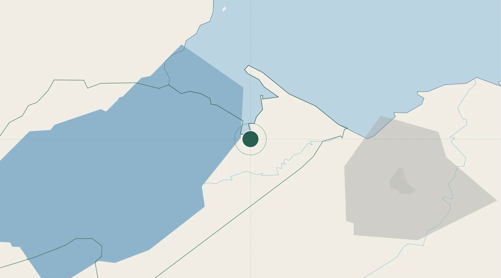
Nearby Logistics Neighbours

Cities
  1. 1Puerto Santo Tomás de Castilla1 km
  2. 2Puerto Barrios4 km
  3. 3Entre Ríos9 km
  4. 4Lívingston23 km
  5. 5Corinto27 km
Nearest neighbours — logibook spatial index (haversine) over the source coordinates
Ports
  1. 1Santo Tomas De Castilla3 km
  2. 2Puerto Barrios6 km
  3. 3Puerto Cortes71 km
  4. 4Big Creek95 km
  5. 5Tela123 km
Nearest neighbours — logibook spatial index (haversine) over the source coordinates
Airports
  1. 1Puerto Barrios Airport6 km
  2. 2Punta Gorda Airport52 km
  3. 3Ramón Villeda Morales International Airport77 km
  4. 4Big Creek Airport95 km
  5. 5Independence Airport96 km
Nearest neighbours — logibook spatial index (haversine) over the source coordinates
Trade Zones
  1. 1Santo Tomas de Castillo Free Zone1 km
  2. 2Green Valley Industrial Park58 km
  3. 3Altia Smart City63 km
  4. 4ZIP San José67 km
  5. 5ZOLI Indhelva Free Zone68 km
Nearest neighbours — logibook spatial index (haversine) over the source coordinates
DatabookThe Record of Consolidated Knowledge
Guatemala beyond logistics?
Browse databook

All Sources

LocationsUN/LOCODE
UN/LOCODE — free
Portsthe NGA World Port Index
Public domain (US gov)
AirportsOurAirports
Public domain
Trade Zonesthe World Bank SEZ database
CC BY 4.0
Trade ZonesOpen Zone Map
CC BY
← Guatemala locations