UN/LOCODE hub · Greece
GRXYT

Xylokeratia Milos

36.6667°, 24.3667°
2
Transport functions

Transport Functions

Port
Road
UN/LOCODE

Hub Profile

Region
L
GeoNames

Location

Location of GRXYT
Natural Earth 10m (public domain) · L · GRXYT · 36.67, 24.37GoogleOSMYandex

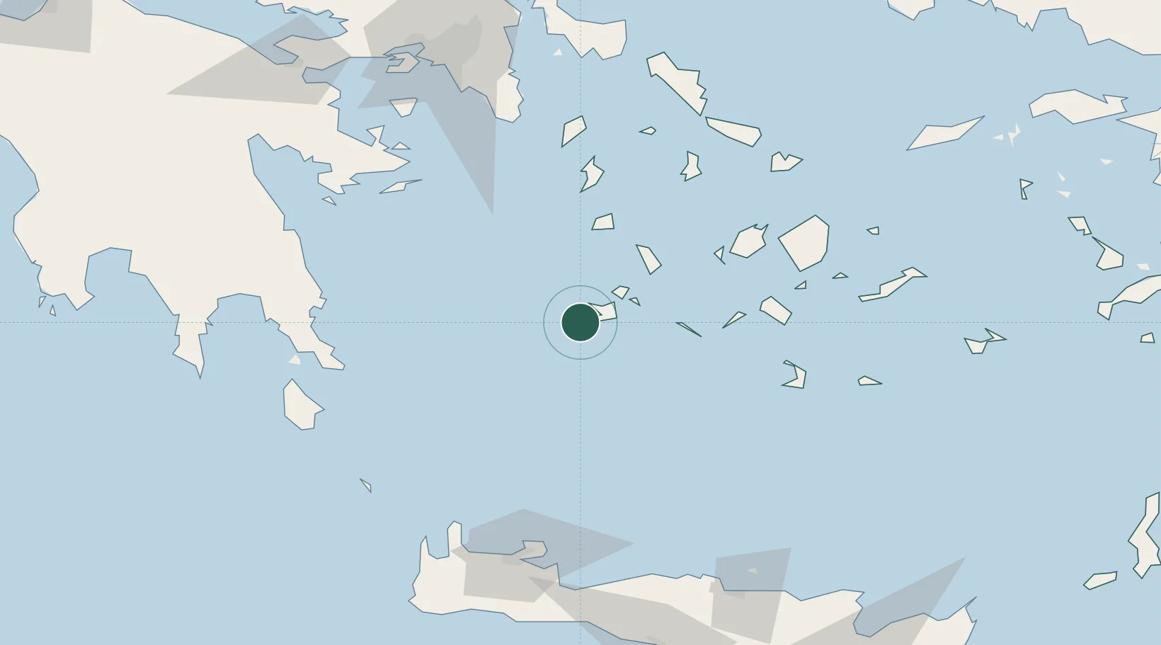
Nearby Logistics Neighbours

Cities
  1. 1Adamas Milos8 km
  2. 2Zefiri11 km
  3. 3Voudia Milos18 km
  4. 4Kímolos23 km
  5. 5Prassa Kimolos26 km
Nearest neighbours — logibook spatial index (haversine) over the source coordinates
Ports
  1. 1Milos9 km
  2. 2Limin Sirou100 km
  3. 3Nisos Naxos101 km
  4. 4Lavrio118 km
  5. 5Mikonos122 km
Nearest neighbours — logibook spatial index (haversine) over the source coordinates
Airports
  1. 1Milos Airport10 km
  2. 2Paros National Airport77 km
  3. 3Syros Airport99 km
  4. 4Naxos Island National Airport100 km
  5. 5Santorini International Airport104 km
Nearest neighbours — logibook spatial index (haversine) over the source coordinates
Trade Zones
  1. 1Free Zone of Piraeus157 km
  2. 2Free Zone of Heraklion175 km
  3. 3Aegean Free Zone306 km
  4. 4Izmir Ataturk Organized Industrial Zone311 km
  5. 5Izmir Free Zone313 km
Nearest neighbours — logibook spatial index (haversine) over the source coordinates
DatabookThe Record of Consolidated Knowledge
Greece beyond logistics?
Browse databook

All Sources

LocationsUN/LOCODE
UN/LOCODE — free
Portsthe NGA World Port Index
Public domain (US gov)
AirportsOurAirports
Public domain
Trade Zonesthe World Bank SEZ database
CC BY 4.0
Trade ZonesOpen Zone Map
CC BY
← Greece locations