UN/LOCODE hub · Greece
GRPKI

Prassa Kimolos

36.8167°, 24.5833°
2
Transport functions

Transport Functions

Port
Road
UN/LOCODE

Hub Profile

Region
L
GeoNames

Location

Location of GRPKI
Natural Earth 10m (public domain) · L · GRPKI · 36.82, 24.58GoogleOSMYandex

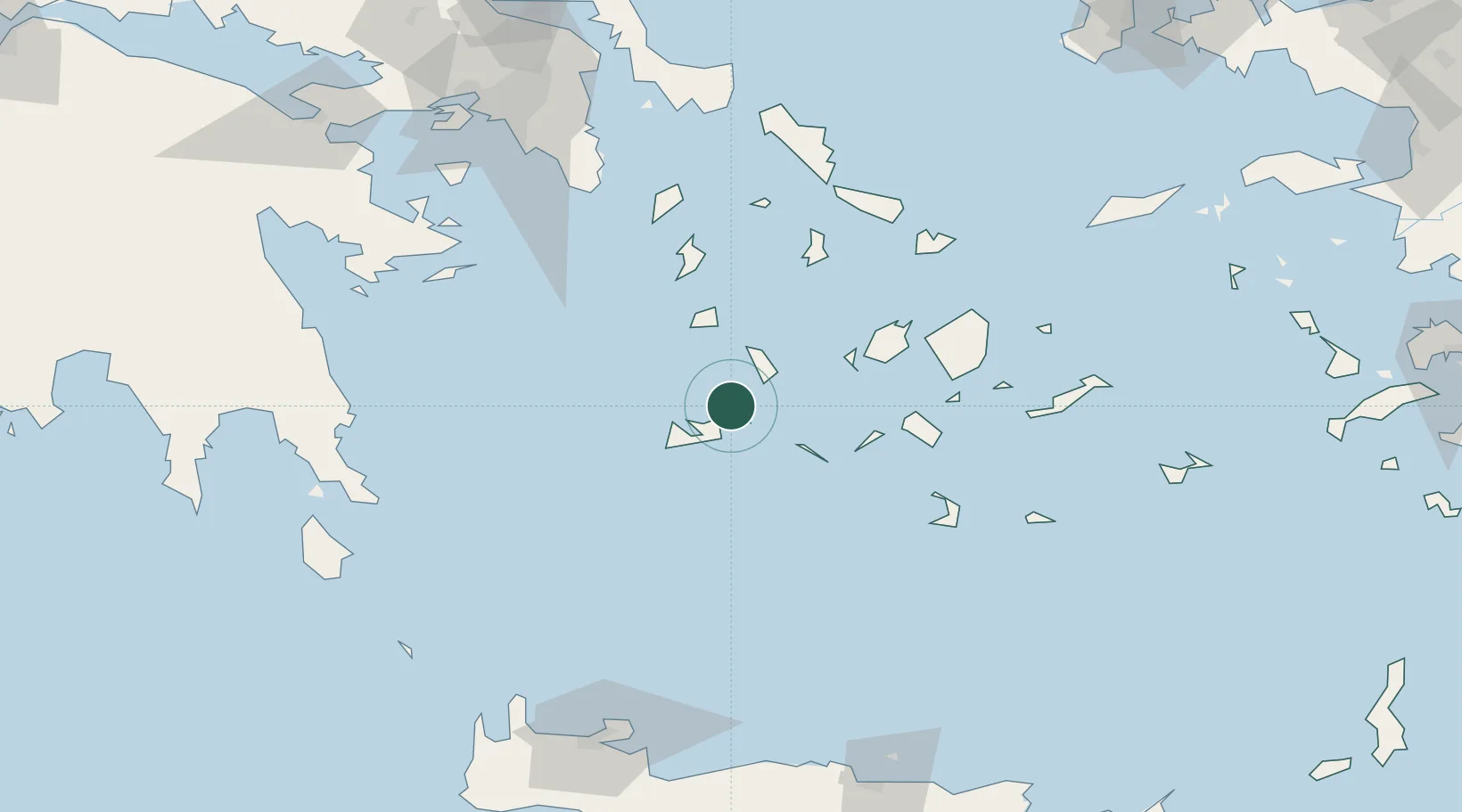
Nearby Logistics Neighbours

Cities
  1. 1Kímolos4 km
  2. 2Voudia Milos9 km
  3. 3Zefiri16 km
  4. 4Adamas Milos17 km
  5. 5Kamares Sifnos20 km
Nearest neighbours — logibook spatial index (haversine) over the source coordinates
Ports
  1. 1Milos16 km
  2. 2Limin Sirou76 km
  3. 3Nisos Naxos76 km
  4. 4Mikonos97 km
  5. 5Lavrio108 km
Nearest neighbours — logibook spatial index (haversine) over the source coordinates
Airports
  1. 1Milos Airport16 km
  2. 2Paros National Airport52 km
  3. 3Syros Airport75 km
  4. 4Naxos Island National Airport76 km
  5. 5Santorini International Airport92 km
Nearest neighbours — logibook spatial index (haversine) over the source coordinates
Trade Zones
  1. 1Free Zone of Piraeus152 km
  2. 2Free Zone of Heraklion185 km
  3. 3Aegean Free Zone281 km
  4. 4Izmir Ataturk Organized Industrial Zone285 km
  5. 5Izmir Free Zone288 km
Nearest neighbours — logibook spatial index (haversine) over the source coordinates
DatabookThe Record of Consolidated Knowledge
Greece beyond logistics?
Browse databook

All Sources

LocationsUN/LOCODE
UN/LOCODE — free
Portsthe NGA World Port Index
Public domain (US gov)
AirportsOurAirports
Public domain
Trade Zonesthe World Bank SEZ database
CC BY 4.0
Trade ZonesOpen Zone Map
CC BY
← Greece locations