UN/LOCODE hub · Greece
GROUR

Ouranópolis

40.3167°, 23.9833°
1
Transport functions

Transport Functions

Port
UN/LOCODE

Hub Profile

Region
64
GeoNames

Location

Location of GROUR
Natural Earth 10m (public domain) · 64 · GROUR · 40.32, 23.98GoogleOSMYandex

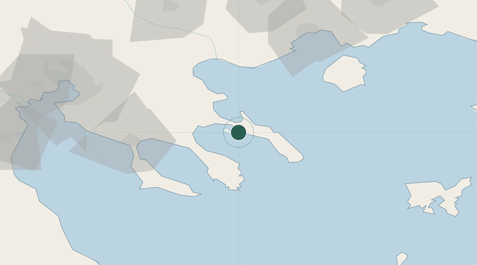
Nearby Logistics Neighbours

Cities
  1. 1Ammoulianí6 km
  2. 2Amolianí6 km
  3. 3Trypiti Chalkidikis8 km
  4. 4Ierissos11 km
  5. 5Moní Vatopedíou19 km
Nearest neighbours — logibook spatial index (haversine) over the source coordinates
Ports
  1. 1Stratoni26 km
  2. 2Yerakini44 km
  3. 3Kavala77 km
  4. 4Thessaloniki96 km
  5. 5Lagos123 km
Nearest neighbours — logibook spatial index (haversine) over the source coordinates
Airports
  1. 1Kavala Alexander the Great International Airport85 km
  2. 2Thessaloniki Macedonia International Airport89 km
  3. 3Limnos Airport115 km
  4. 4Skiathos Island National Airport133 km
  5. 5Skiros Airport156 km
Nearest neighbours — logibook spatial index (haversine) over the source coordinates
Trade Zones
  1. 1Free Zone of Thessaloniki97 km
  2. 2TIDZ Gevgelija159 km
  3. 3TIDZ Strumica161 km
  4. 4TIDZ Berovo182 km
  5. 5TIDZ Radoviš194 km
Nearest neighbours — logibook spatial index (haversine) over the source coordinates
DatabookThe Record of Consolidated Knowledge
Greece beyond logistics?
Browse databook

All Sources

LocationsUN/LOCODE
UN/LOCODE — free
Portsthe NGA World Port Index
Public domain (US gov)
AirportsOurAirports
Public domain
Trade Zonesthe World Bank SEZ database
CC BY 4.0
Trade ZonesOpen Zone Map
CC BY
← Greece locations