UN/LOCODE hub · Greece
GRTRY

Trypiti Chalkidikis

40.3667°, 23.9167°
1
Transport functions

Transport Functions

Port
UN/LOCODE

Location

Location of GRTRY
Natural Earth 10m (public domain) · Kentriki Makedonia · GRTRY · 40.37, 23.92GoogleOSMYandex

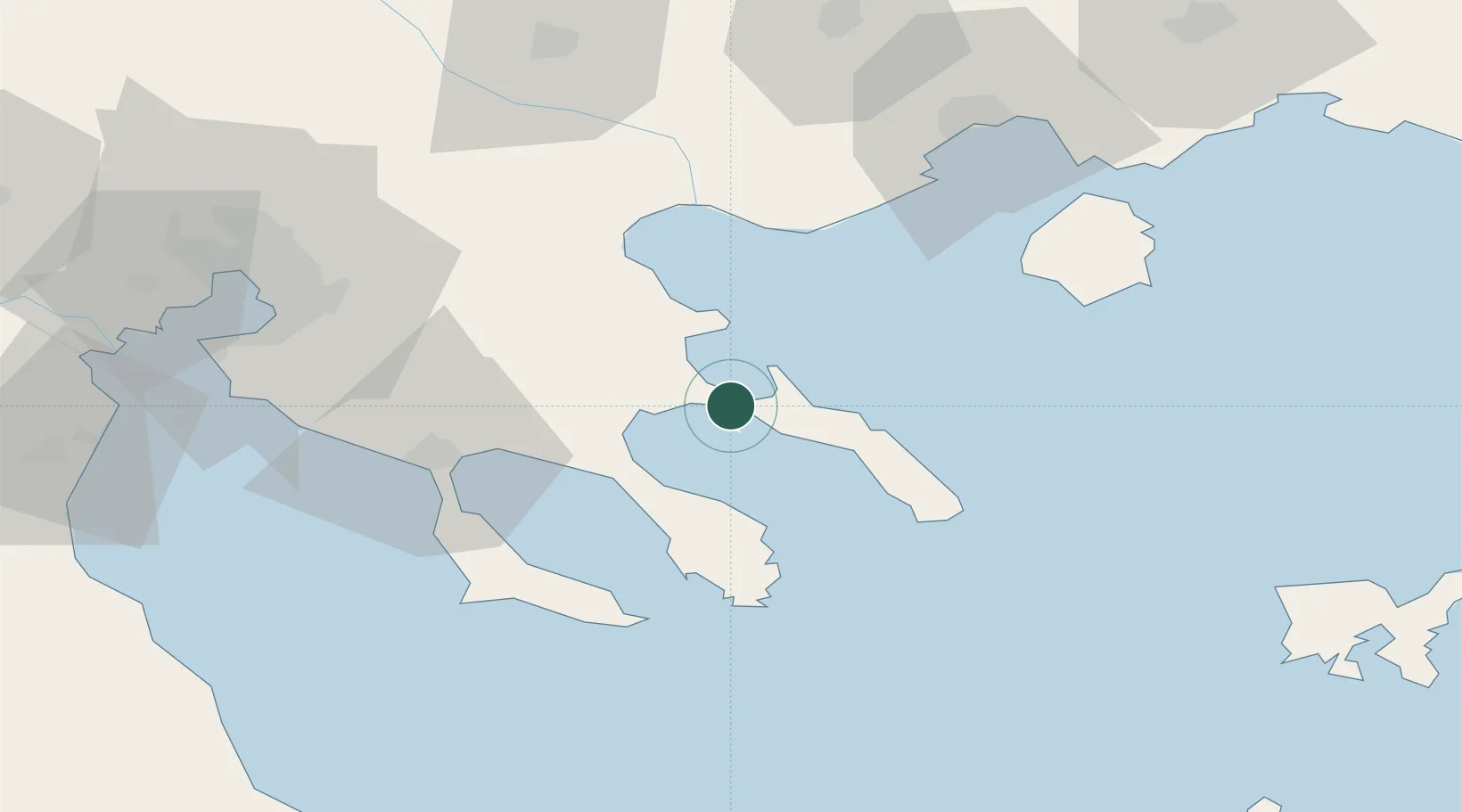
Nearby Logistics Neighbours

Cities
  1. 1Ierissos3 km
  2. 2Amolianí4 km
  3. 3Ammoulianí6 km
  4. 4Ouranópolis8 km
  5. 5Moní Vatopedíou25 km
Nearest neighbours — logibook spatial index (haversine) over the source coordinates
Ports
  1. 1Stratoni18 km
  2. 2Yerakini40 km
  3. 3Kavala75 km
  4. 4Thessaloniki88 km
  5. 5Lagos124 km
Nearest neighbours — logibook spatial index (haversine) over the source coordinates
Airports
  1. 1Thessaloniki Macedonia International Airport82 km
  2. 2Kavala Alexander the Great International Airport85 km
  3. 3Limnos Airport123 km
  4. 4Skiathos Island National Airport137 km
  5. 5Nea Anchialos National Airport160 km
Nearest neighbours — logibook spatial index (haversine) over the source coordinates
Trade Zones
  1. 1Free Zone of Thessaloniki89 km
  2. 2TIDZ Gevgelija151 km
  3. 3TIDZ Strumica153 km
  4. 4TIDZ Berovo174 km
  5. 5TIDZ Radoviš186 km
Nearest neighbours — logibook spatial index (haversine) over the source coordinates
DatabookThe Record of Consolidated Knowledge
Greece beyond logistics?
Browse databook

All Sources

LocationsUN/LOCODE
UN/LOCODE — free
Portsthe NGA World Port Index
Public domain (US gov)
AirportsOurAirports
Public domain
Trade Zonesthe World Bank SEZ database
CC BY 4.0
Trade ZonesOpen Zone Map
CC BY
← Greece locations