UN/LOCODE hub · Greece
GRNAF

Náfplion

37.5667°, 22.8000°
3
Transport functions

Transport Functions

Port
Rail
Road
UN/LOCODE

Hub Profile

Region
11
GeoNames

Location

Location of GRNAF
Natural Earth 10m (public domain) · 11 · GRNAF · 37.57, 22.80GoogleOSMYandex

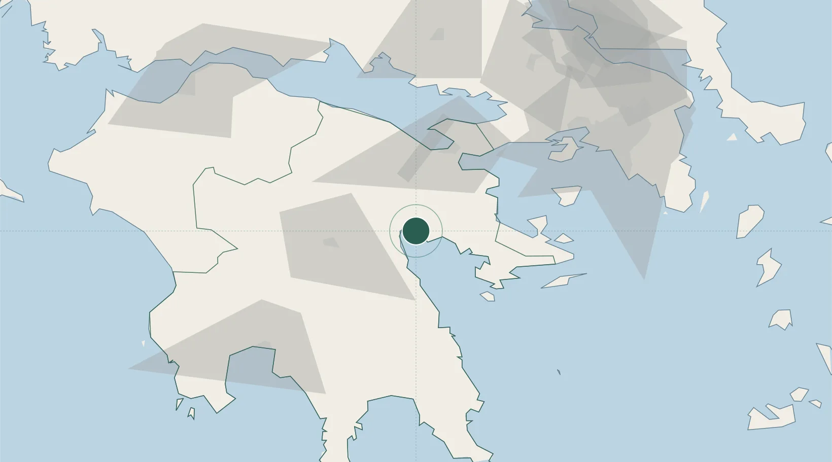
Nearby Logistics Neighbours

Cities
  1. 1Tolo Argolidos7 km
  2. 2Ástros20 km
  3. 3Epidavros32 km
  4. 4Palaiá Epídavros32 km
  5. 5Koilas Ermionidos34 km
Nearest neighbours — logibook spatial index (haversine) over the source coordinates
Ports
  1. 1Navplio0 km
  2. 2Megara Oil Terminal69 km
  3. 3Piraievs85 km
  4. 4Kalamata86 km
  5. 5Yithion93 km
Nearest neighbours — logibook spatial index (haversine) over the source coordinates
Airports
  1. 1Elefsis Air Base86 km
  2. 2Kalamata Airport88 km
  3. 3Athens Eleftherios Venizelos International Airport109 km
  4. 4Tanagra Air Base109 km
  5. 5Patras Araxos Agamemnon Airport137 km
Nearest neighbours — logibook spatial index (haversine) over the source coordinates
Trade Zones
  1. 1Free Zone of Piraeus83 km
  2. 2Free Zone of Platigiali (Astakos Etoloakarnanias)180 km
  3. 3Free Zone of Heraklion333 km
  4. 4Free Zone of Thessaloniki341 km
  5. 5Gjirokastër Freezone360 km
Nearest neighbours — logibook spatial index (haversine) over the source coordinates
DatabookThe Record of Consolidated Knowledge
Greece beyond logistics?
Browse databook

All Sources

LocationsUN/LOCODE
UN/LOCODE — free
Portsthe NGA World Port Index
Public domain (US gov)
AirportsOurAirports
Public domain
Trade Zonesthe World Bank SEZ database
CC BY 4.0
Trade ZonesOpen Zone Map
CC BY
← Greece locations