UN/LOCODE hub · Greece
GRKTS

Keratsínion

37.9665°, 23.6084°
2
Transport functions

Transport Functions

Port
Road
UN/LOCODE

Hub Profile

Logistics facilities
1
UN/LOCODE

Location

Location of GRKTS
Natural Earth 10m (public domain) · Attiki · GRKTS · 37.97, 23.61GoogleOSMYandex

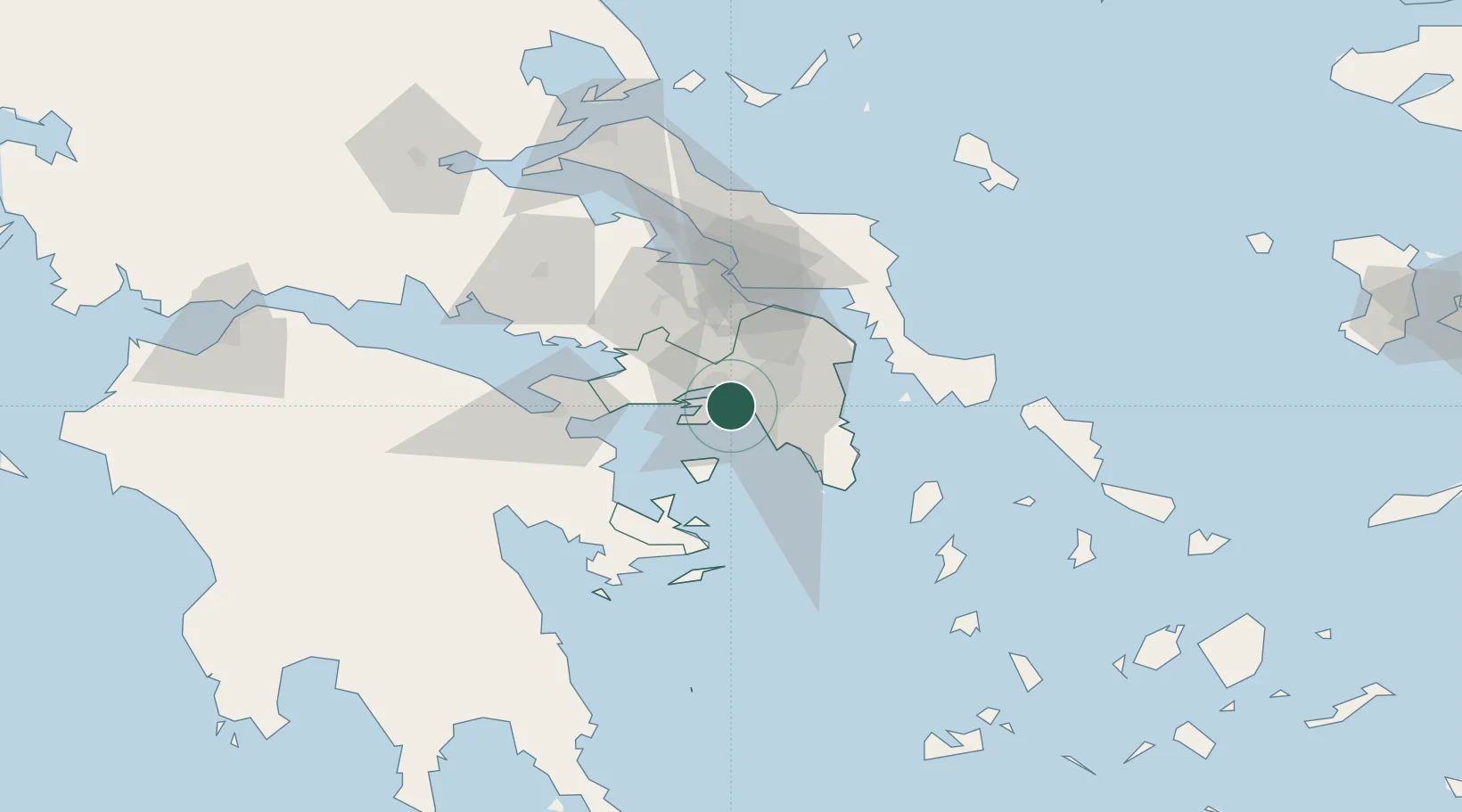
Nearby Logistics Neighbours

Cities
  1. 1Perama2 km
  2. 2Drapetzona2 km
  3. 3Skaramangás4 km
  4. 4Piraeus5 km
  5. 5Moschato/Athínai5 km
Nearest neighbours — logibook spatial index (haversine) over the source coordinates
Ports
  1. 1Piraievs5 km
  2. 2Megara Oil Terminal18 km
  3. 3Lavrio50 km
  4. 4Ormos Aliveriou60 km
  5. 5Navplio84 km
Nearest neighbours — logibook spatial index (haversine) over the source coordinates
Airports
  1. 1Elefsis Air Base12 km
  2. 2Athens Eleftherios Venizelos International Airport30 km
  3. 3Tanagra Air Base42 km
  4. 4Syros Airport133 km
  5. 5Skiathos Island National Airport135 km
Nearest neighbours — logibook spatial index (haversine) over the source coordinates
Trade Zones
  1. 1Free Zone of Piraeus2 km
  2. 2Free Zone of Platigiali (Astakos Etoloakarnanias)226 km
  3. 3Izmir Free Zone299 km
  4. 4Free Zone of Thessaloniki303 km
  5. 5Izmir Ataturk Organized Industrial Zone305 km
Nearest neighbours — logibook spatial index (haversine) over the source coordinates
DatabookThe Record of Consolidated Knowledge
Greece beyond logistics?
Browse databook

All Sources

LocationsUN/LOCODE
UN/LOCODE — free
Portsthe NGA World Port Index
Public domain (US gov)
AirportsOurAirports
Public domain
Trade Zonesthe World Bank SEZ database
CC BY 4.0
Trade ZonesOpen Zone Map
CC BY
← Greece locations