UN/LOCODE hub · Greece
GRDPA

Drapetzona

37.9500°, 23.6167°
1
Transport functions

Transport Functions

Port
UN/LOCODE

Location

Location of GRDPA
Natural Earth 10m (public domain) · Attiki · GRDPA · 37.95, 23.62GoogleOSMYandex

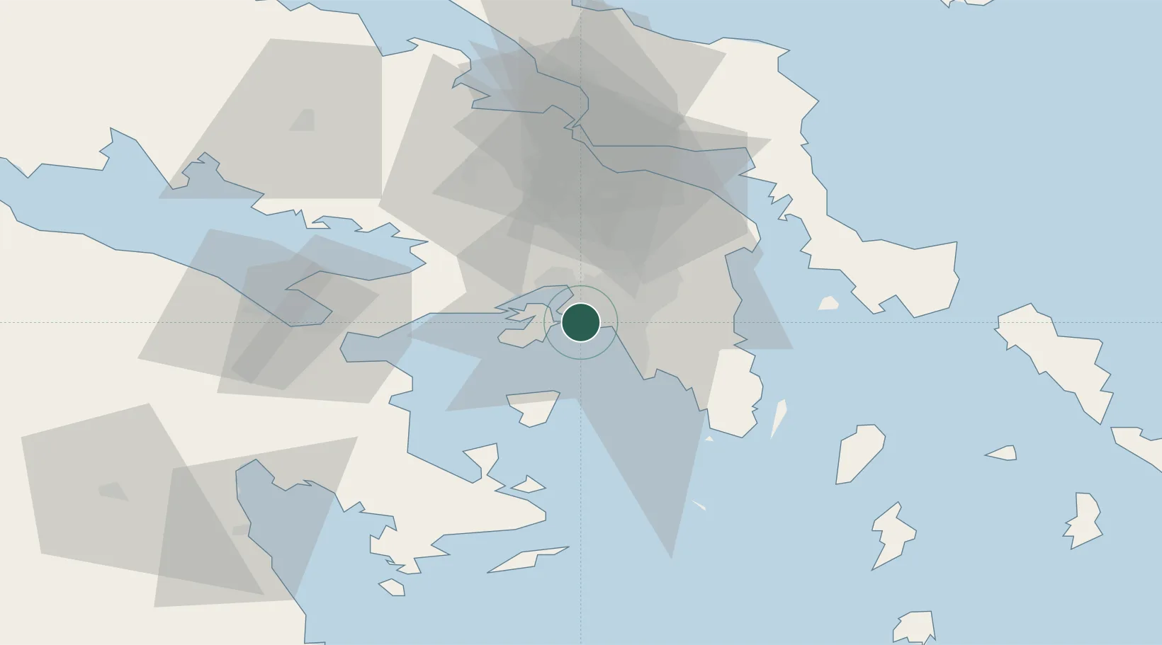
Nearby Logistics Neighbours

Cities
  1. 1Keratsínion2 km
  2. 2Perama4 km
  3. 3Moschato/Athínai4 km
  4. 4Agios Ioannis Rentis4 km
  5. 5Moskhaton4 km
Nearest neighbours — logibook spatial index (haversine) over the source coordinates
Ports
  1. 1Piraievs4 km
  2. 2Megara Oil Terminal19 km
  3. 3Lavrio48 km
  4. 4Ormos Aliveriou61 km
  5. 5Navplio84 km
Nearest neighbours — logibook spatial index (haversine) over the source coordinates
Airports
  1. 1Elefsis Air Base14 km
  2. 2Athens Eleftherios Venizelos International Airport29 km
  3. 3Tanagra Air Base44 km
  4. 4Syros Airport131 km
  5. 5Skiros Airport136 km
Nearest neighbours — logibook spatial index (haversine) over the source coordinates
Trade Zones
  1. 1Free Zone of Piraeus1 km
  2. 2Free Zone of Platigiali (Astakos Etoloakarnanias)228 km
  3. 3Izmir Free Zone299 km
  4. 4Free Zone of Thessaloniki305 km
  5. 5Izmir Ataturk Organized Industrial Zone305 km
Nearest neighbours — logibook spatial index (haversine) over the source coordinates
DatabookThe Record of Consolidated Knowledge
Greece beyond logistics?
Browse databook

All Sources

LocationsUN/LOCODE
UN/LOCODE — free
Portsthe NGA World Port Index
Public domain (US gov)
AirportsOurAirports
Public domain
Trade Zonesthe World Bank SEZ database
CC BY 4.0
Trade ZonesOpen Zone Map
CC BY
← Greece locations