UN/LOCODE hub · Greece
GRGAL

Galatas Troizinas

37.5000°, 23.4500°
1
Transport functions

Transport Functions

Port
UN/LOCODE

Hub Profile

Region
A1
GeoNames

Location

Location of GRGAL
Natural Earth 10m (public domain) · A1 · GRGAL · 37.50, 23.45GoogleOSMYandex

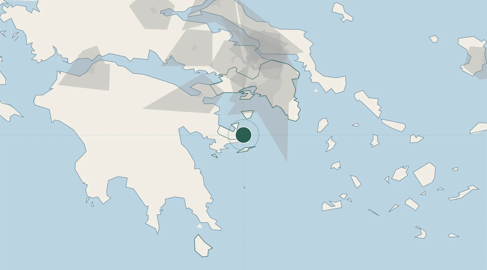
Nearby Logistics Neighbours

Cities
  1. 1Methana13 km
  2. 2Hydra (Idhra)17 km
  3. 3Ermióni22 km
  4. 4Agistri Aiginas26 km
  5. 5Aegina26 km
Nearest neighbours — logibook spatial index (haversine) over the source coordinates
Ports
  1. 1Piraievs51 km
  2. 2Megara Oil Terminal52 km
  3. 3Navplio58 km
  4. 4Lavrio59 km
  5. 5Ormos Aliveriou111 km
Nearest neighbours — logibook spatial index (haversine) over the source coordinates
Airports
  1. 1Elefsis Air Base63 km
  2. 2Athens Eleftherios Venizelos International Airport65 km
  3. 3Tanagra Air Base94 km
  4. 4Milos Airport128 km
  5. 5Syros Airport133 km
Nearest neighbours — logibook spatial index (haversine) over the source coordinates
Trade Zones
  1. 1Free Zone of Piraeus52 km
  2. 2Free Zone of Platigiali (Astakos Etoloakarnanias)233 km
  3. 3Free Zone of Heraklion294 km
  4. 4Izmir Free Zone329 km
  5. 5Izmir Ataturk Organized Industrial Zone333 km
Nearest neighbours — logibook spatial index (haversine) over the source coordinates
DatabookThe Record of Consolidated Knowledge
Greece beyond logistics?
Browse databook

All Sources

LocationsUN/LOCODE
UN/LOCODE — free
Portsthe NGA World Port Index
Public domain (US gov)
AirportsOurAirports
Public domain
Trade Zonesthe World Bank SEZ database
CC BY 4.0
Trade ZonesOpen Zone Map
CC BY
← Greece locations