UN/LOCODE hub · Greece
GRASS

Asprópirgos

38.0378°, 23.6375°
153
Population
3
Transport functions

Transport Functions

Port
Road
Multimodal
UN/LOCODE

Hub Profile

Place type
Populated place
GeoNames
Region
Central Greece
GeoNames
Population
153
GeoNames
Time zone
Europe/Athens
GeoNames
Elevation
861 m
GeoNames
Logistics facilities
10
UN/LOCODE

Location

Location of GRASS
Natural Earth 10m (public domain) · Central Greece · GRASS · 38.04, 23.64GoogleOSMYandex

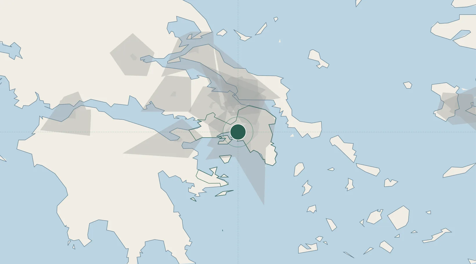
Nearby Logistics Neighbours

Cities
  1. 1Piraeus5 km
  2. 2Néa Liósia6 km
  3. 3Akharnai6 km
  4. 4Skaramangás6 km
  5. 5Aegaleo7 km
Nearest neighbours — logibook spatial index (haversine) over the source coordinates
Ports
  1. 1Piraievs12 km
  2. 2Megara Oil Terminal22 km
  3. 3Ormos Aliveriou53 km
  4. 4Lavrio53 km
  5. 5Kymassi90 km
Nearest neighbours — logibook spatial index (haversine) over the source coordinates
Airports
  1. 1Elefsis Air Base8 km
  2. 2Athens Eleftherios Venizelos International Airport29 km
  3. 3Tanagra Air Base34 km
  4. 4Skiros Airport127 km
  5. 5Skiathos Island National Airport127 km
Nearest neighbours — logibook spatial index (haversine) over the source coordinates
Trade Zones
  1. 1Free Zone of Piraeus10 km
  2. 2Free Zone of Platigiali (Astakos Etoloakarnanias)227 km
  3. 3Free Zone of Thessaloniki295 km
  4. 4TIDZ Gevgelija365 km
  5. 5Përmet Freezone374 km
Nearest neighbours — logibook spatial index (haversine) over the source coordinates
DatabookThe Record of Consolidated Knowledge
Greece beyond logistics?
Browse databook

All Sources

LocationsUN/LOCODE
UN/LOCODE — free
LocationsGeoNames
CC BY 4.0
Portsthe NGA World Port Index
Public domain (US gov)
AirportsOurAirports
Public domain
Trade Zonesthe World Bank SEZ database
CC BY 4.0
Trade ZonesOpen Zone Map
CC BY
← Greece locations