UN/LOCODE hub · United Kingdom
GBREV

Brevig, Barra

56.9500°, -7.4333°
1
Transport functions

Transport Functions

Port
UN/LOCODE

Location

Location of GBREV
Natural Earth 10m (public domain) · Eilean Siar · GBREV · 56.95, -7.43GoogleOSMYandex

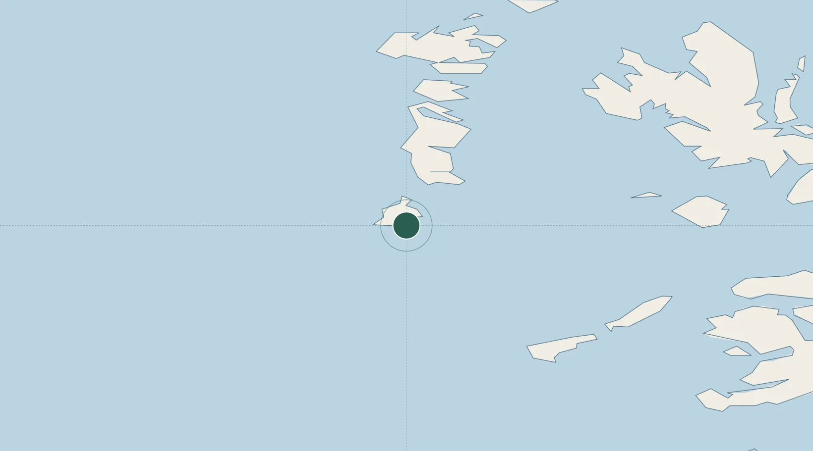
Nearby Logistics Neighbours

Cities
  1. 1Castlebay2 km
  2. 2Ardveenish6 km
  3. 3Northbay6 km
  4. 4Aird Mhor (Ardmhor)8 km
  5. 5Ceann a Gharaidh, Eriskay16 km
Nearest neighbours — logibook spatial index (haversine) over the source coordinates
Ports
  1. 1Castle Bay3 km
  2. 2Lochboisdale24 km
  3. 3Lochmaddy74 km
  4. 4Portree Harbor91 km
  5. 5Tobermory91 km
Nearest neighbours — logibook spatial index (haversine) over the source coordinates
Airports
  1. 1Barra Airport8 km
  2. 2Benbecula Airport59 km
  3. 3Tiree Airport61 km
  4. 4Coll Airport63 km
  5. 5Colonsay Airstrip123 km
Nearest neighbours — logibook spatial index (haversine) over the source coordinates
Trade Zones
  1. 1Prestwick Airport Free Zone237 km
  2. 2Carlisle Kingmoor Park Enterprise Zone357 km
  3. 3Isle of Man Free Zone and Business Park364 km
  4. 4Dublin International Financial Services Centre407 km
  5. 5Blackpool Enterprise Zone449 km
Nearest neighbours — logibook spatial index (haversine) over the source coordinates
DatabookThe Record of Consolidated Knowledge
United Kingdom beyond logistics?
Browse databook

All Sources

LocationsUN/LOCODE
UN/LOCODE — free
Portsthe NGA World Port Index
Public domain (US gov)
AirportsOurAirports
Public domain
Trade Zonesthe World Bank SEZ database
CC BY 4.0
Trade ZonesOpen Zone Map
CC BY
← United Kingdom locations