UN/LOCODE hub · France
FRPI9

Préfailles

47.1333°, -2.2167°
1,185
Population
1
Transport functions

Transport Functions

Port
UN/LOCODE

Hub Profile

Place type
Populated place
GeoNames
Region
Pays de la Loire
GeoNames
Population
1,185
GeoNames
Time zone
Europe/Paris
GeoNames
Elevation
25 m
GeoNames

Location

Location of FRPI9
Natural Earth 10m (public domain) · Pays de la Loire · FRPI9 · 47.13, -2.22GoogleOSMYandex

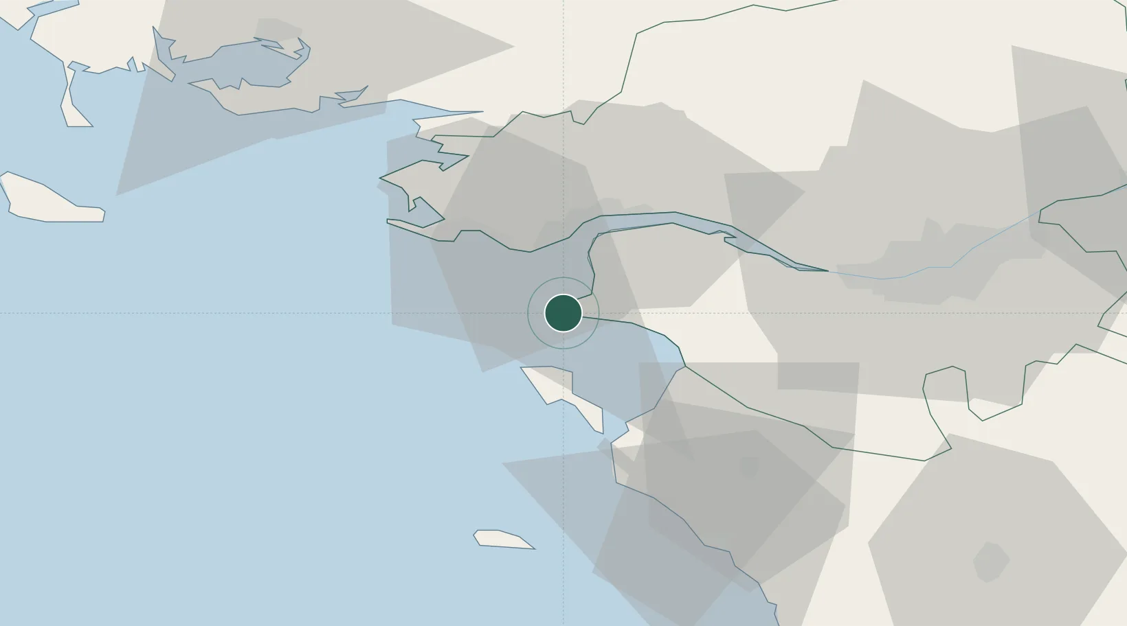
Nearby Logistics Neighbours

Cities
  1. 1Gravette4 km
  2. 2Pornic9 km
  3. 3Saint-Père-en-Retz16 km
  4. 4La Bernerie-en-Retz16 km
  5. 5Pornichet16 km
Nearest neighbours — logibook spatial index (haversine) over the source coordinates
Ports
  1. 1St Nazaire17 km
  2. 2Montoir20 km
  3. 3Donges22 km
  4. 4Nantes50 km
  5. 5Les Sables D' Olonne77 km
Nearest neighbours — logibook spatial index (haversine) over the source coordinates
Airports
  1. 1La Baule-Escoublac Airport20 km
  2. 2Saint-Nazaire-Montoir Airport20 km
  3. 3Beauvoir Fromentine Airfield29 km
  4. 4Nantes Atlantique Airport46 km
  5. 5Ile D'Yeu Port Joinville Heliport46 km
Nearest neighbours — logibook spatial index (haversine) over the source coordinates
Trade Zones
  1. 1ZFU Saint-Nazaire17 km
  2. 2ZFU Nantes et Saint-Herblain40 km
  3. 3ZFU Angers128 km
  4. 4ZFU La Rochelle133 km
  5. 5ZFU Le Mans200 km
Nearest neighbours — logibook spatial index (haversine) over the source coordinates
DatabookThe Record of Consolidated Knowledge
France beyond logistics?
Browse databook

All Sources

LocationsUN/LOCODE
UN/LOCODE — free
LocationsGeoNames
CC BY 4.0
Portsthe NGA World Port Index
Public domain (US gov)
AirportsOurAirports
Public domain
Trade Zonesthe World Bank SEZ database
CC BY 4.0
Trade ZonesOpen Zone Map
CC BY
← France locations