UN/LOCODE hub · France
FRGV6

Gravette

47.1333°, -2.1667°
1
Transport functions

Transport Functions

Port
UN/LOCODE

Hub Profile

Region
44
GeoNames

Location

Location of FRGV6
Natural Earth 10m (public domain) · 44 · FRGV6 · 47.13, -2.17GoogleOSMYandex

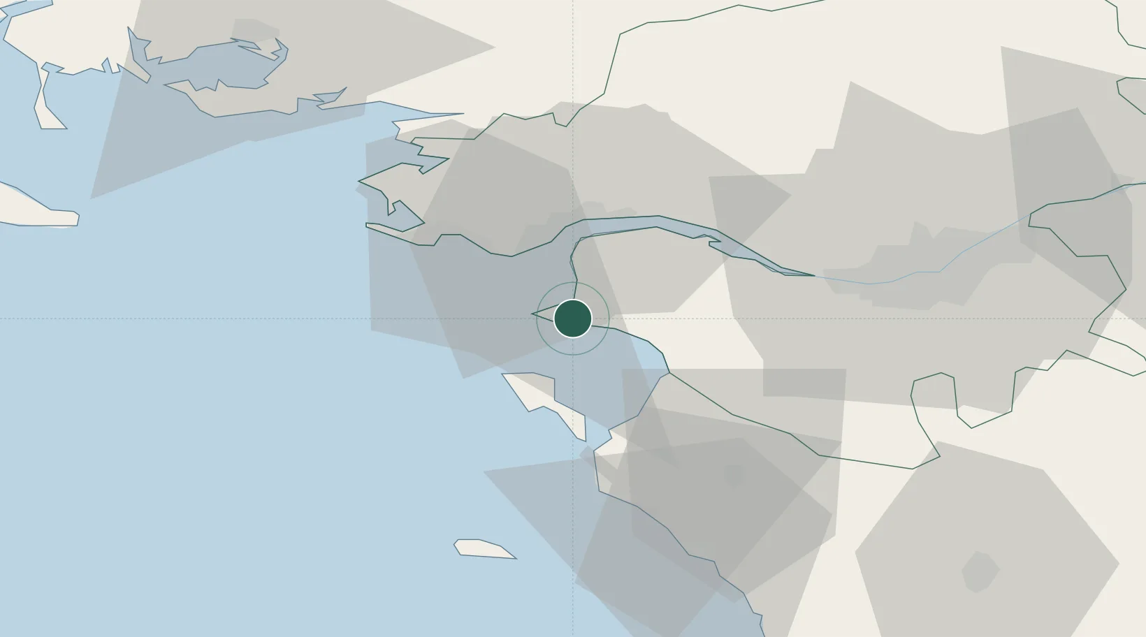
Nearby Logistics Neighbours

Cities
  1. 1Préfailles4 km
  2. 2Pornic5 km
  3. 3Saint-Père-en-Retz13 km
  4. 4La Bernerie-en-Retz13 km
  5. 5Les Moutiers-en-Retz16 km
Nearest neighbours — logibook spatial index (haversine) over the source coordinates
Ports
  1. 1St Nazaire17 km
  2. 2Montoir19 km
  3. 3Donges20 km
  4. 4Nantes46 km
  5. 5Les Sables D' Olonne76 km
Nearest neighbours — logibook spatial index (haversine) over the source coordinates
Airports
  1. 1Saint-Nazaire-Montoir Airport20 km
  2. 2La Baule-Escoublac Airport22 km
  3. 3Beauvoir Fromentine Airfield28 km
  4. 4Nantes Atlantique Airport42 km
  5. 5Ile D'Yeu Port Joinville Heliport47 km
Nearest neighbours — logibook spatial index (haversine) over the source coordinates
Trade Zones
  1. 1ZFU Saint-Nazaire18 km
  2. 2ZFU Nantes et Saint-Herblain37 km
  3. 3ZFU Angers125 km
  4. 4ZFU La Rochelle130 km
  5. 5ZFU Le Mans196 km
Nearest neighbours — logibook spatial index (haversine) over the source coordinates
DatabookThe Record of Consolidated Knowledge
France beyond logistics?
Browse databook

All Sources

LocationsUN/LOCODE
UN/LOCODE — free
Portsthe NGA World Port Index
Public domain (US gov)
AirportsOurAirports
Public domain
Trade Zonesthe World Bank SEZ database
CC BY 4.0
Trade ZonesOpen Zone Map
CC BY
← France locations