Heliport · France

Ile D'Yeu Port Joinville HeliportFR-0165

46.7283°, -2.3507°
10 ft
Elevation

Runway & Layout

Ile D'Yeu Port Joinville Heliport runway & taxiway layout
Runway & taxiway layout — OpenStreetMap (ODbL) / OurAirports

Airport Specifications

Airport class
Heliport
OurAirports
Scheduled service
Yes
OurAirports
Served city
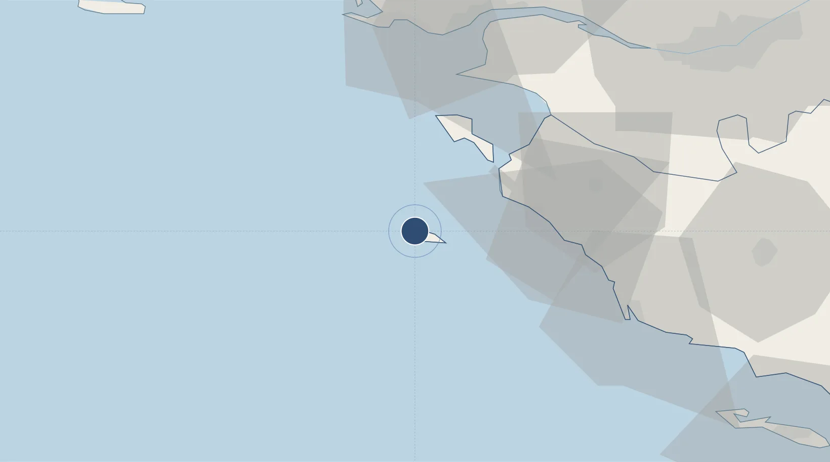
Port Joinville (Ile D'Yeu)
OurAirports

Location

Location of FR-0165
Natural Earth 10m (public domain) · Vendée · FR-0165 · 46.73, -2.35GoogleOSMYandex

Nearby Logistics Neighbours

Airports
  1. 1Île d'Yeu Airport3 km
  2. 2Beauvoir Fromentine Airfield27 km
  3. 3La Baule-Escoublac Airport62 km
  4. 4Saint-Nazaire-Montoir Airport67 km
  5. 5Nantes Atlantique Airport73 km
Nearest neighbours — logibook spatial index (haversine) over the source coordinates
Cities
  1. 1L'Île-d'Yeu1 km
  2. 2Port-Joinville1 km
  3. 3Saint-Jean-de-Monts24 km
  4. 4Le Bonhomme28 km
  5. 5Beauvoir-sur-Mer31 km
Nearest neighbours — logibook spatial index (haversine) over the source coordinates
Ports
  1. 1Les Sables D' Olonne49 km
  2. 2St Nazaire63 km
  3. 3Montoir66 km
  4. 4Donges67 km
  5. 5Nantes79 km
Nearest neighbours — logibook spatial index (haversine) over the source coordinates
Trade Zones
  1. 1ZFU Saint-Nazaire61 km
  2. 2ZFU Nantes et Saint-Herblain74 km
  3. 3ZFU La Rochelle108 km
  4. 4ZFU Angers157 km
  5. 5ZFU Le Mans233 km
Nearest neighbours — logibook spatial index (haversine) over the source coordinates
DatabookThe Record of Consolidated Knowledge
France beyond logistics?
Browse databook

All Sources

AirportsOurAirports
Public domain
Portsthe NGA World Port Index
Public domain (US gov)
LocationsUN/LOCODE
UN/LOCODE — free
Trade Zonesthe World Bank SEZ database
CC BY 4.0
Trade ZonesOpen Zone Map
CC BY
InfrastructureOpenStreetMap
ODbL 1.0
← France airports