UN/LOCODE hub · France
FRNYL

Noyelles

50.1833°, 1.7000°
2
Transport functions

Transport Functions

Rail
Road
UN/LOCODE

Hub Profile

Region
80
GeoNames

Location

Location of FRNYL
Natural Earth 10m (public domain) · 80 · FRNYL · 50.18, 1.70GoogleOSMYandex

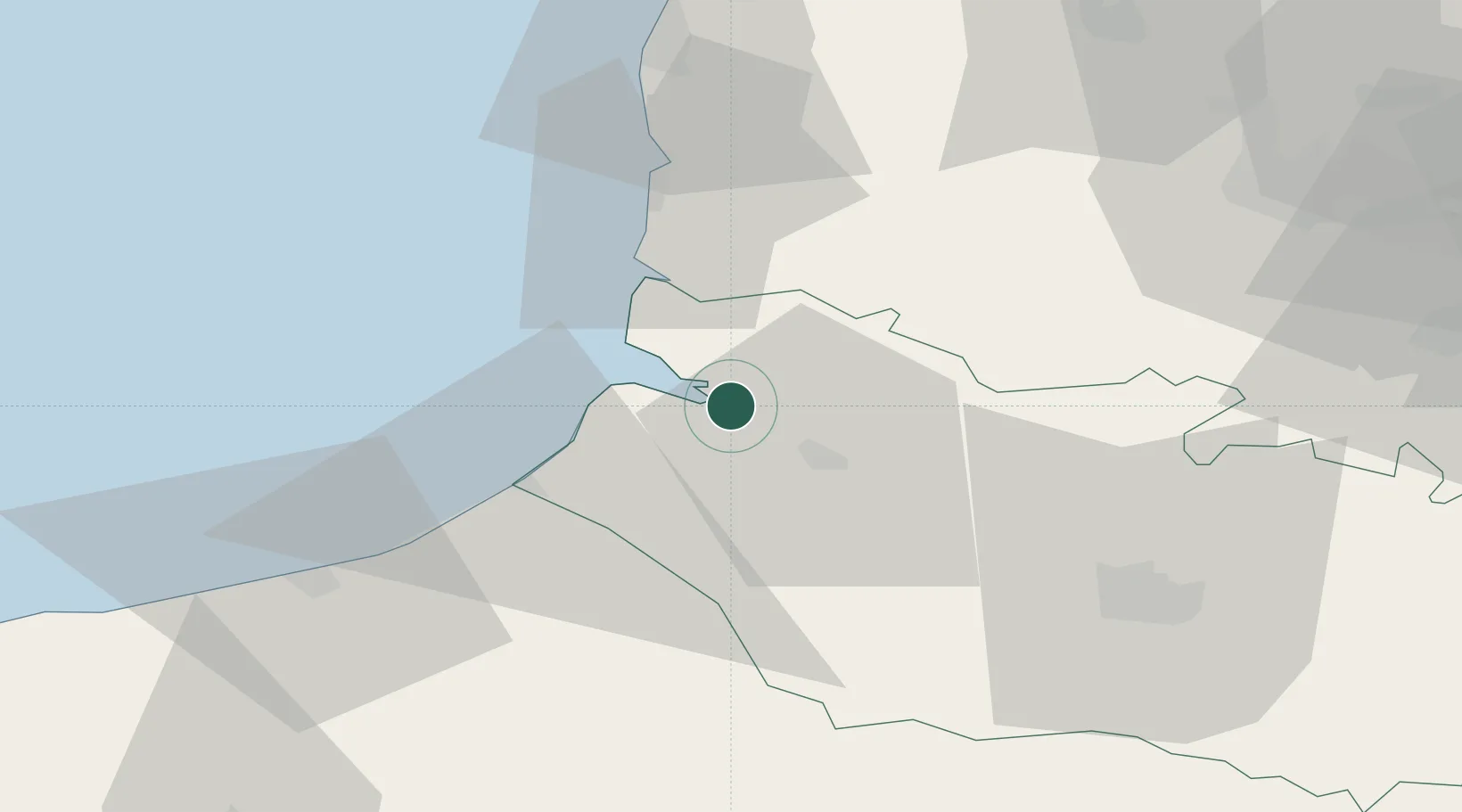
Nearby Logistics Neighbours

Cities
  1. 1Saint-Valery-sur-Somme5 km
  2. 2Le Crotoy7 km
  3. 3Nibas12 km
  4. 4Abbeville13 km
  5. 5Friville-Escarbotin15 km
Nearest neighbours — logibook spatial index (haversine) over the source coordinates
Ports
  1. 1Saint-Valery-Sur-Somme6 km
  2. 2Le Treport27 km
  3. 3Dieppe52 km
  4. 4Boulogne-Sur-Mer62 km
  5. 5Calais88 km
Nearest neighbours — logibook spatial index (haversine) over the source coordinates
Airports
  1. 1Abbeville-Buigny Baie de Somme Airfield10 km
  2. 2Le Touquet-Côte d'Opale Airport38 km
  3. 3Amiens Glisy Airfield60 km
  4. 4Merville-Calonne Airport83 km
  5. 5Beauvais-Tillé airport86 km
Nearest neighbours — logibook spatial index (haversine) over the source coordinates
Trade Zones
  1. 1ZFU Amiens46 km
  2. 2ZFU Calais86 km
  3. 3ZFU Beauvais86 km
  4. 4ZFU Hénin-Beaumont, Montigny-en-Gohelle, Courrières, Rouvroy, Drocourt, Dourges88 km
  5. 5ZFU Rouen Bihorel91 km
Nearest neighbours — logibook spatial index (haversine) over the source coordinates
DatabookThe Record of Consolidated Knowledge
France beyond logistics?
Browse databook

All Sources

LocationsUN/LOCODE
UN/LOCODE — free
Portsthe NGA World Port Index
Public domain (US gov)
AirportsOurAirports
Public domain
Trade Zonesthe World Bank SEZ database
CC BY 4.0
Trade ZonesOpen Zone Map
CC BY
← France locations