UN/LOCODE hub · France
FRHET

Hennebont

47.8000°, -3.2833°
14,288
Population
1
Transport functions

Transport Functions

Port
UN/LOCODE

Hub Profile

Place type
Populated place
GeoNames
Region
Brittany
GeoNames
Population
14,288
GeoNames
Time zone
Europe/Paris
GeoNames
Elevation
15 m
GeoNames

Location

Location of FRHET
Natural Earth 10m (public domain) · Brittany · FRHET · 47.80, -3.28GoogleOSMYandex

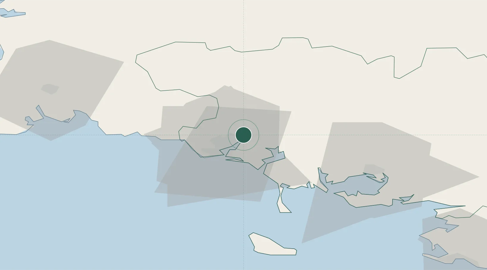
Nearby Logistics Neighbours

Cities
  1. 1Lorient8 km
  2. 2Languidic10 km
  3. 3Pont-Scorff10 km
  4. 4Locmiquélic11 km
  5. 5Port-Louis11 km
Nearest neighbours — logibook spatial index (haversine) over the source coordinates
Ports
  1. 1Lorient8 km
  2. 2Concarneau48 km
  3. 3Le Legue91 km
  4. 4Morlaix96 km
  5. 5St Nazaire100 km
Nearest neighbours — logibook spatial index (haversine) over the source coordinates
Airports
  1. 1Lorient South Brittany (Bretagne Sud) Airport13 km
  2. 2Vannes-Meucon Airport43 km
  3. 3Aérodrome de Belle Île53 km
  4. 4Quimper-Cornouaille Airport69 km
  5. 5Saint-Brieuc-Armor Airport88 km
Nearest neighbours — logibook spatial index (haversine) over the source coordinates
Trade Zones
  1. 1ZFU Saint-Nazaire96 km
  2. 2ZFU Nantes et Saint-Herblain135 km
  3. 3ZFU Angers204 km
  4. 4ZFU Cherbourg-Octeville237 km
  5. 5ZFU La Rochelle241 km
Nearest neighbours — logibook spatial index (haversine) over the source coordinates
DatabookThe Record of Consolidated Knowledge
France beyond logistics?
Browse databook

All Sources

LocationsUN/LOCODE
UN/LOCODE — free
LocationsGeoNames
CC BY 4.0
Portsthe NGA World Port Index
Public domain (US gov)
AirportsOurAirports
Public domain
Trade Zonesthe World Bank SEZ database
CC BY 4.0
Trade ZonesOpen Zone Map
CC BY
← France locations