UN/LOCODE hub · France
FR6MG

Messei-Saint-Gervais

48.7167°, -0.5500°
1
Transport functions

Transport Functions

Multimodal
UN/LOCODE

Hub Profile

Region
61
GeoNames

Location

Location of FR6MG
Natural Earth 10m (public domain) · 61 · FR6MG · 48.72, -0.55GoogleOSMYandex

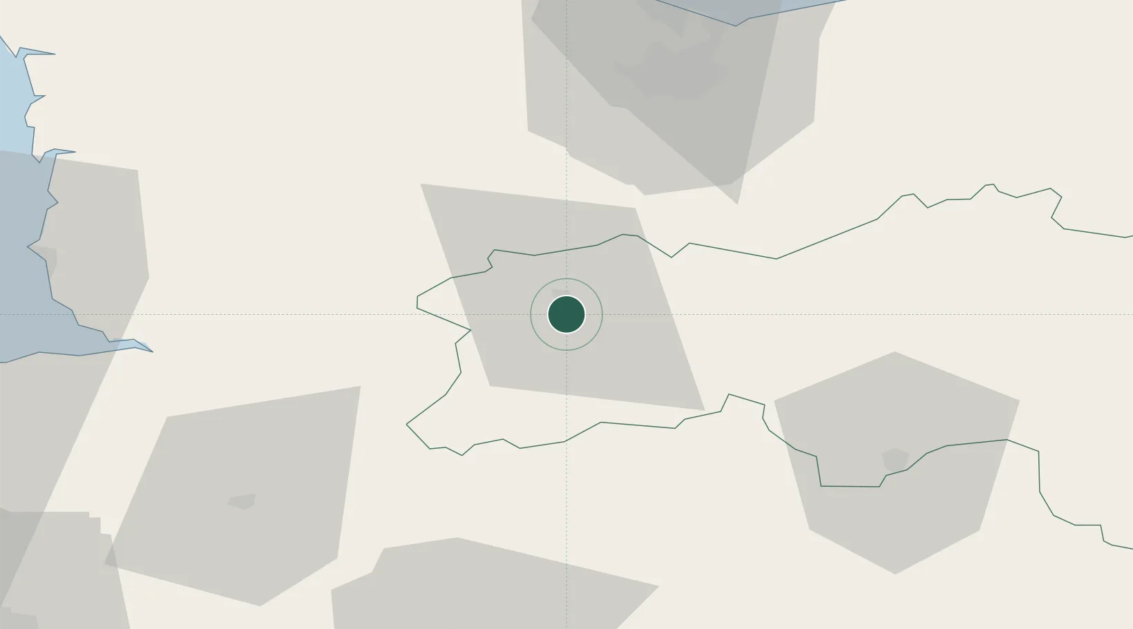
Nearby Logistics Neighbours

Cities
  1. 1Montilly-sur-Noireau11 km
  2. 2Caligny12 km
  3. 3Saint-Georges-de-Rouelley19 km
  4. 4Torchamp22 km
  5. 5Saint-Rémy23 km
Nearest neighbours — logibook spatial index (haversine) over the source coordinates
Ports
  1. 1Port De Caen54 km
  2. 2Ouistreham67 km
  3. 3Granville78 km
  4. 4Deauville86 km
  5. 5Honfleur96 km
Nearest neighbours — logibook spatial index (haversine) over the source coordinates
Airports
  1. 1Caen Carpiquet airport52 km
  2. 2Granville Airport77 km
  3. 3Laval-Entrammes Airport77 km
  4. 4Deauville Normandie airport89 km
  5. 5Le Mans-Arnage Airport102 km
Nearest neighbours — logibook spatial index (haversine) over the source coordinates
Trade Zones
  1. 1ZFU La Guérinière, La Grâce de Dieu53 km
  2. 2ZFU Hérouville-Saint-Clair56 km
  3. 3ZFU Alençon56 km
  4. 4ZFU Le Mans96 km
  5. 5ZFU Le Havre100 km
Nearest neighbours — logibook spatial index (haversine) over the source coordinates
DatabookThe Record of Consolidated Knowledge
France beyond logistics?
Browse databook

All Sources

LocationsUN/LOCODE
UN/LOCODE — free
Portsthe NGA World Port Index
Public domain (US gov)
AirportsOurAirports
Public domain
Trade Zonesthe World Bank SEZ database
CC BY 4.0
Trade ZonesOpen Zone Map
CC BY
← France locations