UN/LOCODE hub · Finland
FIHOU

Houtskär (Houtskari)

60.2167°, 21.3833°
1
Transport functions

Transport Functions

Port
UN/LOCODE

Hub Profile

Region
19
GeoNames

Location

Location of FIHOU
Natural Earth 10m (public domain) · 19 · FIHOU · 60.22, 21.38GoogleOSMYandex

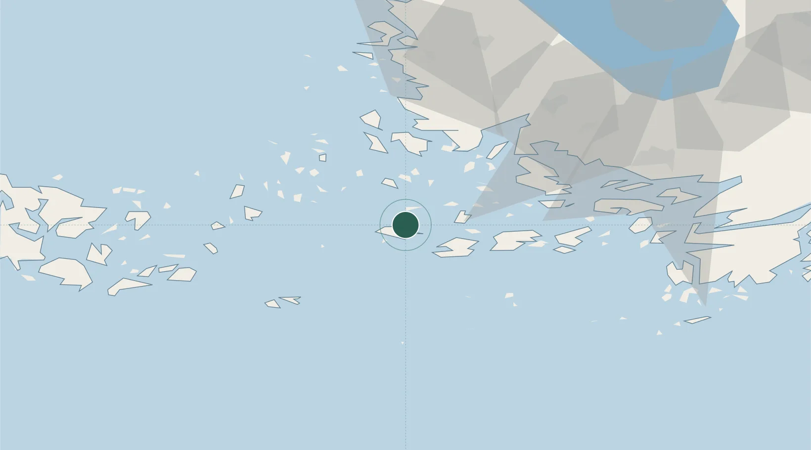
Nearby Logistics Neighbours

Cities
  1. 1Korpo (Korppoo)12 km
  2. 2Iniö20 km
  3. 3Brändö29 km
  4. 4Nagu (Nauvo)30 km
  5. 5Velkua32 km
Nearest neighbours — logibook spatial index (haversine) over the source coordinates
Ports
  1. 1Pargas38 km
  2. 2Naantali45 km
  3. 3Uto48 km
  4. 4Turku54 km
  5. 5Uusikaupunki65 km
Nearest neighbours — logibook spatial index (haversine) over the source coordinates
Airports
  1. 1Turku Airport59 km
  2. 2Mariehamn Airport83 km
  3. 3Pori Airport140 km
  4. 4Kärdla Airport159 km
  5. 5Tampere-Pirkkala Airport180 km
Nearest neighbours — logibook spatial index (haversine) over the source coordinates
Trade Zones
  1. 1Turku Free Zone52 km
  2. 2Freeport of Hanko94 km
  3. 3Paldiski Free Zone180 km
  4. 4Stockholm Free Zone207 km
  5. 5Muuga Free Zone228 km
Nearest neighbours — logibook spatial index (haversine) over the source coordinates
DatabookThe Record of Consolidated Knowledge
Finland beyond logistics?
Browse databook

All Sources

LocationsUN/LOCODE
UN/LOCODE — free
Portsthe NGA World Port Index
Public domain (US gov)
AirportsOurAirports
Public domain
Trade Zonesthe World Bank SEZ database
CC BY 4.0
Trade ZonesOpen Zone Map
CC BY
← Finland locations