UN/LOCODE hub · Germany
DEGOS

Goslar

51.9000°, 10.4333°
43,560
Population
2
Transport functions

Transport Functions

Rail
Road
UN/LOCODE

Hub Profile

Place type
District seat
GeoNames
Region
Lower Saxony
GeoNames
Population
43,560
GeoNames
Time zone
Europe/Berlin
GeoNames
Elevation
270 m
GeoNames

Location

Location of DEGOS
Natural Earth 10m (public domain) · Lower Saxony · DEGOS · 51.90, 10.43GoogleOSMYandex

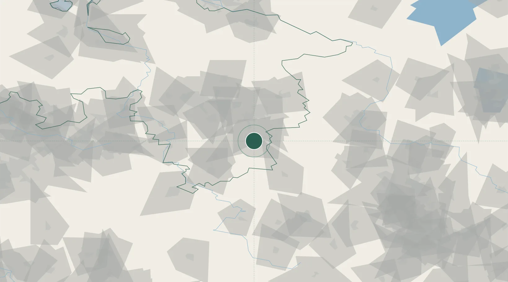
Nearby Logistics Neighbours

Cities
  1. 1Bad Harzburg9 km
  2. 2Vienenburg11 km
  3. 3Seesen17 km
  4. 4Staufenberg20 km
  5. 5Haverlah20 km
Nearest neighbours — logibook spatial index (haversine) over the source coordinates
Ports
  1. 1Bremen178 km
  2. 2Hamburg187 km
  3. 3Elsfleth199 km
  4. 4Oldenburg202 km
  5. 5Butzfleth204 km
Nearest neighbours — logibook spatial index (haversine) over the source coordinates
Airports
  1. 1Braunschweig-Wolfsburg Airport47 km
  2. 2Hannover Airport81 km
  3. 3Celle Army Airfield82 km
  4. 4Kassel Airport90 km
  5. 5Wunstorf Air Base92 km
Nearest neighbours — logibook spatial index (haversine) over the source coordinates
Trade Zones
  1. 1Freeport of Bremerhaven (Freihafen Bremerhaven)174 km
  2. 2Freeport of Cuxhaven (Freihafen Cuxhaven)248 km
  3. 3Freeport of Duisburg270 km
  4. 4Freeport of Emden271 km
  5. 5Freeport of Kiel271 km
Nearest neighbours — logibook spatial index (haversine) over the source coordinates
DatabookThe Record of Consolidated Knowledge
Germany beyond logistics?
Browse databook

All Sources

LocationsUN/LOCODE
UN/LOCODE — free
LocationsGeoNames
CC BY 4.0
Portsthe NGA World Port Index
Public domain (US gov)
AirportsOurAirports
Public domain
Trade Zonesthe World Bank SEZ database
CC BY 4.0
Trade ZonesOpen Zone Map
CC BY
← Germany locations