UN/LOCODE hub · China
CNYZU

Yuzhu

23.1000°, 113.4167°
2
Transport functions

Transport Functions

Port
Road
UN/LOCODE

Hub Profile

Place type
Local administrative seat
GeoNames
Region
Guangdong
GeoNames
Time zone
Asia/Shanghai
GeoNames
Elevation
0 m
GeoNames

Location

Location of CNYZU
Natural Earth 10m (public domain) · Guangdong · CNYZU · 23.10, 113.42GoogleOSMYandex

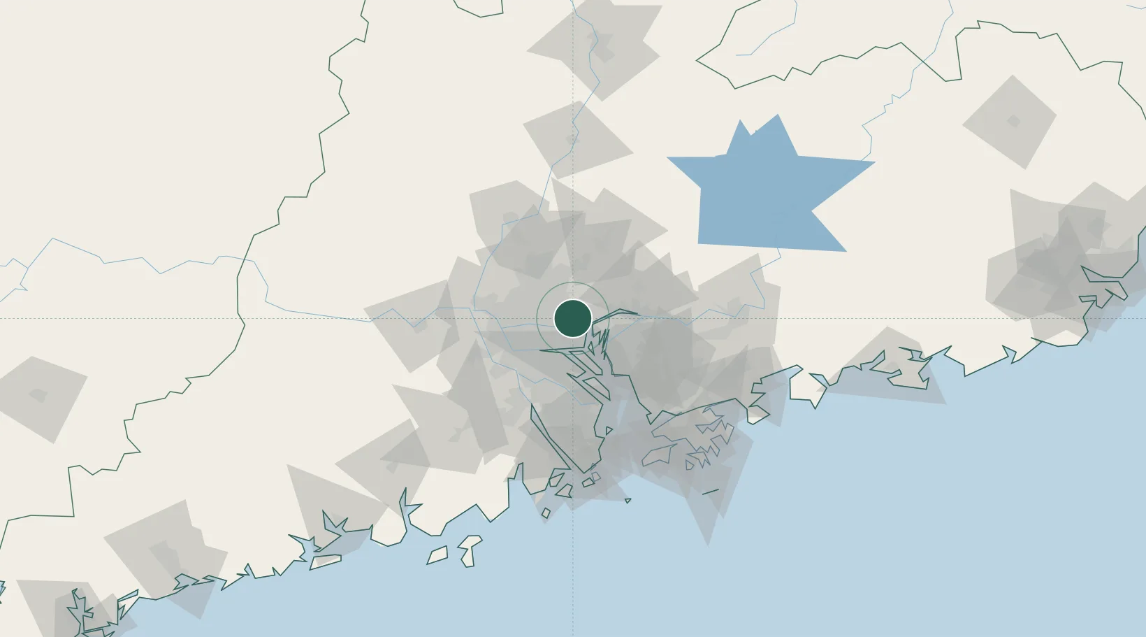
Nearby Logistics Neighbours

Cities
  1. 1Neigang0 km
  2. 2Wu Chong Kou2 km
  3. 3Xiaohudao3 km
  4. 4Shating6 km
  5. 5Xinzao8 km
Nearest neighbours — logibook spatial index (haversine) over the source coordinates
Ports
  1. 1Huangpu2 km
  2. 2Huangpuxingang10 km
  3. 3Guangzhou19 km
  4. 4Shekou84 km
  5. 5Zhuhai98 km
Nearest neighbours — logibook spatial index (haversine) over the source coordinates
Airports
  1. 1Guangzhou Baiyun International Airport35 km
  2. 2Foshan Shadi Airport35 km
  3. 3Shenzhen Bao'an International Airport65 km
  4. 4Shek Kong Air Base100 km
  5. 5Hong Kong International Airport102 km
Nearest neighbours — logibook spatial index (haversine) over the source coordinates
Trade Zones
  1. 1Guangzhou Export Processing Zone12 km
  2. 2Yunpu Industrial Park14 km
  3. 3Longhu Industrial Park26 km
  4. 4Baiyun Industrial Park28 km
  5. 5Fushan Industrial Park39 km
Nearest neighbours — logibook spatial index (haversine) over the source coordinates
DatabookThe Record of Consolidated Knowledge
China beyond logistics?
Browse databook

All Sources

LocationsUN/LOCODE
UN/LOCODE — free
Portsthe NGA World Port Index
Public domain (US gov)
AirportsOurAirports
Public domain
Trade Zonesthe World Bank SEZ database
CC BY 4.0
Trade ZonesOpen Zone Map
CC BY
← China locations