UN/LOCODE hub · Brazil
BRCMG

Corumbá

-19.0000°, -57.6333°
96,520
Population
5
Transport functions

Transport Functions

Port
Rail
Road
Airport
Multimodal
UN/LOCODE

Hub Profile

Place type
Populated place
GeoNames
Region
Mato Grosso do Sul
GeoNames
Population
96,520
GeoNames
Time zone
America/Campo_Grande
GeoNames
Elevation
152 m
GeoNames

Location

Location of BRCMG
Natural Earth 10m (public domain) · Mato Grosso do Sul · BRCMG · -19.00, -57.63GoogleOSMYandex

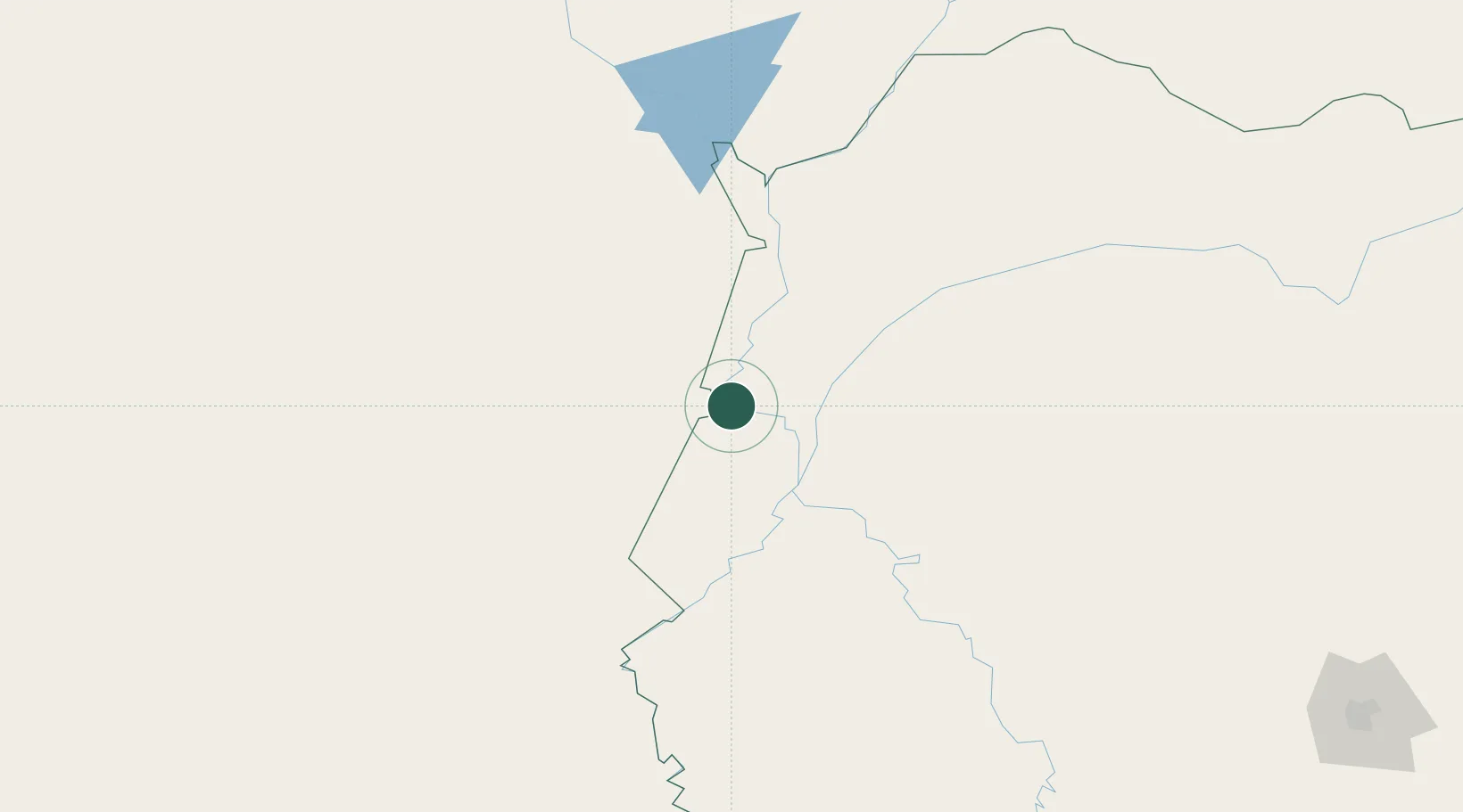
Nearby Logistics Neighbours

Cities
  1. 1Ladário4 km
  2. 2Puerto Suárez18 km
  3. 3Puerto Busch120 km
  4. 4Puerto Quijarro136 km
  5. 5Fuerte Olimpo229 km
Nearest neighbours — logibook spatial index (haversine) over the source coordinates
Ports
  1. 1Puerto De Asuncion697 km
  2. 2Paranagua1184 km
  3. 3Sao Francisco1225 km
  4. 4Itajai1274 km
  5. 5Santos1295 km
Nearest neighbours — logibook spatial index (haversine) over the source coordinates
Airports
  1. 1Corumbá International Airport4 km
  2. 2Capitán Av. Salvador Ogaya G. airport20 km
  3. 3Fazenda Riozinho Airport146 km
  4. 4Bonito Airport279 km
  5. 5Campo Grande Airport350 km
Nearest neighbours — logibook spatial index (haversine) over the source coordinates
Trade Zones
  1. 1ZPE DE Corumbá4 km
  2. 2Central Aguirre Portuaria9 km
  3. 3Zona Franca Puerto Suárez22 km
  4. 4ZPE de Cáceres325 km
  5. 5Winner Commercial and Industrial Free Zone596 km
Nearest neighbours — logibook spatial index (haversine) over the source coordinates
DatabookThe Record of Consolidated Knowledge
Brazil beyond logistics?
Browse databook

All Sources

LocationsUN/LOCODE
UN/LOCODE — free
LocationsGeoNames
CC BY 4.0
Portsthe NGA World Port Index
Public domain (US gov)
AirportsOurAirports
Public domain
Trade Zonesthe World Bank SEZ database
CC BY 4.0
Trade ZonesOpen Zone Map
CC BY
← Brazil locations